The cold front is coming.
A fairly warm, muggy morning will give way to a northwesterly blast of air later today, reaching northwest parts of the area by 10 a.m. or so, moving through downtown around 11 a.m., and off the coast by or before 1 p.m.
The cold front is coming.
A fairly warm, muggy morning will give way to a northwesterly blast of air later today, reaching northwest parts of the area by 10 a.m. or so, moving through downtown around 11 a.m., and off the coast by or before 1 p.m.
Rumors of cold weather have been circulating for a little while now. As I write this, we’re about 36 hours away from “go” time. The details…
TODAY
One more day of balmy weather will greet us today. We hit 79° yesterday at IAH Airport, but we’ll likely shave three to five degrees off that today. Expect low to mid 70s, with another round of sunshine.
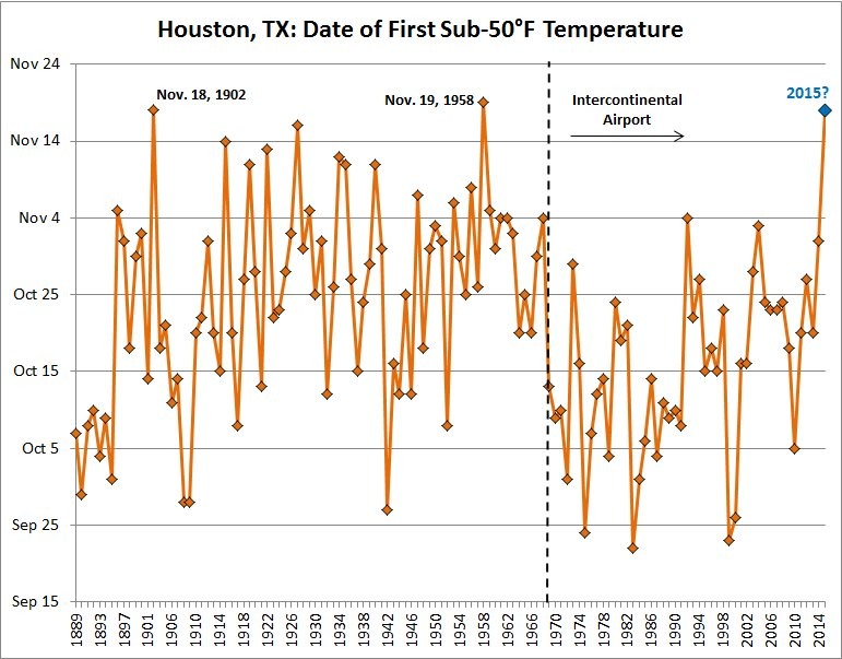
If it seems like it’s been a slower-than-usual slide into fall this year, that’s because it has been.
Houston finally recorded its first overnight temperature in the 40s of the season on Wednesday morning, if only barely, at 49 degrees. According to data compiled by Brian Brettschneider this ties as the second-latest date (1902) in the fall season that Houston has recorded a temperature in the 40s.
Do you remember when I talked about a cold spell arriving around the time of Thanksgiving week? Well, it’s coming a little bit early, beginning on Saturday.
TODAY and FRIDAY
We’ll have two more gorgeous days like Wednesday, with full sunshine, dry air, cool nights and highs in the mid- to upper-70s. This is how fall should feel.
SATURDAY
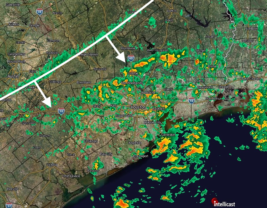
A strong cold front will approach and move through the area on Saturday. It doesn’t appear as though we’ll see a squall line of storms, or anything like that, but beginning Friday night through most of the day Saturday conditions should be mostly gray, with light rain chances. I don’t expect accumulations of more than a tenth of an inch or two. The biggest change will be winds — gusting to above 20 mph — and colder air. By late afternoon or early evening the temperature will be in the upper 50s.
SUNDAY and MONDAY
Hello winter.
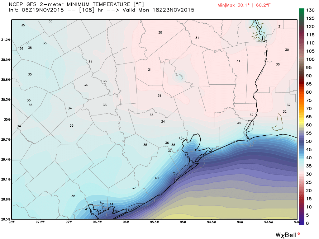
After a start to the day with temperatures around 40 degrees, highs on Sunday will struggle to climb out of the 50s under mostly sunny skies. Monday night should be the region’s coldest since early March. Much of the area, at least inland parts, could see lows in the upper 30s. The forecast models have trended lower (see the GFS forecast for Monday morning), but I don’t think we’ll see temperatures get that close to freezing. Still, it’s gonna be CHILLY.
THANKSGIVING
We’ll gradually warm up during the rest of next week and I’d expect highs on Thanksgiving to be in the upper 70s, or so. Unfortunately rain, or even storms, will be possible some days later next week but it’s too early to have any confidence in when.