I’m not sure you could script a string of days better than you could have yesterday, today, and Saturday here in the Houston area. If you know anyone up north, these are the types of days you package up and sell to them in January.
TODAY
Sunshine will dominate the skies once again today. After hitting 65° yesterday, we’ll make a run for the low 70s today.
Forecast high temperatures this afternoon (Weather Bell)
I think today is most definitely a near-perfect weather day for most people.
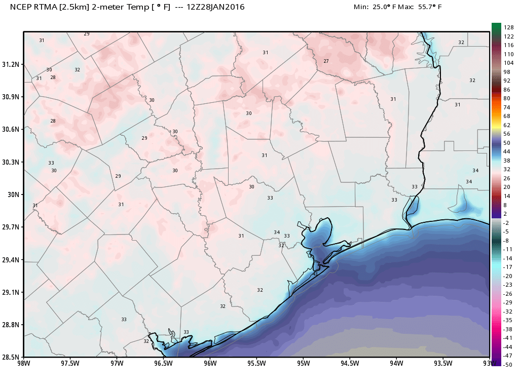
It’s chilly this morning across Houston, generally in the low- to mid-30s, and some areas such as Tomball, Brenham and The Woodlands have dipped just below freezing.
TODAY
With sunny skies we’ll warm into the mid-60s today. With light winds we’ll see near deal winter weather. Lows tonight will be about 10 degrees warmer.
Temperatures at 6 a.m. Thursday morning were near freezing in metro Houston, and below freezing in some outlying areas. (Weather Bell)
Following the gloomy start to the week we’ll now see some sunshine.
TODAY
Much drier air is now moving into Houston after Tuesday’s showers, ending the rain, and we should begin to see partly sunny skies later today. Highs will be in the mid- to upper-50s.
THURSDAY
Mostly clear skies tonight will allow for good cooling, but I expect most of the Houston metro area to remain in the mid-30s, above freezing, on Thursday morning. After that we’ll see a really pretty day with highs in the low 60s.
Low temperature forecast for Thursday morning. (Weather Bell)
FRIDAY-SUNDAY
We’ll see a slow warming trend for what should be a spectacular winter weekend. Highs will climb from the upper 60s on Friday to the mid-70s by Sunday. Overnight lows will rise from the low 40s on Friday morning to around 60 degrees by Sunday. Skies will remain mostly sunny.
If you’re heading to Galveston Island, expect highs in the 60s for the weekend, with partly cloudy skies. Evening and nighttime temperatures should remain around 60 degrees.
NEXT WEEK
A stronger cold front should arrive next Monday or Tuesday, bringing with it our next chance of rain. While I wouldn’t rule out a freeze with that front, I don’t consider it likely.
A cold front has pushed through the region, bringing some showers that look to continue (especially south and east of Houston) for much of today.
TODAY
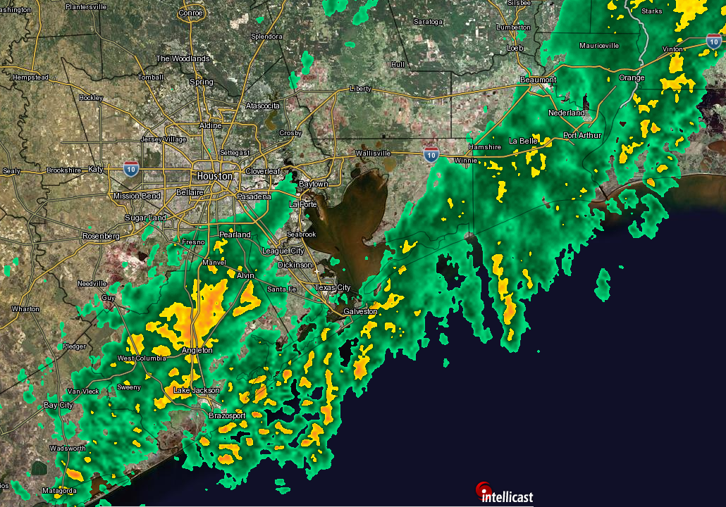
Rain showers will continue off and on throughout the day, especially as you work south of I-10 and east of I-45. Radar as of 6:15 AM shows heavy showers in Brazoria County (where a Flood Advisory was just issued) and lighter showers extending north and east from there along the coast to Port Arthur.
Radar as of 6:15 AM shows heavier showers south of Houston. (Intellicast)
As the day wears on, these showers will more or less continue in place. Some parts of Brazoria County have seen 1-2″, mainly north and west of Angleton, so some typical nuisance flooding seems possible there as rains continue. It won’t be until tonight that we kick this stuff out of here, as an upper level trough swings through, ending rain from west to east.
Outside of rain, it will be a notably “raw” day today: Temperatures mainly in the low to mid 50s and edging downward into the 40s as the day wears on. Add in the dampness and some 20 mph wind gusts, and you have the recipe for a pretty wintry day by Houston standards.