Well, if you like consistency, this forecast is for you. And if you want to see some truly fall-like weather, it is not. For the remainder of October, and at least the first few days of November, Houston will continue to see temperatures 2 to 5 degrees above normal.
Wednesday through Sunday
A stagnant pattern has settled over Houston, with high pressure to the west of the region, and easterly winds. This will lead to mostly sunny days, rain chances near zero and warmish temperatures for late October.
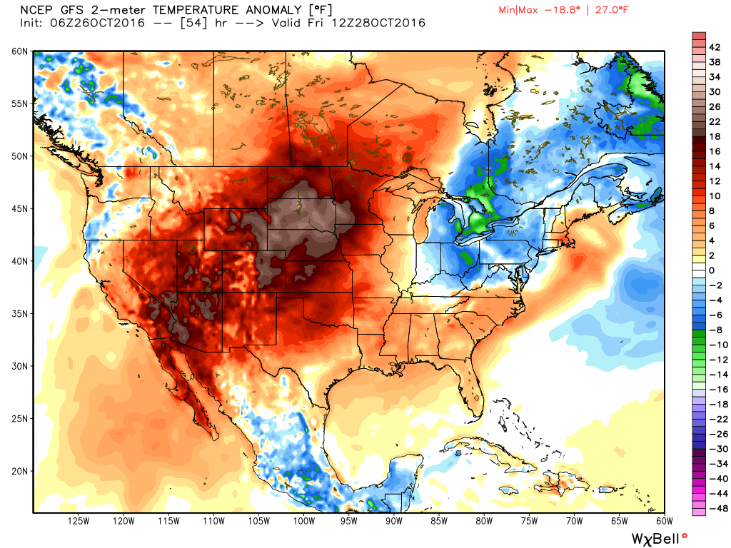
It’s not just Houston. With high pressure over the western United States temperatures in some areas may be 25 degrees or more warmer than normal. (Weather Bell)
With very little (ok, none) rain in the forecast let’s discuss for a moment the possibility of a drought returning to the greater Houston area.
A drought returns?
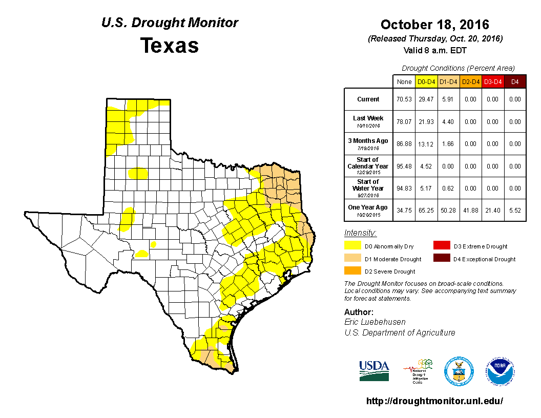
Harris County hasn’t been in a “moderate” or worse drought since August, 2015. However, last week most of the region fell into the “abnormally dry” category, which is just one step below a drought in the catalog kept by the US Drought Monitor.
(US Drought Monitor)
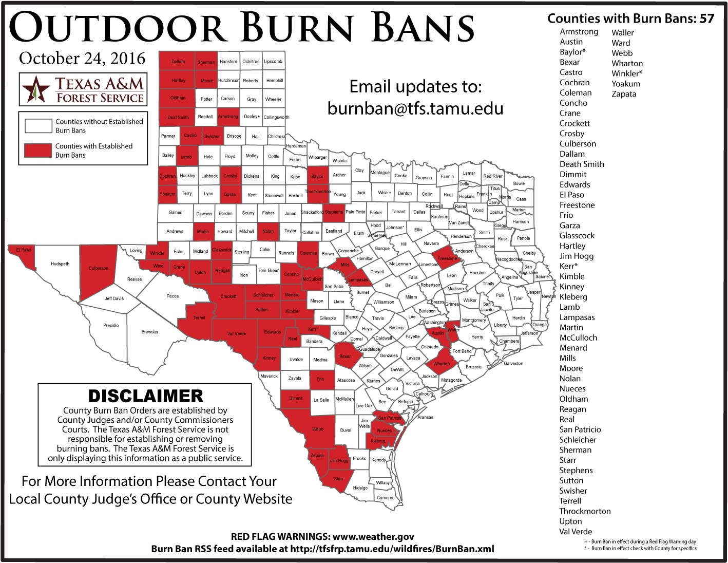
We are starting to see other indications of almost-drought like conditions crop up across the state after a dry late summer and early fall. According to the Texas A&M Forest Service, 57 Texas counties now have burn bans, including Waller, Austin and Wharton counties just to the west of the Houston metro area.
Texas counties with burn bans. (Texas A&M Forest Service)
After a great, fall-like weekend Houston will slide back into a warmer—although not oppressively so—weather pattern this week.
Today
A small atmospheric disturbance will move from the I-35 corridor in Texas eastward through Houston later today. Were the atmosphere not so dry we might see some widespread showers, but as it is, while a few stray showers may pop up for the most part we’re going to see some clouds.
With that said, moisture levels will rise today after last week’s cool front, and humidity levels will continue to deepen after a spectacular weekend. Expect high temperatures in the low 80s, with lows in the mid-60s.
Tuesday through Friday
For the rest of the week our weather really should be quite boring. High pressure will settle into the region and should bring us partly to mostly sunny skies. We’ll have what I’m going to call Goldilocks weather, which means not too hot, not too cold, with some humidity. Highs will be in the 80s, with low 80s closer to the coast, and upper 80s for far western parts of the region; and lows in the lower 60s for far inland areas to around 70 degrees right along the coast.
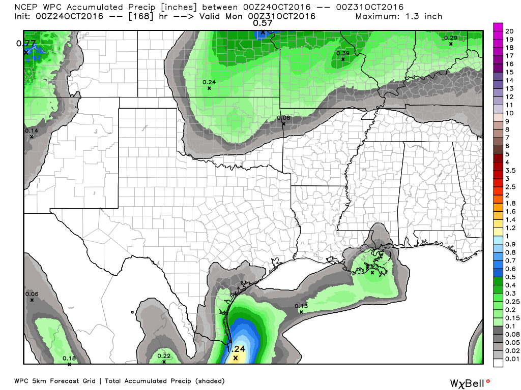
Here’s your rain accumulation forecast for now through next weekend. (Weather Bell)
How sweet it is! Relief has arrived. Stepping outside this morning is more a pleasure than a chore. Yesterday’s cold front is now offshore, and we’re firmly entrenched in a pleasant and cooling air mass. That sets up what should be a great weekend.
Today through Monday
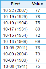
With the front through and dry northerly winds ongoing, expect a delightful Friday. Sunshine will dominate with highs in the mid to upper 70s. We’re skirting an interesting, albeit random record today. Tomorrow would tie the latest we’ve ever recorded our first 80° or cooler high temperature for the season. That means we’ll miss the record by one day today. I doubt anyone will complain.
The 10 latest first dates of 80° or lower for a high temperature in Houston. (NOAA)
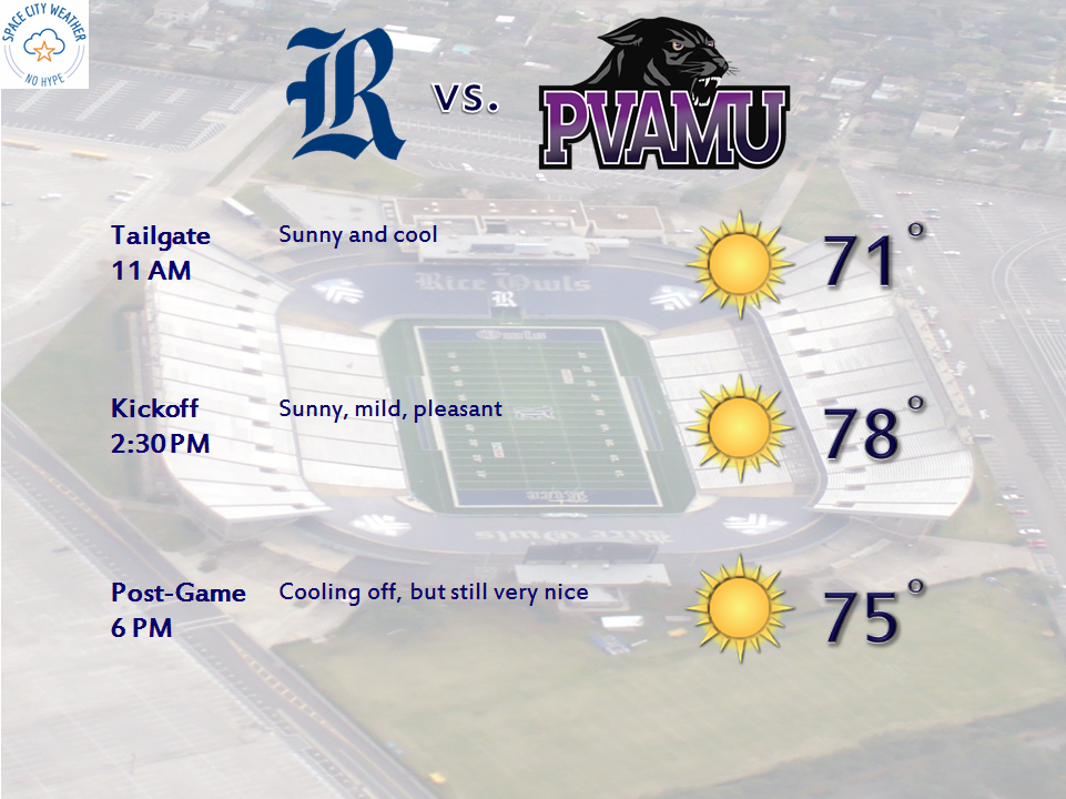
So with that in mind, the rest of the weekend looks pretty solid. After we see lows in the low to mid 50s tonight (and some 40s away from the city and the coast),we’ll have another winner of a day Saturday. Expect more sunshine and highs in the mid to upper 70s again. Heading to Rice to see the Owls take on Prairie View A&M? It looks great.
Sunday looks good also. Expect a start in the 50s again, followed by even more sunshine. I do think some high clouds will slip through on Sunday, but it shouldn’t be anything too serious. Temps will max out around or a few ticks above 80° on Sunday afternoon.