Quiet to start Memorial Day weekend, but rain chance increasing

Texas has had a bit of a checkered weather history on Memorial Day weekends. The good news is that a good chunk of this weekend will be fine, albeit quite hot. The final part of it should see more active weather and rain chances. Whether you’re heading to Hill Country, Big Bend, South Texas, or Dallas, you’ll have at least some rain and storm chances to contend with at some point this weekend.

Today and Saturday

We have turned up the humidity this morning, and we’ll continue to raise it as the day goes forward. Low clouds this morning may be a bit stubborn, but expect sunshine to begin peaking out a bit later. High temperatures should be around 90 degrees as long as we get sunshine. It will turn partly to mostly cloudy tonight, and it’s going to remain on the muggy side, with lows likely not dropping below the upper 70s or even 80° in spots.

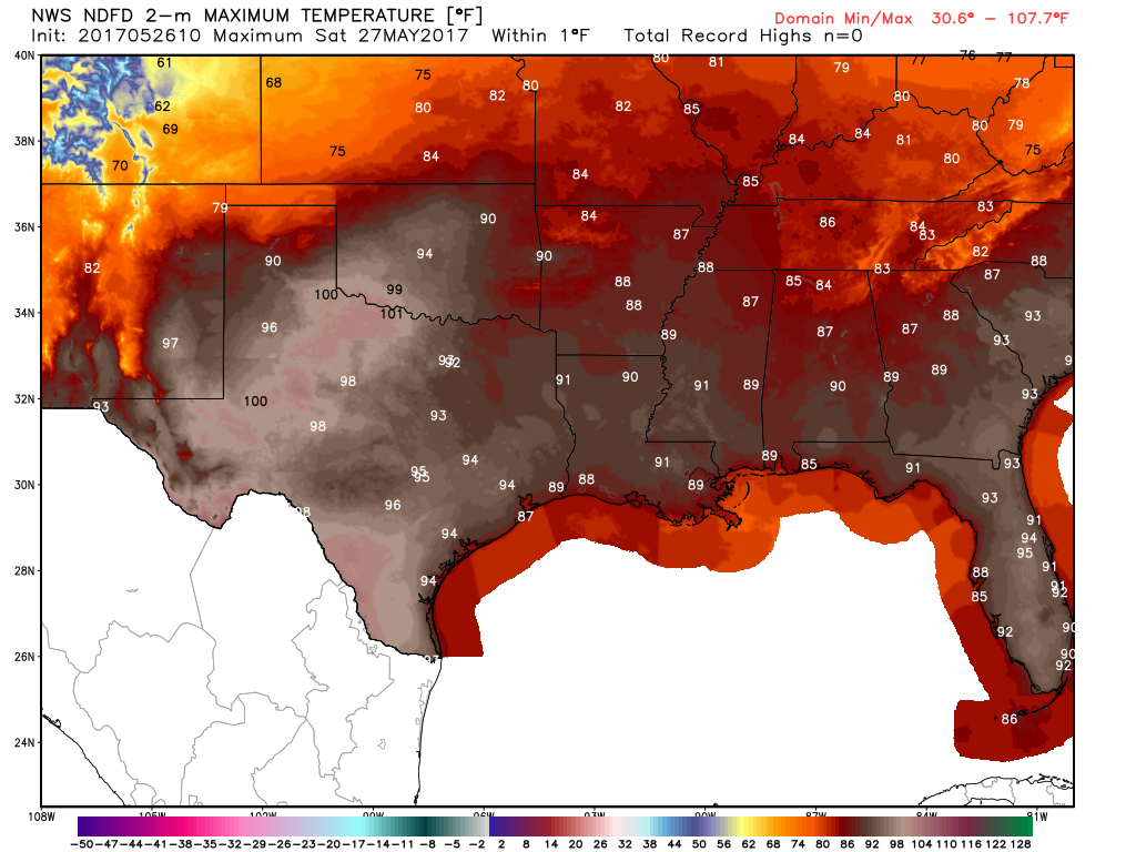
Saturday afternoon looks mostly alright, but it’s going to be hot. Temperatures should officially hit at least the low-90s Saturday, with some chance we see mid-90s officially (upper 80s to near 90° at the coast). Heat index values will be pretty high, and given that we haven’t had to deal much with that yet this year, use caution if you’ll be taking in the outdoors. Drink plenty of water.

No matter where in Texas you might be on Saturday, it’s going to be very hot. (Weather Bell)

Rain risks Saturday would be confined to a very isolated morning shower near the coast or Galveston Bay. Anything serious should stay way up in far north Texas or Oklahoma. Those showers and storms will likely fall apart as they get south of Dallas.

(Space City Weather is sponsored this month by Jetco Delivery)

See full post

Houston will warm up now, and some rain likely returns next week

After Wednesday’s absolutely gorgeous weather—easily one of the nicest days in late May in the last 20 years—conditions are now going to warm up some across Houston. But the weather is still going to remain relatively calm for awhile, until the forecast turns wetter at the beginning of next week.

Today

This morning is still going to be quite nice across the Houston area, with lows starting out in the 60s for most of the region, and still relatively dry air. Highs today should reach into the mid-80s or so under mostly sunny skies. But later on today you’re probably going to notice winds picking up out of the south, which will signal the return of humidity, and eventually, better rain chances.

Friday and Saturday

Heading into the weekend we’re going to see warm, almost summer-like weather. (Which seems appropriate because let’s face it, folks, summer is almost upon us). Look for high temperatures of around 90 degrees, and relatively steamy overnight lows only falling into the upper 70s. Skies should remain sunny for the most part.

(Space City Weather is sponsored this month by Jetco Delivery)

See full post

Hard to believe Houston is a week away from June

After some nastier than expected thunderstorms moved through Houston on Tuesday evening, with damaging winds west and south of Houston, conditions have settled down nicely. Fewer than 3,000 CenterPoint Energy customers remain without power, and skies are clearing as the sun comes up this morning. Notably, Bush Intercontinental Airport did officially fall below 60 degrees this morning, giving Houston its coolest temperature in late May in two decades. Enjoy the cooler weather—because you know it won’t last.

Temperatures across Texas on Wednesday morning. (Weather Bell)

Today

What a day we have in store. After a cool start, with northerly winds holding down humidity levels, highs today should climb into the low to mid-80s with mostly sunny skies. Conditions will be marvelous this evening. Simply exceptional weather for late May.

Thursday, Friday and Saturday

Thursday morning will be pleasant again, with lows generally in the mid-60s across the region. But winds should begin to swing back around to come out of the south by Thursday morning, which will signal the end of our spring fling, and a slow rise in humidity levels. Look for high temperatures in the upper 80s to 90 degrees to end the work week, and into Saturday, with continued sunny skies.

(Space City Weather is sponsored this month by Jetco Delivery)

See full post

Severe thunderstorm watch Tuesday Evening for Houston north & west

Just a quick late afternoon update for everyone. The National Weather Service has issued a Severe Thunderstorm Watch until 11 PM for basically everyone north and west of the center of Houston.

Severe Thunderstorm Watch through 11 PM for Houston and areas northwest of the city. (NWS)


A few showers and storms are developing north and west of College Station, mainly in the I-35 corridor this afternoon as a cold front slides this way.

Radar image as of 3:50 PM shows storms in the I-35 corridor, ready to drop south and east. (GRLevel3)

As we go into this evening, we expect these storms to hold together and strengthen a bit further. As a result, scattered showers and strong to severe thunderstorms will approach the Houston metro area after about 6-7 PM. They should clear the coast by about 11 PM or so. Storms will probably peak in intensity northwest of Houston, but some of the stronger ones could hold together to the coast as the front moves through the Houston metro this evening. The NWS may expand the watch a little later if necessary. Any thunderstorms could have strong winds (50-70 mph or so), large hail, and heavy rain. Tornadoes are always a possibility with severe weather, but in this case, the risk of that looks very low and is not a significant concern.

HRRR model depiction of timing/orientation of storms this evening. Expect storms moving northwest to southeast across our area from about 6-11 PM. (Weather Bell)


As is often the case in these scenarios, not everyone will see thunderstorms or severe weather; that will be isolated to scattered. But some of you could see some strong to severe storms this evening. Have a way to receive weather warnings, particularly if you’ll be outside enjoying the nice weather we’re having today. Don’t worry: Equally nice or nicer weather is on tap tomorrow.

(Space City Weather is sponsored this month by Jetco Delivery)

Posted at 3:50 PM by Matt