Wetter, cooler week for Houston before “summer” returns

A number of people have asked about the early season development of two tropical storms last week—Bret and Cindy—and how this portends for the rest of the 2017 Atlantic hurricane season. Does this signify this year will be a busy one for the tropics? The answer is not really. The following graphic shows the correlation between Atlantic ACE (accumulated cyclone energy, a measure of total seasonal activity) before and after certain dates in a given year. The R-value for an active first three weeks of June (about 0.15 on this graphic) indicates a “very weak” correlation.

R correlation before and after a certain date in the Atlantic. (Brian Brettschneider)

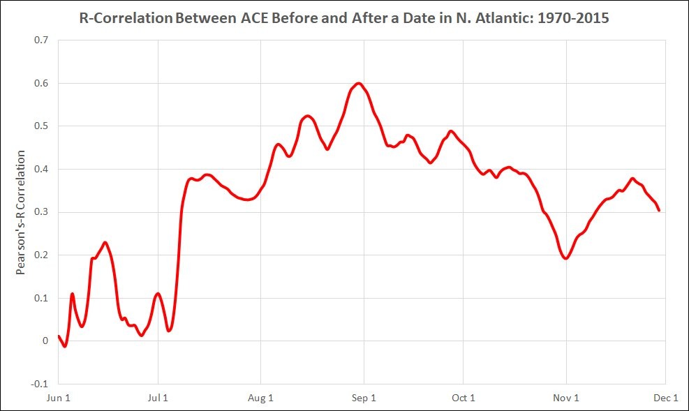
In other words, the fact that three tropical storms have developed before the end of June does not mean a whole lot with regard to potential activity for the rest of the season. If July is busy as well, that’s another story.

Monday and Tuesday

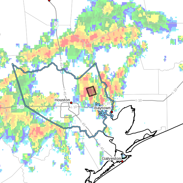
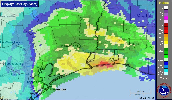
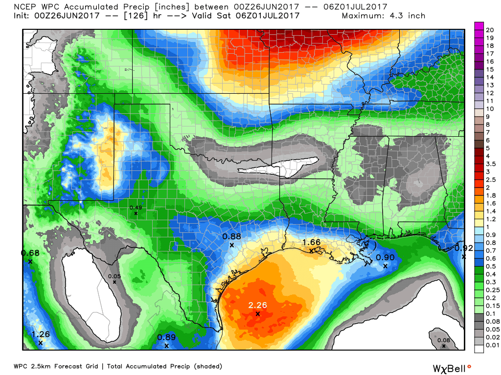
The Houston region experienced some very heavy downpours this weekend, the result of a rare June cold front sagging into the area and combining with high levels of atmospheric moisture. Accumulations of more than 5 inches of rain in a few areas flooded streets, but generally didn’t cause widespread, lingering problems.

This front will hang around for the next few days, allowing for a good chance of scattered to numerous thunderstorms to develop, especially during the afternoon and evening hours. I don’t think accumulations will be nearly so great as during the weekend, but certainly we could see some localized heavy rains that briefly turn roadways into waterways. The upside for this weather is that it should keep daytime temperatures in the upper 80s for the most part—a real blessing for late June in Houston. Nighttime lows should be in the mid-70s, rather than the upper 70s.

NOAA rainfall accumulation forecast for this week. (Weather Bell)

Wednesday through Friday

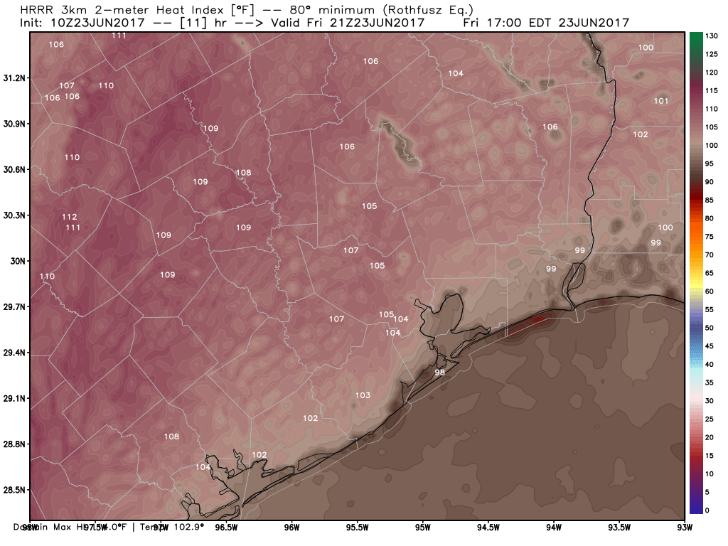
This pattern should linger through most of the work week, with a healthy chance of showers and thunderstorms—although nothing too disruptive—and highs in the upper 80s to around 90 degrees. Most areas will probably see about 0.5 to 1.5 inches of rain this week.

Saturday and Sunday

By the end of this week we should see high pressure building over the Houston area from the west. The most probable forecast for the coming weekend, then, is partly to mostly sunny skies, with high temperatures climbing into the lower- to mid-90s. A good beach weekend, perhaps?

Posted at 7:25am CT on Monday by Eric

Strong thunderstorms moving through Houston this weekend

As expected, some moderate-to-strong thunderstorms have developed across the Houston area this morning as a weak cold front sags closer to the region. This unsettled pattern will persist throughout the day and likely Sunday as the atmosphere is very moist.

Due to some especially heavy thunderstorms over northeastern Harris County, where in excess of 4 inches of rain have fallen since midnight, the National Weather Service has had to issue a flash flood warning until 11 am.

Area of flash flood warning in effect until 11am. CT. (National Weather Service)

Strong storms have also developed near Sugar Land and Katy this morning. Most areas are not going to see nearly so much rain as 4 inches, but the flood warning warning illustrates the potential for heavy rainfall due to the abundant tropical moisture in our atmosphere. Basically, the advice Matt gave yesterday holds for this weekend—bring an umbrella, and be prepared to have outdoor activities disrupted due to periods of inclement weather.

Unsettled summer weather settling back in

With Cindy in the rear-view mirror, we’re tracking back to a more standard but unsettled summer weather pattern. No serious trouble is expected the next few days, but if you’ll be outdoors this weekend, you’ll want to have a rain plan. Let’s break it down.

Today

The main story today is going to be unpleasant temperatures. Highs should reach the lower or middle 90s in Houston and the upper-80s at the coast. But in the wake of Cindy, humidity is going to be oppressive. Dewpoints at Galveston may hover around 78-80° most of tomorrow. When you factor that humidity in with temperatures, it will feel gross. Heat index values will be quite high today, so you’ll want to take it easy outdoors.

Model forecast of heat index at 4 PM says it will feel like around 105° in most areas, Hotter west. Limited relief at the coast. (Weather Bell)


The National Weather Service has heat advisories posted today for Wharton, Colorado, Austin, Grimes, and Brazos Counties, as well as the cities of Austin, Dallas, Waco, and San Antonio.

In terms of rainfall, today should carry the lowest risk of the next several. If I were placing odds, I’d give it about a 10% chance of a rogue downpour, mainly this morning and mainly southeast of the city.

See full post

After Cindy, Houston to see a rainy pattern through the weekend

As Tropical Storm Cindy turned to the north on Wednesday evening, the system’s rain bands went with it. The storm clearly demonstrated how miles matter when it comes to tropical weather, bringing about 6 inches of rainfall to an area between Beaumont and Lake Charles along the Gulf coast, and far less just 100 miles to the west in Galveston. For Houston, as we suggested here on Wednesday, Cindy turned out to be a non-event, with 0.5 to 2.0 inches of rain across the eastern half of the region, and very little rain to the west.

With this rain accumulation map it’s not hard to see where Cindy made landfall. (NOAA)

Cindy also showed why it’s best to be on the west, or left, side of a tropical system—where there’s generally less rain, wind, and the northerly flow on the back side of a tropical system can sometimes bring drier air as we saw on Wednesday with the lower humidity. My concern is that when a more serious tropical system threatens, residents will remember Cindy and think, “Oh, it’s no big deal.” That’s why Matt and I started this site, to not hype storms like Cindy, so when the real deal comes you’ll take us at our word.

Today

After making landfall near the Texas-Louisiana border before sunrise, Cindy has continued moving north. Additional showers and thunderstorms from the back side of the tropical system may rotate through Houston today, but I don’t think they’ll bring more than 1 to 2 additional inches of rain even for the hardest hit areas. Highs should again be limited to about 90 degrees.

Friday

Muggy weather returns on Friday, and with partly sunny skies we can expect temperatures to likely warm into the mid-90s. It’s going to feel hot after the cooler mid-week weather Houston experienced due to Cindy.

Saturday and Sunday

This weekend should be fairly wet, especially for the southern half of the Houston area. The combination of an approaching front—not really cold front, sorry—and the region’s moist and warm environment should allow for the development of widespread showers and thunderstorms. Some areas could see an additional 1 to 2 inches of rain, but right now I’m not anticipating any flooding problems. Mainly, the rains may be a hassle for those with outdoor plans. Highs will reach the lower 90s.

Next week

Rain chances won’t be quite as robust next week, but I’d still expect at least scattered showers and thunderstorms, with partly sunny skies, to start next week. This weather isn’t all bad for late June, a month which some times can be a scorcher, as it should help to keep highs around 90 degrees.

Posted at 7:20am CT on Thursday by Eric