After our wild Wednesday, we were treated to absolutely gorgeous weather yesterday in Southeast Texas. That will lead to another winner of a day today, albeit warmer. We continue to watch the weekend however, and the chance for both severe weather and heavy rainfall. Here’s the stormy breakdown.
Today
No weather trouble at all today. Expect ample sunshine, warm temperatures, and a breeze. We should make it into at least the middle 80s for high temperatures after a pleasant start this morning. Humidity will gradually work its way back ashore later today and tonight, but the majority of the day should feel pretty comfortable. That said, tree pollen (oak and cedar) remains high despite recent rain, and both grass pollen and mold spores are high also. So if you’re an allergy sufferer (raises hand), we still have a ways to go.
Quick cool thing I wanted to share. Here’s a satellite loop over South Texas this morning from the new GOES-16 satellite that was launched last November. This is experimental and non-operational data, as they’re still doing fine tuning, but check out how many lakes and different bodies of water you can detect on the satellite even at night.
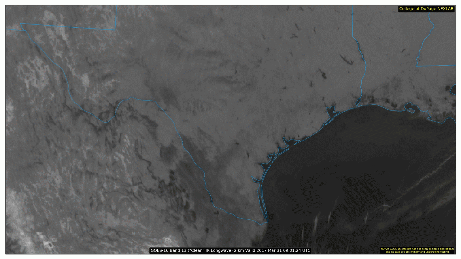
Amazing difference, and it’s like going from a clunky box of a TV to an HD set for meteorologists.
Saturday
The forecast gets a little trickier Saturday. Humidity will continue to flood ashore through the day. I expect we’ll see increasing clouds after a fairly sunny start. The last couple days it’s looked close for perhaps a few storms as early as late Saturday afternoon. Recent model data limits those chances until late evening. So while I think we’ll be dry during the day and early evening Saturday, if you’ll be heading up to the Shell Houston Open or to the Dynamo/Red Bulls match or Whatever Fest east of Downtown, just be aware later in the day in case it does get stormy.
(Space City Weather is sponsored this month by an anonymous donor)
Sunday
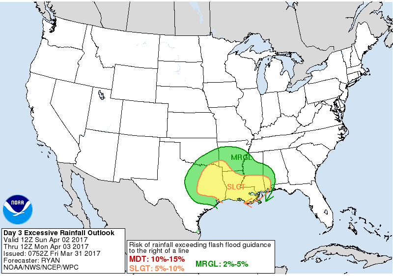
Onward to Sunday, the main event. For days now, the models have been remarkably consistent in pegging a heavy rain and thunderstorm threat for us Sunday. We know that the environment is going to be extremely supportive of heavy rain and probably very supportive for severe thunderstorms. What we don’t know yet are the details. What happens Sunday is going to be contingent on smaller scale factors we just can’t entirely predict more than 12-24 hours in advance. We know there will probably be heavy rain across the region, which is why the NWS Weather Prediction Center has much of the area (especially north) in a marginal or slight risk for excessive rainfall.
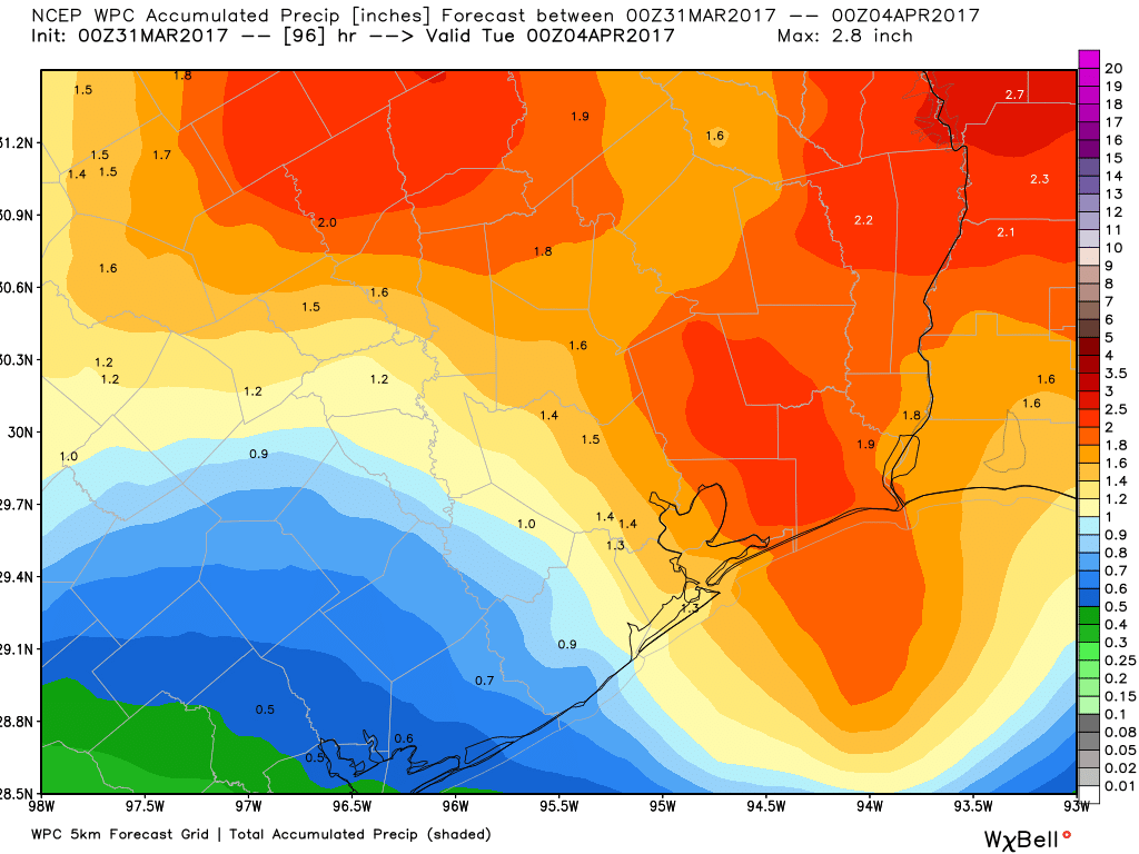
The current rainfall forecast from the NWS remains stout, with 1-2.5″ over the region. This seems reasonable as an average, but I’m willing to bet some places will see considerably more rainfall than that. We just can’t say exactly where or how much that will be yet.
We also can’t say for sure whether or not there will be severe weather, but we know the atmosphere on Sunday will be very favorable for it. In fact, the Storm Prediction Center already has Southeast Texas in an enhanced risk for storms.
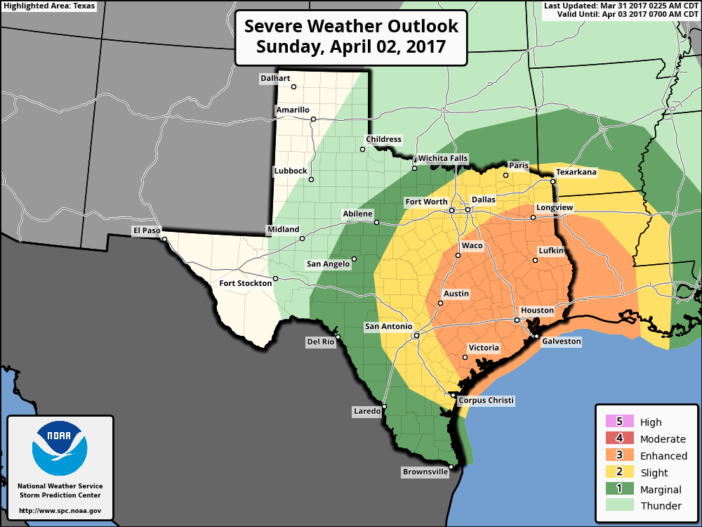
The current setup certainly supports the risk of hail, strong, damaging winds, and isolated tornadoes.
Bottom line on Sunday: If you have plans Sunday, have a way to receive weather warnings in a timely fashion. I expect outdoor events to be impacted by weather from at least mid-morning onward, including the Ironman 70.3 in Galveston and the final round of the Shell Houston Open. We will keep you posted this weekend.
Next Week
After Sunday, we should get back into this see-saw pattern of warm back to pleasantly comfortable weather a few days. But it looks very quiet next week, with limited rain and storm chances. A few days of less stormy weather would be a nice break, so here’s hoping the forecast holds.
Posted at 6:55 AM by Matt
Are you able to compare Sunday’s threats to Wednesday’s weather ?
There are some similarities but a lot of differences. This looks to have more moisture available so I think we may see a little more rain in spots (especially north of Houston). The dynamics are similar for severe weather, but this system has some issues with things possibly not coming together perfectly to get severe weather like we saw Wednesday. But if it does come together perfectly, the ultimate end game may be similar to Wednesday. Just a lot of little things going on that will impact the forecast.
Any indication how quickly the storms will be moving?
Storms should move at a fairly quick pace, but the trouble may be if storms line up one by one behind each other in a few spots…then you get the training storms with heavy rain and street flooding. We won’t know for sure until it starts up. Good news is that the system as a whole should move quick, so it’s in Sunday morning, out Sunday night.
Thanks Matt. You and Eric provide a great service to the Houston community.
I don’t particularly agree with that. Again, it’s not a situation to worry over…it’s just one to be aware of and have a way to get weather warnings during, just to be safe.
GOES-16 – – Spy satellite technology coming to you soon!
Not good for the Golden Triangle to be under the target again. Lots of family and friends took some flooding on Wednesday. Not sure they can handle much more.
It seems like I’m seeing increased talk about tornadoes with this system. Are these likely just small/spin-up ones as usual, or more of a threat than that? And which general areas might be more prone to them with this system?
They will be possible…in terms of whether it’s small spin ups or something bigger, it’s really tough to say, but it *could* be something bigger if certain ingredients can come together. As far as general areas, right now the entire region will have the risk almost equally. Timing-wise, it may be a bigger risk in the morning than the afternoon, but that’s very much to be determined yet.
No…this isn’t that kind of storm.
Rain totals don’t necessarily have to line up with where severe weather occurs. The heaviest rain may actually stay north of Houston while the best parameters for isolated severe weather may stay south. It’s a really complex situation that is almost never simple to pin down. I wouldn’t worry much…just have a way to receive warnings just in case.