Tropical Storm Cindy began moving again on Tuesday evening, but after strengthening into a 60-mph system it has become a little ragged overnight. Increasing wind shear and dry air have caused the system to look like something less than a tropical storm. This bodes well for the Houston region, as without wrap-around rains the storm seems unlikely to bring the worst—floods and damaging winds—into the area.
Track
Cindy has been moving to the northwest overnight, and models now generally agree that the system will turn north toward the Texas-Louisiana border later today. It should make landfall around midnight tonight, or during the pre-dawn hours Thursday. This would place the greater Houston region on the left side of Cindy tonight and that should make some difference in our weather conditions.
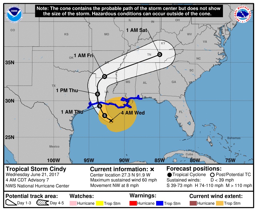
Rainfall
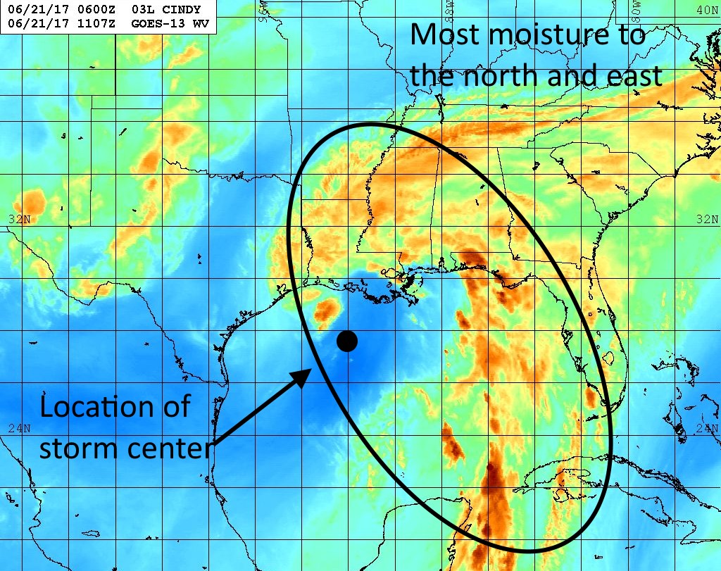
During the last 24 hours Cindy’s northern rain bands have battered the northern Gulf Coast, generally producing 4 to 6 inches of rain across a widespread area along Interstate 10 from Louisiana through the Florida panhandle. More is coming today while the west and southern sides of the storm remain mostly dry. This is due to the asymmetric structure of the storm in which most of the severe weather is north and northeast of the center.
We had some serious concerns yesterday that a lot of this moisture would wrap all the way around the center as it approached the northwest Gulf coast, which could have potentially produced a serious flooding event near where Cindy made landfall—including the Houston area. However we haven’t seen too much evidence of that overnight. This doesn’t mean Houston won’t see rainfall later today, Thursday and possibly into Friday, it just means that most likely the area will probably see 1 to 5 inches of rain, rather than the kinds of heavier rains that could produce widespread flooding. It is true that some isolated areas could see in excess of 6 inches of rain, especially to the east of Interstate 45, but as of right now I’m not overly concerned about flooding in the metro area.
Winds
The other major concern will be winds. Although Cindy is disorganized, it nonetheless has some pockets of 50-mph winds around both sides, and it will bring those to the coast tonight. It seems possible that Galveston and Bolivar Peninsula will see sustained winds around 40mph, and its likely that most of the Houston region will see wind gusts in the 30s to possibly low 40s tonight and Thursday morning. These aren’t high enough to cause serious damage, for the most part, but will be unpleasant to be out and about in. These winds may be enough to delay some flights tonight for the Houston airports, but flying conditions should be fine today, and most of Thursday.
Tides
We should expect tides to run 3 to 4 feet above normal along the upper Texas coast later today and Thursday morning.
Bottom line
Right now Houston’s forecast looks manageable due to the ragged appearance of Tropical Storm Cindy, and a likely turn to the north, away from a Houston landfall. We’re going to have to closely watch rainfall tonight to ensure we don’t see the kinds of tropical flooding these storms can produce, but at this point we’re cautiously optimistic. Regardless, we’ll stay on top of things for you.
Posted at 6:30am CT on Wednesday by Eric
Good riddance! Tropical storms are a curse for Houston
Thunderstorms are an even bigger curse for Houston, Weathernut.
Bring it! This time of year I welcome a mild tropical storm or depression. My yard needs the moisture, and plants know the difference between city water and God’s own. Of course, I’m located on the “dry” side… fingers crossed that my yard benefits.
I know it has been said before, but thank you for bringing some sanity to the Houston weather scene.
You’re quite welcome.
Any update on predictions for Houston rush hour tonight? Will we have to contend with heavy rain/t-storms/…?
Don’t think rush hour will be too bad. Tomorrow morning it will be worth checking conditions before you go out, however.
Any views on the latest “jog” Cindy too to the west? Will the turn to the north materialize anytime soon?
It’s hopping around a little but I still think its overall motion is to the NW.