As of 7 am CT a cold front has swept through most of the Houston area, bringing an end to the warmest late December streak of weather in the city’s history, an unprecedented five days of 80-degree weather during the Christmas to New Year’s period. As we swing back toward colder weather here’s a look back at the coldest temperatures across the region this season, so far.
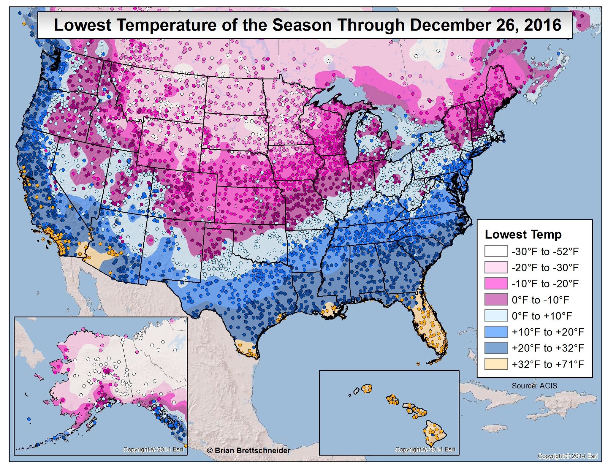
Notably a few parts of Texas, Louisiana and the southwestern United States have yet to experience a freeze this year. Now let’s zoom in on southeast Texas, where you can really see the effect of warmer waters in the Gulf of Mexico and Galveston Bay on land temperatures. A small slice of the coast has yet to freeze, and that’s unlikely to change in the next week or 10 days.

Today
With the front moving through this morning, Houston will see breezy conditions today, as winds out of the north gust up to 25 mph. Morning temperatures of about 70 degrees should fall into the low- to mid-60s by afternoon, and humidity levels are already falling like a rock. Temperatures tonight should fall into the mid-40s under mostly cloudy skies. You can finally wear that Christmas sweater!
Friday
A fine, cool day, with highs around 60 degrees under partly sunny skies. Winds will veer back to the southeast later on Friday, setting the stage for a warmer, wetter weekend.
New Year’s Weekend
Welcome back to the swamp. As southeasterly winds pick up we can expect to see rising humidity levels and daytime temperatures climbing back into the low- to mid-70s. Increasing moisture levels will also bring a healthy chance of light to moderate rain showers back into Houston, especially for areas closer to the coast and east of Houston.
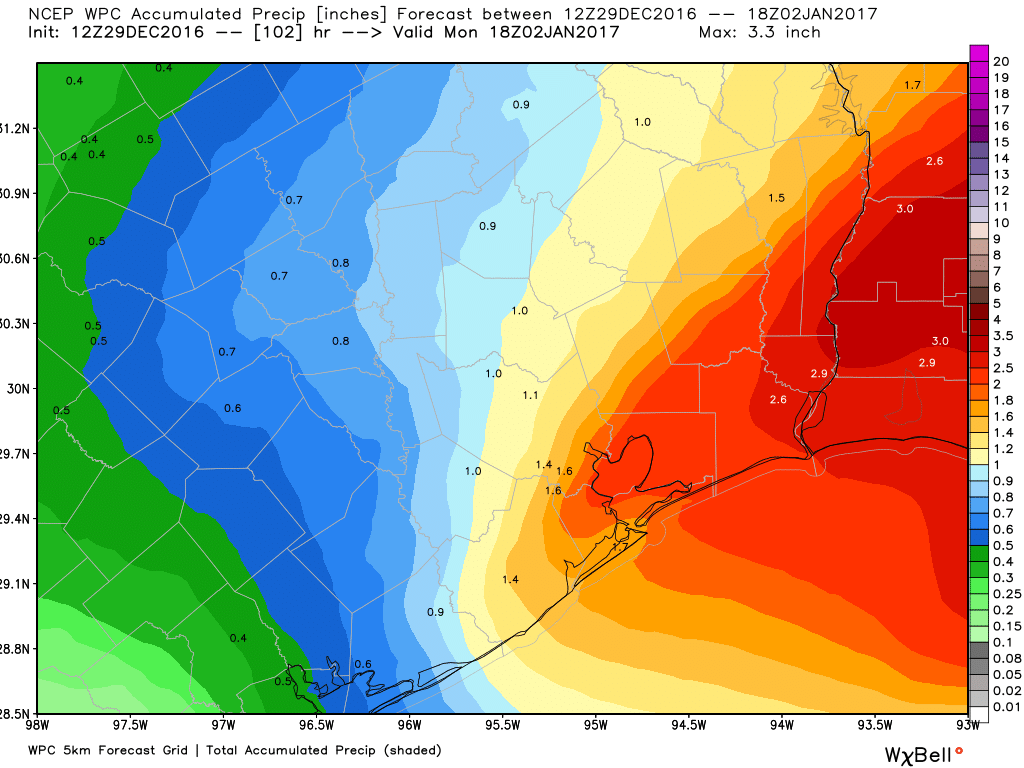
The showers will have the potential to disrupt New Year’s revelries, and we can’t rule out a few thunderstorms on Saturday and Sunday across the region. Rains end sometime on Monday morning or early afternoon, with skies likely clearing out.
Next week
Warmer weather will linger on Tuesday before a likely cool front on Wednesday brings cooler weather to Houston for several days—with highs likely in the 50s or low 60s—well into next weekend under gray skies.
Posted at 7:15am CT on Thursday by Eric