After a pretty nice and quiet Thursday, we head into Friday with similarly decent weather. We have a couple question marks this weekend, but I don’t think it will be anything to really mar the Easter weekend. But let’s hop to it.
Today
Again, no issues today. I expect it will be partly to mostly sunny and warm. Probably a lot of similarities to Thursday! High pressure is in control, but it is moving away, so onshore flow may get a little steadier late, which could lead to a shower or two in just a couple spots. More subtly, this will mean an increase in humidity very late today or tonight. But the bulk of Friday looks alright.
Saturday
The forecast gets a touch more challenging Saturday. A weak disturbance a few thousand feet up will pivot across the region, probably just east of Houston. This should be enough to set off scattered showers and storms, but also probably just east of Houston.
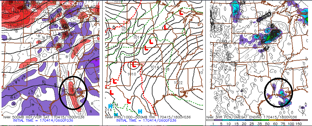
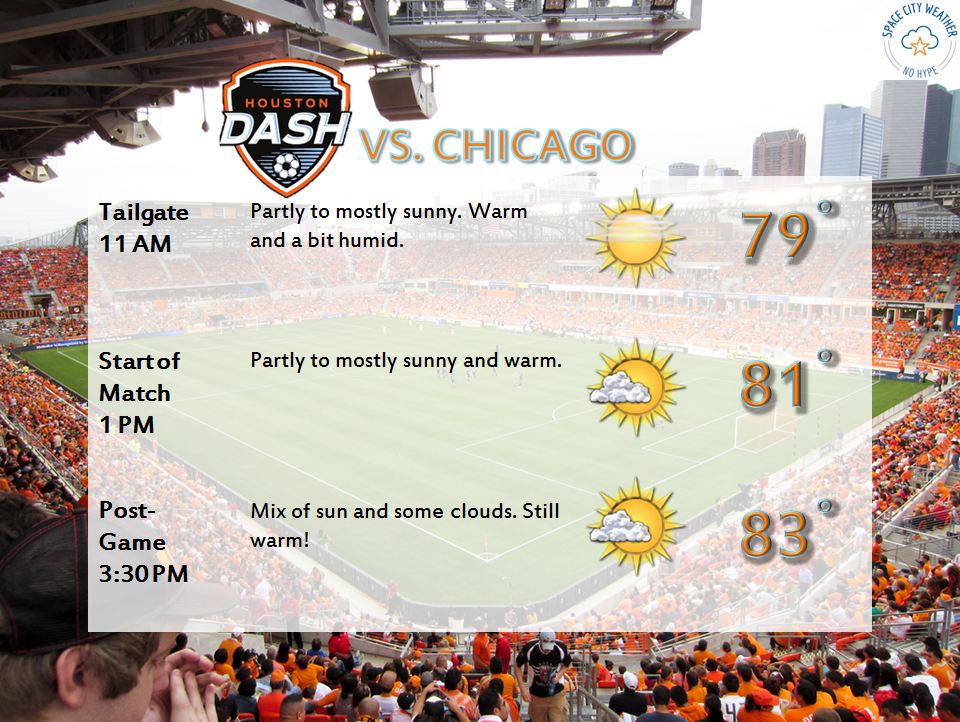
So the bottom line on Saturday: It’ll be a bit more humid. It will also be a couple degrees warmer. While I can’t entirely rule out a shower or two in the area, odds favor most of us staying dry. The best chance for a scattered shower will be east of I-45 and probably as far east as Beaumont or Lake Charles. So if you’re headed to Hobbyfest or Buzzfest, it looks pretty good. The Houston Dash also kick off the season at BBVA Saturday afternoon. It looks great.
(Space City Weather is sponsored this month by The Mole, a Jonathon Price novel.)
Easter Sunday
So what about Easter? As Eric pointed out on Thursday, the atmosphere is going to be adding moisture through the weekend, and our precipitable water values (or “PWATs,” usually a good gauge of how much moisture will be available for showers and storms) will inch upwards Sunday. PWAT values go from about an inch in the morning to about an inch and a half in the afternoon.
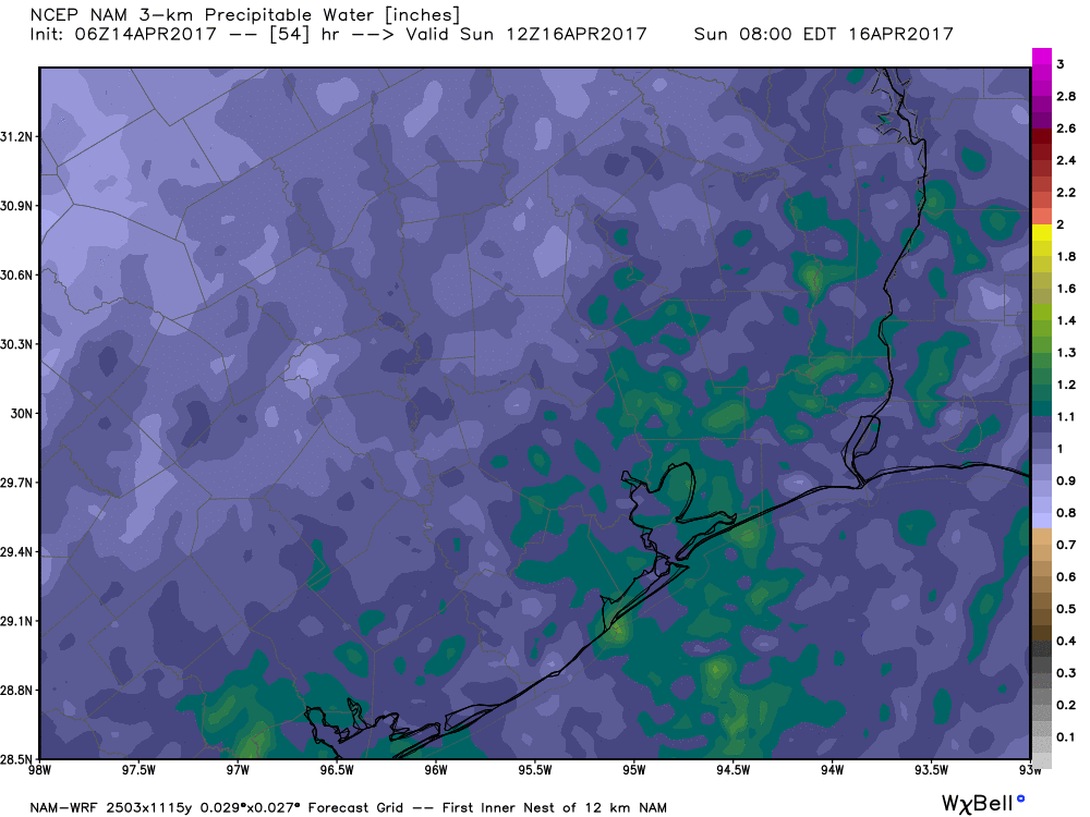
That’s not necessarily uncommon around here in spring, but that actual value is more typical for June. There are basically three ways to get storms here this time of year: Cold fronts, upper level disturbances, and the sea breeze off the Gulf. I’ve scoured the weather models for possible disturbances Sunday, and I see nothing through late afternoon that could act as a large scale trigger for storms (except well north and west of Houston). There are no fronts coming either. So that leaves the Gulf as the possible trigger for storms Sunday. Weather models are pretty low key about storms on Easter. So here’s how I see it:
- Expect partly sunny skies, warm temps, and a healthy dose of humidity Sunday.
- There will likely be a few showers or thunderstorms in the area Sunday, but exactly where, when, and how many is impossible to say.
- I don’t expect anything widespread or significant.
- Have an umbrella or a plan to shift the festivities indoors for a short time Sunday. But no need to make any changes in plans.
Next Week
Timing and details are very much TBD, but I do see at least one likely upper level disturbance Monday or Tuesday that should act as a trigger to get more widely scattered showers and storms going. It doesn’t look like a big system though, so this should be more standard springtime-type fare. Wednesday and Thursday should see quieter weather. The front Eric has alluded to this week is still on the weather models, so we’ll hold out some hope here. The timing on that appears to be in the Saturday-ish time frame next weekend. If you’ve got outdoor plans next weekend, stay tuned next week.
I see what you did there.
Happy Easter!
Was it me or was it actually a bit hot Thursday afternoon?
I took one my last 2016(!) vacation days Thursday to get caught up around the yard on a four day weekend. The morning was comfortable, but around 1-2 PM, it was getting rather uncomfortable even walking the neighborhood. It must have been in the mid 80s or even higher.
I know, it’s only going to get worse in the very near future.
Silly me – a quick check of the PWS nearest to me on Wunderground shows a high of 87.3 F at 1:30 PM.
So it was hot.
I don’t think so. Any storms this time of year can be strong with heavy rain, but the ingredients for any sort of severe weather are pretty much absent this weekend.
Those of us putting together the March for Science are very interested in the timing of the weather this coming Saturday. Hopefully it blows in during the very early AM hours or holds off until late afternoon. Fingers crossed.