Grim, gray weather has persisted across the Houston metro area on Saturday, but by far the heaviest rains have developed along the coast, where as much as 10 inches of rain have fallen in the last 24 hours. The following map shows estimated satellite rainfall accumulations through the middle of Saturday afternoon:
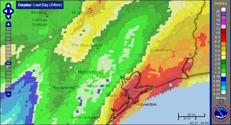
Officially, at of 4:15pm CT, the city of Galveston has recorded 6.14 inches of rain on Saturday, and when the city reaches 6.31 inches it will surpass Dec. 17, 1995, as the wettest December day ever recorded on the island.
Rest of today
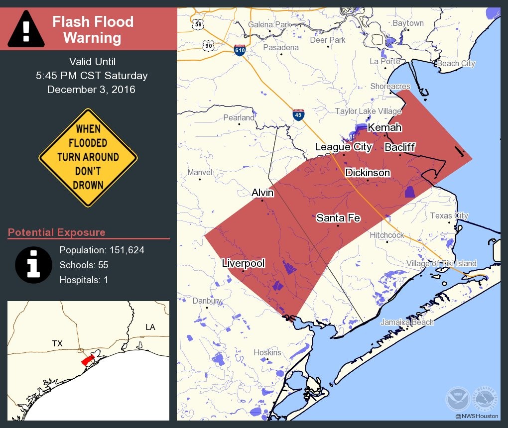
A flash flood watch remains in effect for the entire area through Sunday evening, but as we’ve seen the heaviest rains have set up along the coastal counties, that’s where the biggest concern lies. Accordingly a flash flood warning is in effect through 5:45pm CT on Saturday for northwestern Galveston, and northeastern Brazoria counties. Grounds there are now fully saturated.
It seems likely that these coastal storms will persist at least for a few more hours this evening before the area begins to see—perhaps—a bit of a respite.
Sunday and Monday
Such a respite will be short-lived, however, as another upper-level disturbance should move toward the Houston area from the southwest late tonight, and into Sunday morning. Right now the timing is a bit uncertain, but it looks as though we could see the development of additional heavy rainfall over much of the Houston area by as early as 10 or 11pm CT on Saturday night, and persisting through at least Sunday morning.
At this time it’s not clear whether the storms will remain heaviest along the coast, or set up more inland on Sunday. If the rains fall over central or northern Houston, I don’t think they’ll cause too much of a problem, as these areas remain well suited to cope with additional rainfall. However if the heaviest storms again develop from League City to Galveston we definitely could see some more significant flooding problems. We’ll be watching it closely.
After this disturbance passes on Sunday, more showers will be possible on Monday, and unfortunately at this time they appear most likely to develop along the coast. A real break from the rain is unlikely before Monday evening or so.
Posted at 4:20pm CT on Saturday by Eric
Already > 2.5 ” of rain around Ellington.
The ditch by the Park & Ride at Bay Area is running real high.
Off topic:
Eric, what problems (if any) do you expect from the expected Arctic front later this week?
Should be no major problems, just cold air.