As of noon on Saturday the heaviest rains associated with today’s storms have moved through central Houston and are pushing off to the east.
Finally, right?
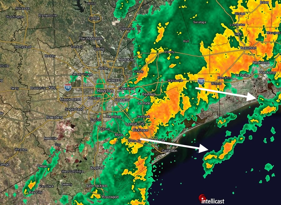
Although forecasts for the timing of the heavy rains were accurate — I had pegged midnight Friday to noon on Saturday for the most intense rains — amounts were not. Instead of isolated areas of six or more inches, widespread areas of the metro region received that much. And isolated areas to the east-northeast of Houston, including Crosby, received a staggering 11 inches of rain during the last 24 hours.
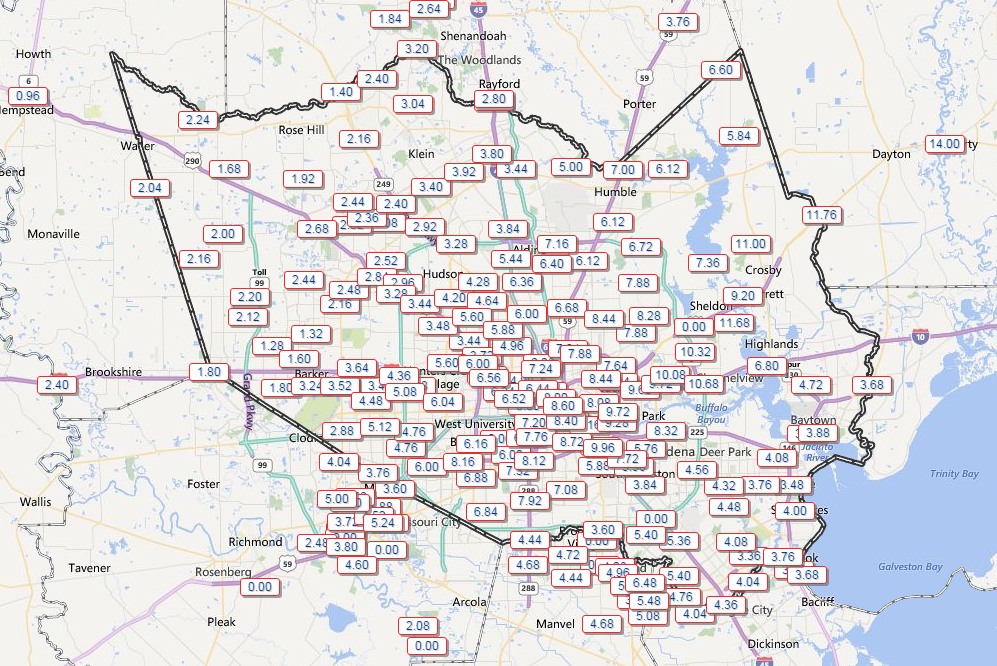
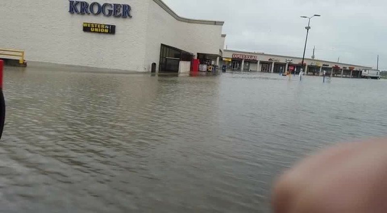
Despite the very heavy rains, however, bayous for the most part stayed within their banks — if only just. Yes, there was some street flooding, which is to be expected, and some homes were affected in Harris County. You don’t get 6 to 8 inches without some problems. But we didn’t see widespread home flooding in most areas of Houston.
The exception is homes along Hunting Bayou, and other areas further to the northeast of Houston, including Crosby and Dayton. Impacts there from a foot or more of rain have been significant.
I’m expecting to see continued development of scattered, light rain showers this afternoon. And I can’t rule out more light rain tonight. But I do not think we will see widespread, heavy rain and thunderstorms that would preclude trick-or-treating. It won’t be the best night, but it’s likely going to be far from a washout.
Overnight we’ll start to see some cooler, drier air work its way into the region. Expect highs in the 70s on Sunday and Monday, with partly sunny conditions, and lows in the upper 50s or lower 60s.
Posted at 12:15 p.m. Saturday
The sun is trying to come out in the Ellington/Clear Lake area, and I just had the easiest in/out from Baybrook Mall on an early Saturday afternoon in 30 years.
Rain gauge now at 4.4″ for the event.
Any cold weather in the forecast?
Yes, next weekend is looking quite chilly.
Woo Hoo!
After this summer, I could go for some snow right now.
But I’ll settle for some fall Big 10 football weather. That’s about I’ll I can ask for in Houston.
11.76″ down here on the lower San Jac. A small tornado come through an roughed the neighbors homes up. San Jac is real high, well up into the yard. We still have another 4-5′ before it gets to the slab under our house. No worries though, we are on 11′ pilings.
Pretty impressive rain totals, and glad you’re high and dry.
My rain gauge for the event was 7 inches – West University Place.
My rain gauge for the event (Jersey Village area) read 3.25″. Rain was over by 9:30-10:00 this morning.
I only just learned that you left the Chron during last weekend’s storm. Congrats on your move!
For selfish reasons, I’m surely going to miss your timely, informative news updates. Will your new gig allow free access or require a paid subscription?
Free access, but at some point I’m hoping to find a sponsor.
Thanks for following me over here.