As one would expect toward the end of August, the Atlantic tropics are starting to heat up, and we may see both a Gaston and a Hermine within the next week. As of 1pm CT on Monday, here’s the state of play in the Atlantic tropics.
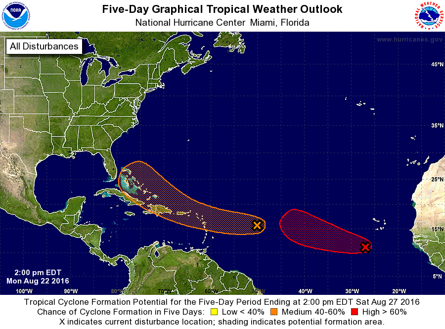
The red blob on the right is Invest 90L, and it’s soon to become Tropical Storm Gaston. I feel pretty confident that that’s all we’re going to gave to say about Gaston as a threat, because it has the look of a “fish storm,” meaning the system will probably recurve before it reaches the United States. We may have some concerns down the road about this being a threat to Bermuda, but I don’t think it gets that far west.
So what about the other storm?
Unfortunately we can’t be so dismissive about the orange blob, which is Invest 99L. The system remains rather disorganized right now, and due to the influence of dry air the National Hurricane Center only gives 99L a 50 percent chance of developing into a tropical storm or depression during the next five days.
While the system may not develop it’s expected to drift toward the Bahamas by this weekend. Here’s a look at the GFS model forecast positions for the “low” associated with 99L by Sunday night:
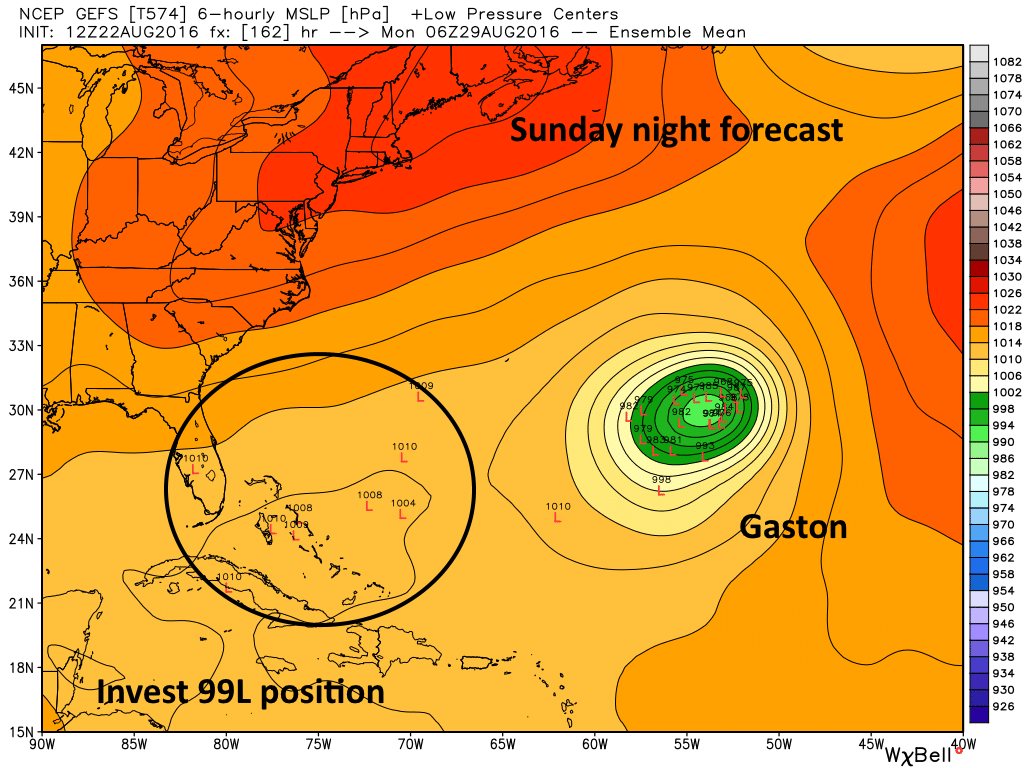
Now the GFS model isn’t too bullish on 99L, but the European model (and to a lesser extent the CMC model) do show some development by the weekend as the system finds more favorable conditions for development.
Tropical Storm Hermine?
Matt and I have conferred about this and we’re both planning to watch 99L fairly closely. This is because as the system (if it develops into Tropical Storm Hermine) moves toward Florida this weekend it’s going to run into a fairly strong ridge of high pressure. At that point it’s either going to get pulled to the northeast by the flow of Gaston, or may get forced west, across the Florida peninsula and into the Gulf of Mexico (see here for a good primer on Hurricane steering conditions).
Here’s how the European model looks early Monday morning:
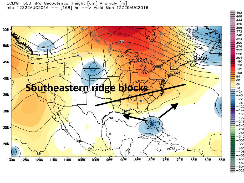
If you’re wondering, the European model eventually brings a strong tropical system into the eastern Gulf of Mexico and then bends it northeast toward the Florida Panhandle. But please don’t get caught up in any specific outcome at this time. The ultimate movement of 99L depends on a number of factors difficult to predict: How strong will Gaston get? How strong will high pressure be over the southeastern United States? How strong will 99L itself get? We have many more questions than answers at this time.
We don’t think this is a Texas storm, but there are no guarantees on that. For some part of the United States 99L may well become a wet, windy mess by this weekend, or early next week. We’ll stay on top of it for you.
Posted at 3pm CT on Monday by Eric
Thanks for the clear analysis. As usual.
Why don’t you think it’s a Texas storm, Eric? I noticed one of your arrows is pointing toward central Louisiana. If that ridge moves a little further south……
When I saw the phrase “orange blob” I was worried you were referring to Trump. Glad to know its a developing tropical storm instead – much less frightening.
What does invest 99L stand for