Hot, hot, hot! Thursday was the hottest day of the year so far in Houston. We hit 95°, which is right about average for our first 95° day of the year. Typically, our first 95° day occurs about June 13th (based on records back to the 1880s). Fun fact: In 1899, we didn’t hit 95° for the first time until August 8th! If only…
Today & Weekend
With our first 95° in the books, we’ll try and tack on at least one more this weekend. High pressure should dominate the next two to three days, keeping us mostly dry and hot. I suppose we can’t entirely rule out a stray downpour Friday, Saturday, or Sunday, but for the most part, the only detriment this weekend will be the heat. If you’re outside, make sure you stay hydrated, wear sunscreen and find some shade when possible. It’s very basic, common sense stuff, but it’s always worth a reminder.
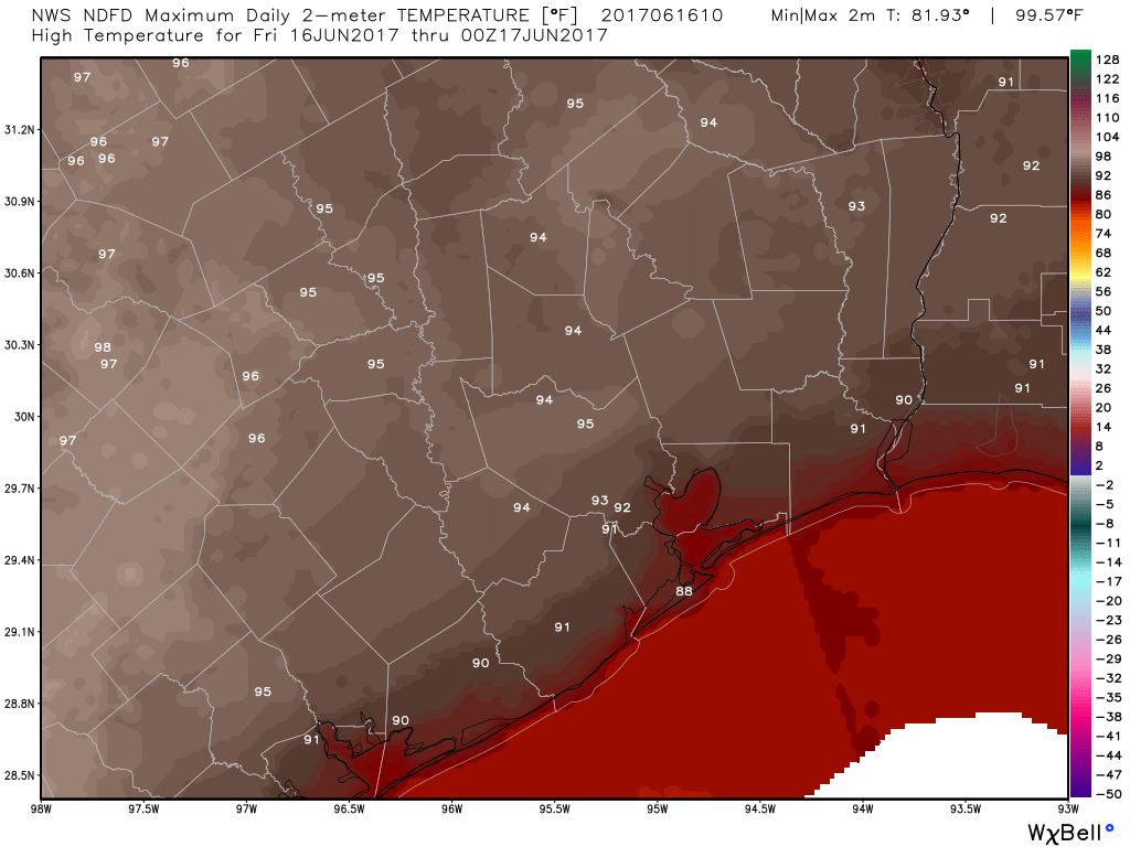
All three days should see low to mid-90s for highs. Nighttimes will be sultry, with upper 70s in Houston and about 80 degrees along the Southeast Texas coast. Galveston will offer limited relief at night this weekend.

Next Week
The forecast for much of next week really hinges on what happens with the potential area of low pressure in the Gulf of Mexico that we’ve been keeping tabs on. Unfortunately, trying to pin down details of what that system will do, if anything, is an extremely challenging job right now.
Here’s what we know….
Monday and Tuesday are likely to be an extension of this weekend, with hot conditions and only a slight chance of a shower or storm. Expect another day of mid-90s, and it’s possible Monday will be the hottest of the upcoming days.
Wednesday through Friday will be contingent on the low. The National Hurricane Center continues to outline about a 50% chance of development (update: The NHC boosted odds of development to 60% after this post was published).
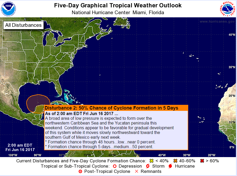
We have models basically split into two camps right now. One camp takes the majority of the system and slides it slowly westward toward either the far South Texas coast (think Corpus Christi or Brownsville areas) or northern Mexico. The other camp keeps it further east, mostly toward the Central Gulf or Florida. Within the weather model ensembles, there are some solutions that do take it in between, perhaps toward us and there are some solutions where the system never even develops at all.
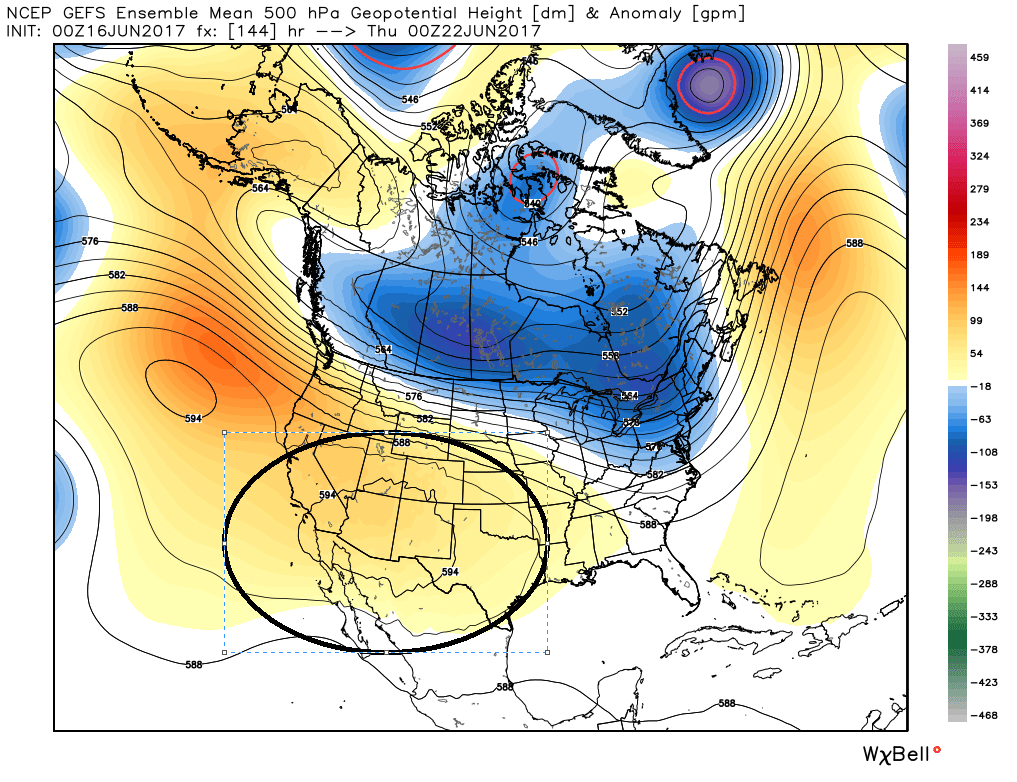
As of now, we’re not terribly concerned about this. First off, it will be a broad system in size. Those tend to struggle more with development, meaning whatever development takes place will probably be slow. Second, overnight weather models strengthened upper level high pressure near Texas. If that trend can continue, this system will likely have no chance to make it to the upper Texas coast and would be suppressed south into Mexico or blocked to our east.
This system will be worth watching through the weekend. It hasn’t formed yet, and while most solutions make this mostly a non-issue for us, there have been a few models willing to bring some of the moisture from the system further north up the Texas coast. So the Wednesday through Friday period would be stormy in that instance. But as of now, I’d say that’s a low-probability scenario, and I’d expect hot, mostly dry weather later next week.
Eric and I will continue to monitor this for you and update as we need to. While we aren’t really too worried about this system, this serves as your periodic reminder to have your hurricane plans and kits up to date.
Posted at 6:25 AM Friday by Matt
Thanks Matt reference your data driven discussion about the low in the Gulf…that will help balance the TV hype surely to follow…
Very clear analysis. Thanks!
Thank you, I have been wondering about that low.