Houston has had a pretty dull fall, with warmer than normal temperatures, little rainfall, and almost no severe weather. But now things appear to be getting a little more interesting, with a wet weekend on tap, and significantly colder weather likely next week.
Today
After the region set record high temperatures on Tuesday (84 degrees, breaking a record from 2006), a cold front finally moved through last night. Temperatures this morning have fallen to around 60 degrees for most of the area, but the dewpoint has fallen off a cliff—the relative humidity this time on Tuesday was 100 percent, this morning it is 39 percent. Under mostly sunny skies temperatures today should rise to nearly 70 degrees.
Thursday
After lows start off in the low 40s north of Houston, and in the mid-40s for central parts of the city, we’ll have another spectacular day with a high near 70 degrees under fully sunny skies.
Friday
Friday will start off just a few degrees warmer than Thursday. But winds should pick up from offshore, returning moisture and setting the stage for what should be a wet, cool and gray weekend. Some rain is possible on Friday and Friday night, although it should be of the light to moderate variety. Highs will be near 70 degrees.
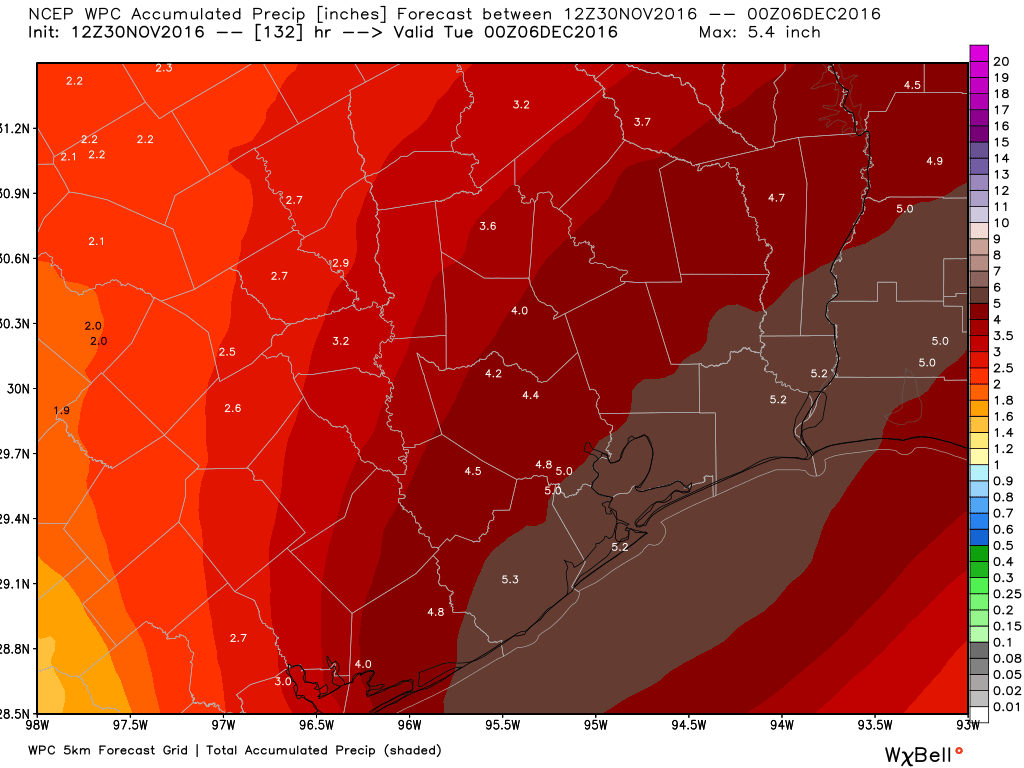
Saturday and Sunday
The combination of elevated moisture levels and lower pressures at the surface should make for a rainy weekend. It appears that chances for heavy rainfall will be greatest from about noon on Saturday through noon on Sunday, but there’s a good chance for light to moderate rainfall all weekend long. Look for highs in the 60s on Saturday, and likely only about 60 degrees on Sunday as some cooler air works its way into the region. As for rainfall accumulations, I think we’re still looking at about 2 to 4 inches for most areas, with some isolated areas seeing greater totals. I’m not overly concerned about flooding, but it’s a possibility, so we’ll be watching it closely for you.
Next week
The heavy rains now seem likely to end by, or on Monday, and highs next week should warm into the low 70s before a strong cold front pushes through on Wednesday or Thursday. I wrote about the potential for colder weather next week in a post yesterday.
Posted at 6:40am CT on Tuesday
“Winter, it is coming”…I still haven’t yet announced the arrival of fall to my family…a yearly tradition…maybe I should just forget about it this year?!
Milt, Houston only has two seasons – freakin’ hot and not so freakin’ hot.
Hmmm – maybe I should get my gutters cleaned out before the rain hits.