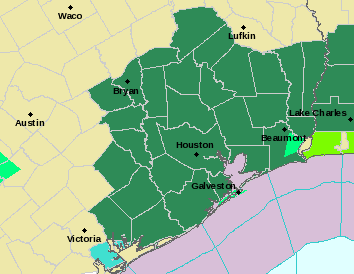
Good morning, everyone. The National Weather Service in Houston has posted a Flash Flood Watch for the entire region through tomorrow evening. As expected, conditions will become more favorable for flooding to occur in the hardest hit parts of the area as we go deeper into today, tonight, and tomorrow.
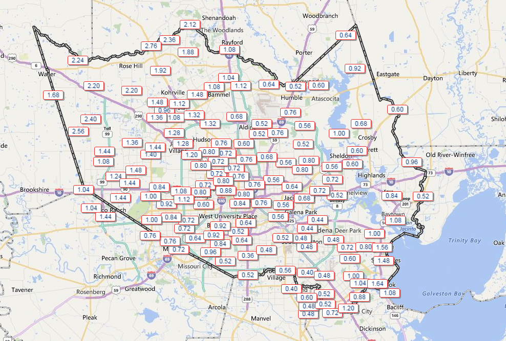
Rainfall since yesterday afternoon across the area has been mostly manageable to this point. Northwest Harris County has seen 1-3″, while central and southeast portions of the county have received about a half inch to perhaps up to 1.5″ of rainfall.
Outside of Harris County, Galveston has already set a daily rainfall record for today with over 4″ reported as of the 8 AM observation.
Rest of Today
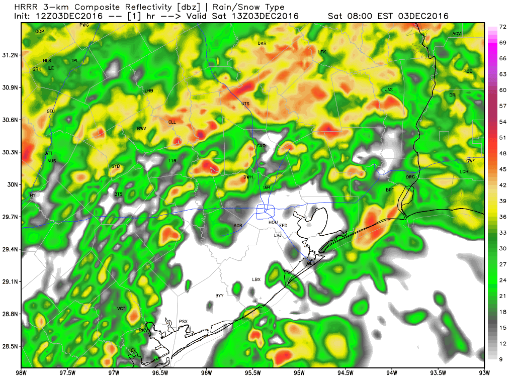
Radar as of 8:30 AM shows not a widespread rain, but bands of heavy rainfall strung out over the area.
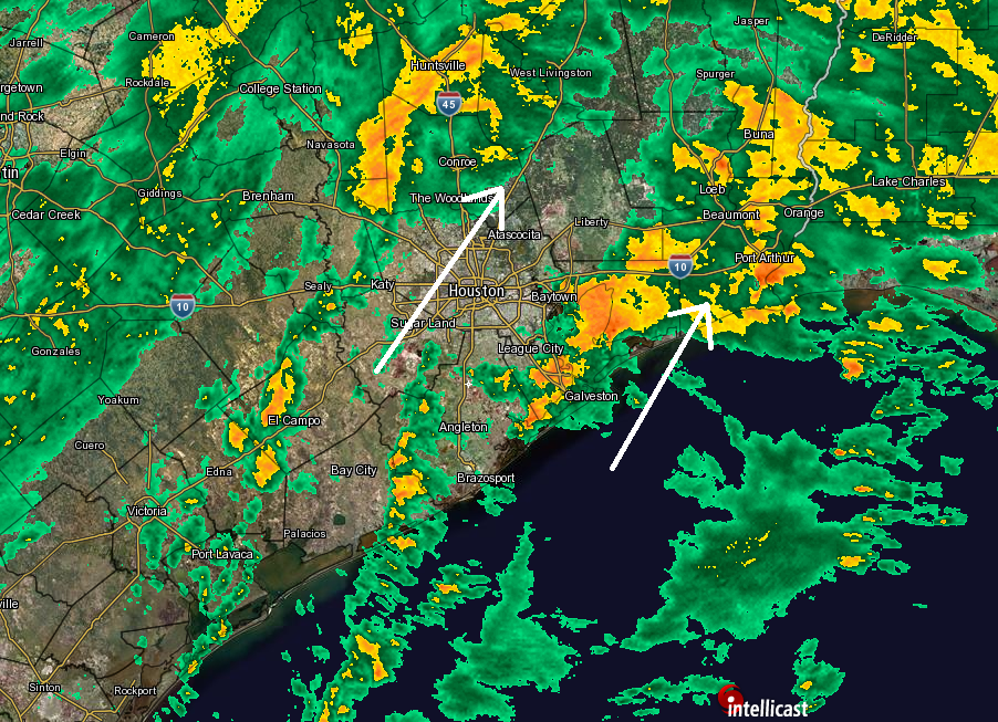
Areas close to Galveston and just inland from there continue to get repeated heavy rainfall. Heavy rain is also causing issues in the Port Arthur area as well this morning. Around Houston, it’s quiet at this point, with just a few downpours, transitioning to more frequent rain as you get northwest of about an El Campo-Brookshire-Conroe line.
Storms just offshore of Galveston have occasionally shown the ability to produce waterspouts (tornadoes over water) since last night. If you’ll be at the coast today or along Galveston Bay, keep an eye on this potential throughout the day.
As we go into this afternoon, rain should continue in fits and starts. Many places will have breaks in the rain, but others (like we see near Galveston this morning) could see a few hours of heavier rainfall.
As we go into this evening, there *may* be a more pronounced lull, before the next wave of heavy rain moves in overnight. The exact timing of this could change, however. Heavy rain will continue into tomorrow morning, and there’s likely to be one more round late tomorrow or tomorrow night. Eric will have an update on the situation for tonight and Sunday later today.
Bottom line: Periods of heavy rain will be likely through the day today, though there will also likely be periods of drier weather. A widespread round of heavy rain should move in tonight, continuing into Sunday. Sunday and Monday will see more rain, and a Flash Flood Watch is posted for the region until at least Sunday evening. Our next update comes later today.
Posted at 8:50 AM by Matt
1.32 inches overnight just south of Second Baptist West…19500 west I-10.
Thanks to all of you at Space City Weather for keeping us informed during this rainy weekend. We appreciate you!
Watching this page closely….thank you for all y’all do.
Rain totals since midnight Friday night for Galveston State Park area are 6.5 inches and rain is heavy.