As the southern edge of a major storm system moves approaches Houston the western half of the metro area is under severe thunderstorm warning this morning until 5:30am CT.
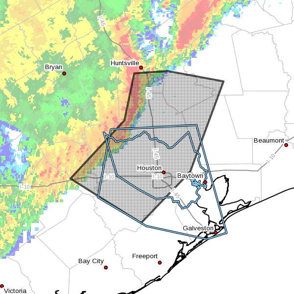
In addition to heavy rain (about 0.5 to 1 inch with this line of storms) this means there may be strong winds, hail and possibly even a tornado over a northern part of the city near Spring. I expect the thunderstorm warning area to expand eastward as we get closer to sunrise.
One saving grace from this system is that it continues to steadily move eastward and should move out of the eastern half of the Houston region by 7 or 8 am CT. After the main line of storms moves through we could see some additional scattered showers and thunderstorms later this morning and afternoon. But as for the potential for very heavy rain and severe weather, this is the main event.
Posted at 4:45am CT Wednesday
Thank you for watching for us!
Thanks for the heads up, Eric.
4:46 AM? Don’t you two ever sleep?
Went to bed early last night as a precaution!
How much rain (inches) is predicted this weekend ? Any training ? Is it as bad as it sounds. ?
Hard to predict. In my latest post I call for 2-4 widespread, with localized areas of 5+ inches.
New York City
New York City