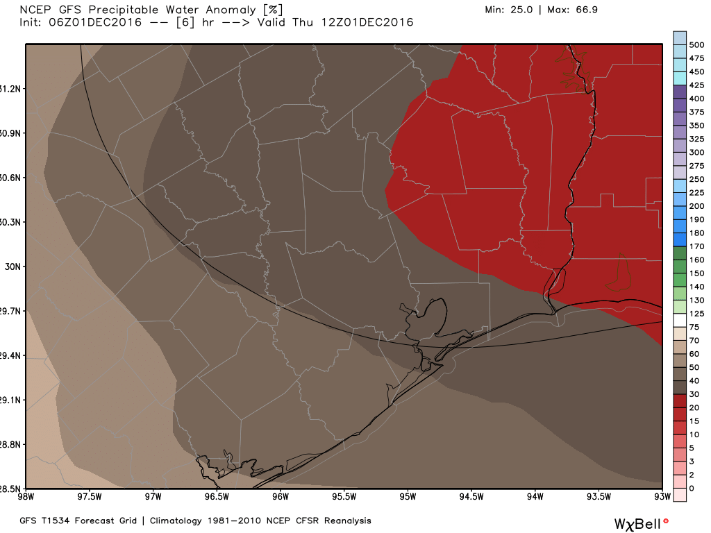
Good morning. It’s chilly out this morning, and very dry. How dry? Atmospheric moisture levels (shown below) are barely 10 percent of normal levels. Enjoy the calmer weather because big changes are coming for this weekend.
Today
Expect a cool and sunny day, with light northerly winds. Highs in the upper 60s and lows Thursday night should see temperatures three to five degrees warmer than Wednesday night.
Friday
Friday will bring about a change as winds shift to out of the east, and they’ll become gusty as moisture moves inland. At the same time a large upper-level low pressure system will approach Texas from the west, and these ingredients will set the stage for a wet—and potentially very wet—weekend. Friday itself should be mostly cloudy, with high temperatures in the mid-60s, and a chance of light to moderate rain during the afternoon and evening hours.
(Space City Weather is brought to you by Harmony Strings this month)
Saturday and Sunday
The best rain chances will occur on Saturday and Saturday night with lower pressures just off the coast goosing rainfall rates. It’s not entirely clear where the heaviest rains will set up, as the models have vacillated between along the coast, and further inland, just to the west of Harris County. However there is the potential for some areas to pretty quickly pick up 3 to 5 inches of rain on Saturday, with more widespread totals of 1 to 3 inches. Highs Saturday will likely remain in the upper 60s.
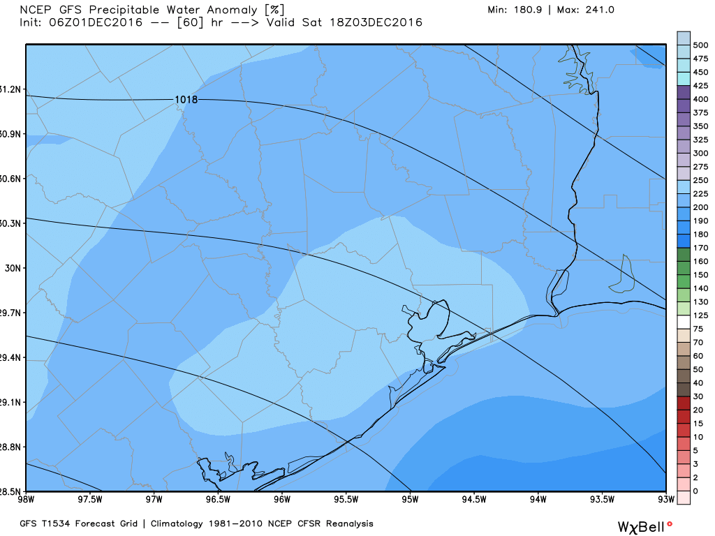
On Sunday conditions aren’t quite as favorable for heavy rain, but at least light to moderate showers and thunderstorms will again remain likely for the metro region, with highs of around 60 degrees as cooler air moves in.
Monday
Oh, you thought the rain was over? That upper-level low pressure system that approached Texas over the weekend now appears likely to move over the area on Monday, which could produce another round of showers and thunderstorms. So expect another gray and rainy day—three in a row if you’re counting.
All in all I don’t think these storms will produce widespread flooding, but we’re going to be watching them closely for you all weekend.
Tuesday and beyond
Some sunshine should return by Tuesday and Wednesday of next week, with highs around 70 degrees, before a strong cold front moves through. The end of the next work week still looks quite cold, with a freeze possible for some parts of the metro area. We’ll focus more on that when we get through the coming, soggy weekend.
Posted at 6:50am CT on Thursday by Eric
What do you expect at Hobby around 8:30 Saturday morning? Heading to Green Bay for the Texans game.
Jeff, I think conditions on Saturday morning may be OK for getting out. Certainly flights won’t be delayed all day, but your flight could be running late.
It was a cold morning for a 540am bike ride.