Anyone watching a radar this afternoon will have seen a line of thunderstorms moving toward Houston from central Texas. While these storms have weakened somewhat, and should continue to do so, they are strong enough to produce moderate to heavy rains as they move eastward. A flood advisory is now in effect for the Brenham area.
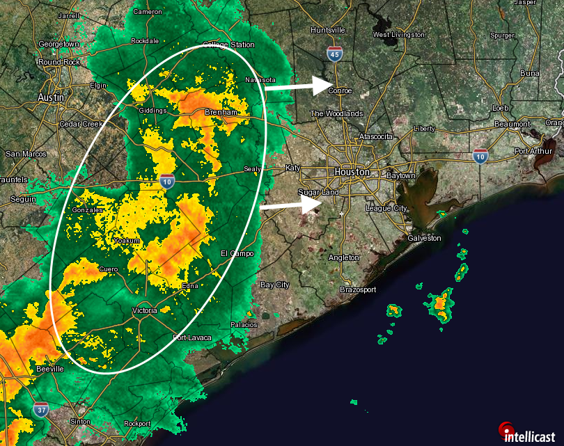
These storms should push through the Houston metro are between 7pm CT and midnight. Some areas may see 1 inch or more of rain, but I think most of the Houston metro region, especially to the east of Interstate 45, will see considerably less than that.
This, of course, is just the beginning. More rain is possible on Wednesday, in the form of at least scattered showers, before heavier rain chances increase further during the Thursday through Saturday period. It’s not the news anyone wants to hear, but it is the reality of what’s likely to happen.
1. Does the ULL you mentioned in an earlier blog being over CENTRAL Texas makes things worse for Houston than if it were over SE TX, Eric?
2. I have a doctor’s appointment @ 10:00 A.M. on Thursday. Should I consider rescheduling, or do you think the rains will hold off until later that day?
It’s impossible to make a forecast for 10am CT on Thursday morning. It probably will be OK.
And the ULL over Central Texas instead of SE Tx? Why is that a concern for you? Does it make things worse?
Please add a date to your WordPress posts. Thanks.
I try to remember to date and time stamp every post at the bottom.