This is the latest edition of Weather whys, a series of posts by Braniff Davis explaining the science behind weather phenomenon affecting Texas.
Now that we’ve enjoyed a few sunny days after an extremely wet May and early June, we wanted to tackle a few ‘weather whys’ questions people have asked, either on Facebook, Twitter, or in the blog comments. One reader asked why the weather system last week, which dumped so much rain on the region, was not considered a ‘tropical system.’ After all the system spun counter-clockwise, and had the satellite appearance of a tropical cyclone.
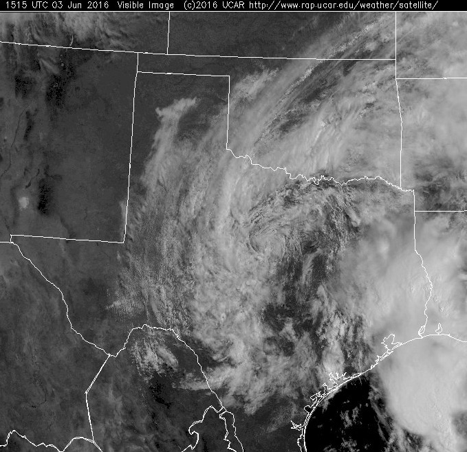
The answer has to do with how and where different low pressure cyclones form. Pressure, and how it influences weather systems, is vexing. Often, it was the most challenging concept for my students to grasp in my introduction to meteorology classes. We could probably do a 50-part series on the science behind it, called cyclogenesis. For now, we’ll spare you that and only focus on the large, synoptic scale cyclones that influence our weather.
EXTRATROPICAL VS. TROPICAL CYCLONES
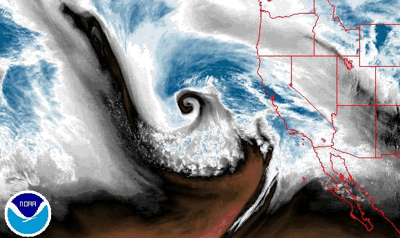
Basically, there are two major classifications of low pressure cyclones: extratropical and tropical. Extratropical cyclones, or mid-latitude cyclones (or Nor’easters, or Alberta Clippers…there are a lot of names in meteorology for the same thing), form in the mid-latitudes (between 30 and 60° north of the equator). They begin in baroclinic zones, or regions where temperature and dew points change over a distance. Warm, moist air collides with cold arctic air, over land or over cold water, providing the energy needed to power the system. In meteorology, we call this a cold-core low. These are the large cyclones that influence weather in the United States every fall, winter, and spring, with associated fronts that drastically change the temperature, humidity, and winds in a region. A good portion of rains in May, for the most part, were directly or indirectly influenced by the mechanics of these systems.
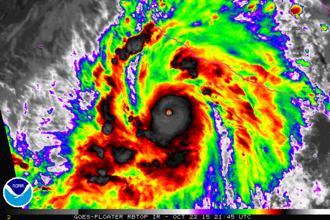
Tropical cyclones, on the other hand, form in the tropics, between 5 and 30° latitude. Unlike the extratropical cyclone, tropical cyclones (or hurricanes, or typhoons, or simply, cyclones) derive their energy from latent heat, or the energy released when warm, tropical water evaporates, then condenses into clouds—creating a warm-core low. Tropical systems form only over warm water—if the water is too cold, or if the system goes over land, it loses its energy. There are also no fronts associated with tropical cyclones. While the two may look similar in satellite imagery, if we look at a surface weather map, the differences are more apparent:
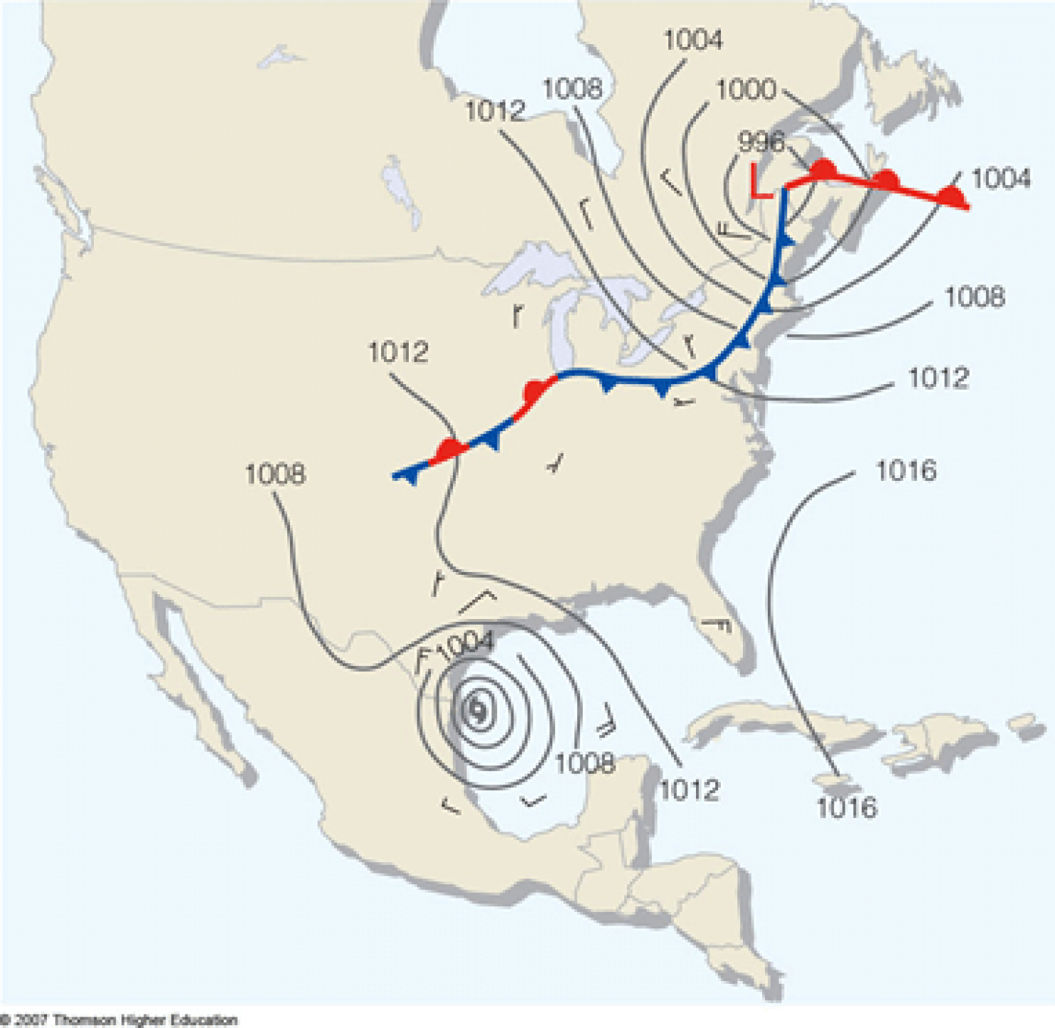
Here, we can see the fronts associated with an extratropical cyclone, along with the associated region of low pressure, shown with isobars. The tropical cyclone, meanwhile, has no fronts.
There are many other differences between these two types of cyclones, but hopefully this explains the basic difference between these two influential weather systems. If you have questions about this, or any other meteorology topic, let us know!
Love the Weather Whys!! Please keep them coming!
Thank you. I feel smarter!
The Norwegian Model of Cyclogenesis lives on!
Thanks for the explanation, but I have two questions:
1. There was considerable chatter about last week’s system transitioning to a warm-core low. Can you tell us what that means and what the impact would have been if it had done so?
2. Shouldn’t “energy released when warm, tropical water evaporates” be “energy released when warm, tropical water condenses”?
Greg,
1) Cold cores can transition to warm cores, but usually only if it sits over warm water for an extended period of time. If this were to happen, the system would probably weaken with height, or be weakened by convection from the warm water environment. Another possibility is a transition into a thermal low (another type of warm core, caused by strong surface heating), but these are more associated with isolated storms, not so much the constant, steady rain we’ve seen.
2) Thanks for the catch! You’re right, it’s the condensation of water vapor into cloud droplets that releases the latent heat energy.
Interesting to say the least, very informative. Thank you.