Let’s face it. We’ve gotten off very, very easy this spring in most of Southeast Texas. It’s been pleasant very often lately, despite a couple days of heat and humidity mixed in. So as we continue on another nice, lengthy stretch of fair weather, let’s quickly review where we are right now.
A Texas Spring Fling
Rainfall amounts haven’t been at all like the last two springs. It also hasn’t been terribly dry either. In fact, precipitation over the last 60 days is averaging just a little above normal in most of the Houston area.
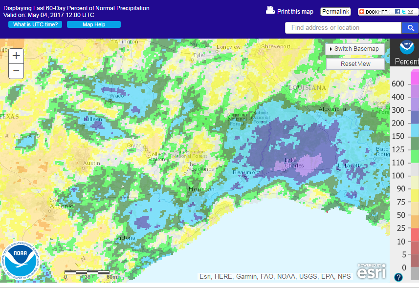
It’s a bit drier than normal in patches around the area also, but we’re by no means in drought. Even despite recent dryness near and west of San Antonio, those areas aren’t really in drought either.
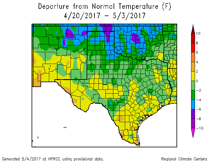
And on top of this, temperatures have been sublime at times. Yes, we’ve already hit 90° twice, but let’s be frank: We’ve had multiple days like yesterday and today, and they’ve been amazing. The last two weeks have been especially lovely.
So for most of late April and now early May, rather than drifting into our miserable, stable summer of high humidity and plenty of heat, we’ve only had tastes of it.
(Space City Weather is sponsored this month by Jetco Delivery)
Impacts on the Gulf of Mexico
Recall last month, we did an in depth posting on Galveston’s ridiculous stretch of records from November through April. They set 70 warm records from November 1st through the end of April. We explained the reasons, including climate change and the record warm sea surface temperatures in the western Gulf of Mexico. You can see what those water temperature anomalies looked like a month ago in the post I linked to. Well, guess what? This recent bout of cool temperatures, driving lows in the upper 50s and low 60s to the coast on several occasions has done serious damage to the temperature anomalies in the western Gulf of Mexico.
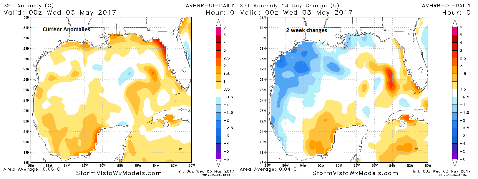
This time of year typically sees Gulf temperatures warming. With recent cool weather and the fact that Gulf had been so warm through early spring, we’ve seen temperatures hold steady or even decrease some. As a result, the turbocharged warm anomalies that were there a month ago have vanished, and the Gulf just looks broadly warmer than normal, not menacing. We told you last month that things can change quickly in spring, and they have this year. While the Gulf will always be warm enough to sustain tropical systems during hurricane season, it’s definitely a bit of a relief to see it look less warm right now.
So, Houston, after the last two springs, I really hope you are savoring every minute of this one. We’ve been lucky, and that lucky streak just might continue another week or two. Let’s dive into the forecast.
Today through Monday
We will make this easy: If you have outdoor plans the next couple days, enjoy them! If you don’t, and you have the ability to, make them. As Eric noted yesterday, we simply don’t get stretches of weather like this in June, July, or August. Devour them now.
Brilliant weather continues today with sunshine and temperatures rising from the 50s in many spots into the low 80s again. Repeat today on Saturday and add two or three more degrees. Onshore flow begins to return a little by Sunday. So it will begin to feel a little more humid, but not in a “Houston summer is coming” sort of way. Tolerable. Monday sees a few more clouds with the onshore flow. We could revert to a morning clouds giving way to late morning sunshine type of pattern Monday. Morning lows will go from the 50s today to the mid 60s Monday. Rain chances through Monday are essentially zero.
Next Week
Beyond Monday, we stay in the moderate humidity, moderately warm temperature pattern for Tuesday and Wednesday. We could see 86, 87, or 88° for highs by next Wednesday. Shower chances will edge up slightly for Tuesday, Wednesday, and Thursday. Our next meaningful chance of rain may hold off until Thursday or Friday.
Guess what? The weather models are hinting at the potential for another clean cold front passing through in the next Friday-ish timeframe. We may get yet another shot of nice, comfortable weather for a couple days. Stay tuned.
Keep the greens, blues, and purples coming on those temperature graphs!
Lovely Spring….