A steady line of storms has continued to make a westward progression toward Houston, bringing the threat of damaging winds and possibly an isolated tornado.
As the southern half of this storm system has weakened, the primary threat will remain largely to the north of Interstate 10, where a severe thunderstorm warning is in effect.
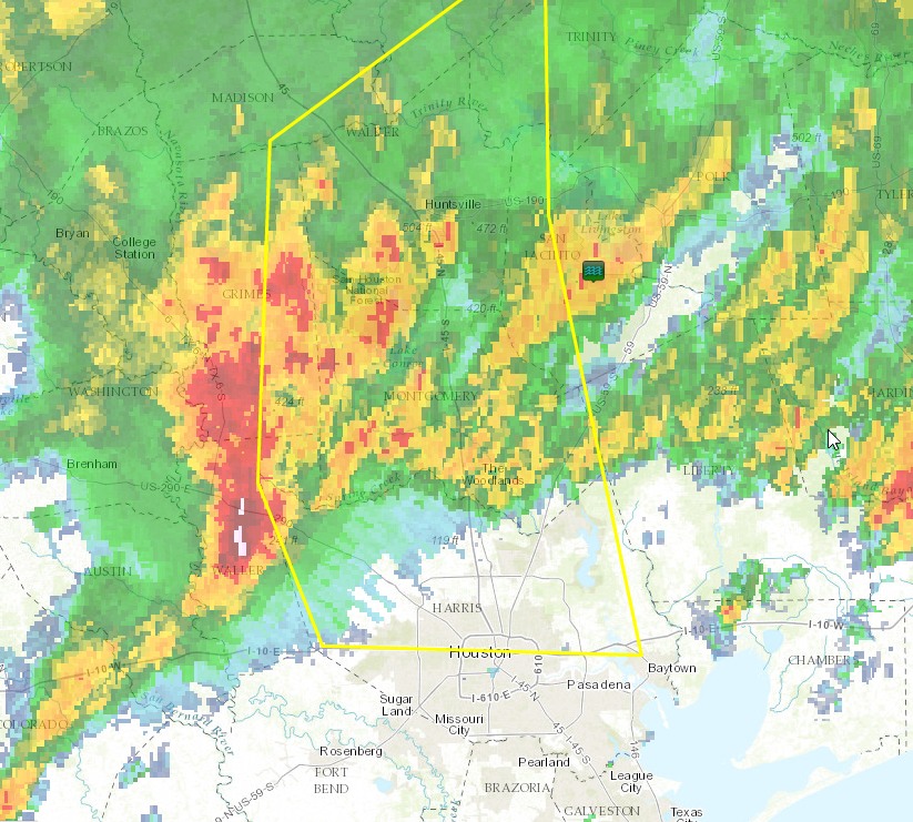
While these storms will unquestionably pack a punch as they move through, they are, in fact, continuing to move along. This will keep additional rainfall amounts this morning to 1-2 inches north of Interstate 10, and considerably less than that to the south. Also, with the rapid eastward movement, most of the Houston metro area will be in the clear by or before 10am CT this morning, leading to fairly benign conditions for most of the rest of the day. Further to the east, areas in Beaumont will see storm activity persist for a few hours more.
Posted at 7:50am CT Saturday
We dodged a real nightmare, when last nights activity to the North missed us!
Thank you Eric/Matt for this site. I hope you and Matt become everyone in these parts
go to weather. No others are as dedicated and exact as you two! I need the spacecityweather.com shirt… ASAP….Thank’s again
Thanks Robert! We’re working hard to earn people’s trust!
I completely agree with Robert. I don’t go to anyone but Eric and Matt as to weather…I am a real estate agent, so knowing and having a good weather report is very important to me.
Just started raining around Ellington, pretty light, but a surprise given this morning’s radar which showed nothing south of I-10.