Happy Friday, Houston! Summer may have taken a little time to kick off this year, but we’re definitely locked in the doldrums now, with what you would expect this time of year. Let’s jump into it.
TODAY
Looking at weather maps this morning, we see a pretty rich area of precipitable water (PWAT) approaching the Coastal Bend to our south. In English, that means there’s going to be gradually increasing amounts of moisture available for thunderstorms to pop up this afternoon.
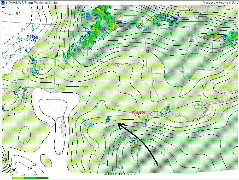
So while it has been mostly quiet the last couple days, I expect we’ll see just a few more pop-up storms this afternoon (perhaps this morning along the coast). The best chance for greater coverage of afternoon hit/miss storms will be west of I-45 and south of I-10. The further north and east you go, the slightly drier the air mass stays today, so that should keep pop-up storms to a minimum. High temperatures will remain hot, into the low 90s, with heat indices into the low 100s.
WEEKEND
We’ll see a weaker ridge and even slightly better available moisture on Saturday, so that means there will be better coverage of hit and miss storms throughout the entire region. No, it won’t be a wash out by any means, but Saturday will have a few storms around. As is often the case, they’ll probably start before sunrise closer to the coast, before gradually focusing more inland through the day.
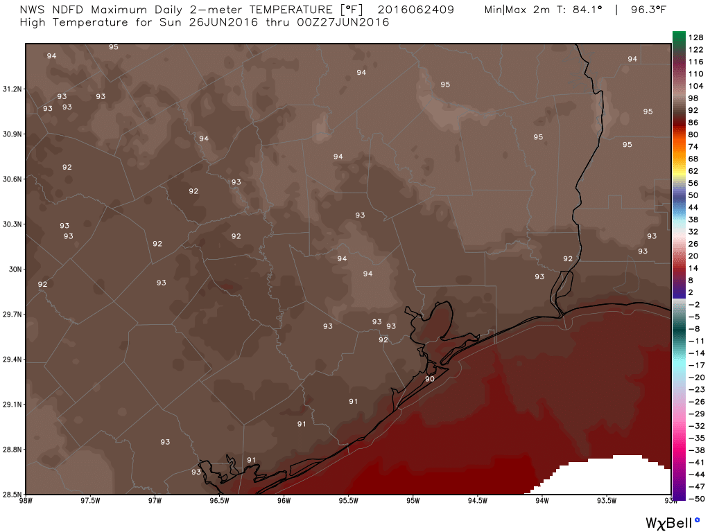
By Sunday, upper level ridging strengthens over East Texas and Louisiana. This should mean reduced coverage of showers/storms across the area (still just a slight chance, especially south and west of Houston), along with slightly hotter temperatures. Sunday’s highs could hit the mid 90s.
NEXT WEEK
At this point, Monday looks to be an extension of Sunday, with continued hot temperatures and just a slight chance of a shower or storm. I do expect the upper level pattern to transition a bit for the middle of the week, possibly into late week. This should mean a slight cooldown (which means temperatures closer to 90° than 95°), along with a better chance of showers and storms each day. No particular day truly stands out right now, but I’m thinking Tuesday or Wednesday may have the better chance of scattered storms.
TROPICS
The GFS giveth, the GFS taketh away. Overnight GFS model runs took away any tropical system in the Gulf after July 4th weekend. None of the 21 GFS ensemble or 51 European model ensemble members show an organized tropical system in the Gulf over the next 2 weeks. Meanwhile, the National Hurricane Center is monitoring a disorganized system over the Yucatan, but that will track into Mexico this weekend, so it isn’t a concern for Texas. So if you’re hearing or reading rumblings about Gulf hurricanes, you have nothing to worry about right now. We’ll be on top of this and let you know when it’s time to pay close attention!
Thank you Eric for the report. Sounds like a perfect weekend to me!
Hey Eric,
I would like to suggest that, if possible, you start using simpler colorbars for your maps. For instance, I find the color scheme for the map of Sunday’s forecast high temperatures to be very difficult to interpret. The map is brown and red, and yet there are actually two zones in the colorbar that are brown and red! (The first from roughly 8F to 20F, and the second from 74F to 98F)
And secondly, the scale goes from -50F to 128F, even though we’re really only interested in a small range around 90F.
Is this something that is fixed by WeatherBell, or can you change it?? Sorry to be a stickler, but it really does limit the usefulness of those graphics.
Thanks!
Well, since you haven’t mentioned the threat of any t-storms with frequent lightning and strong gusty winds, can I assume there are none expected Saturday, Eric?
Is the GFS likely to go back on its Texas vs. Hurricane tangent like it did last week?