Some isolated, heavy storms possible this weekend; Houston heats up next week

Good morning. Just a quick update today as both Matt and I are traveling.

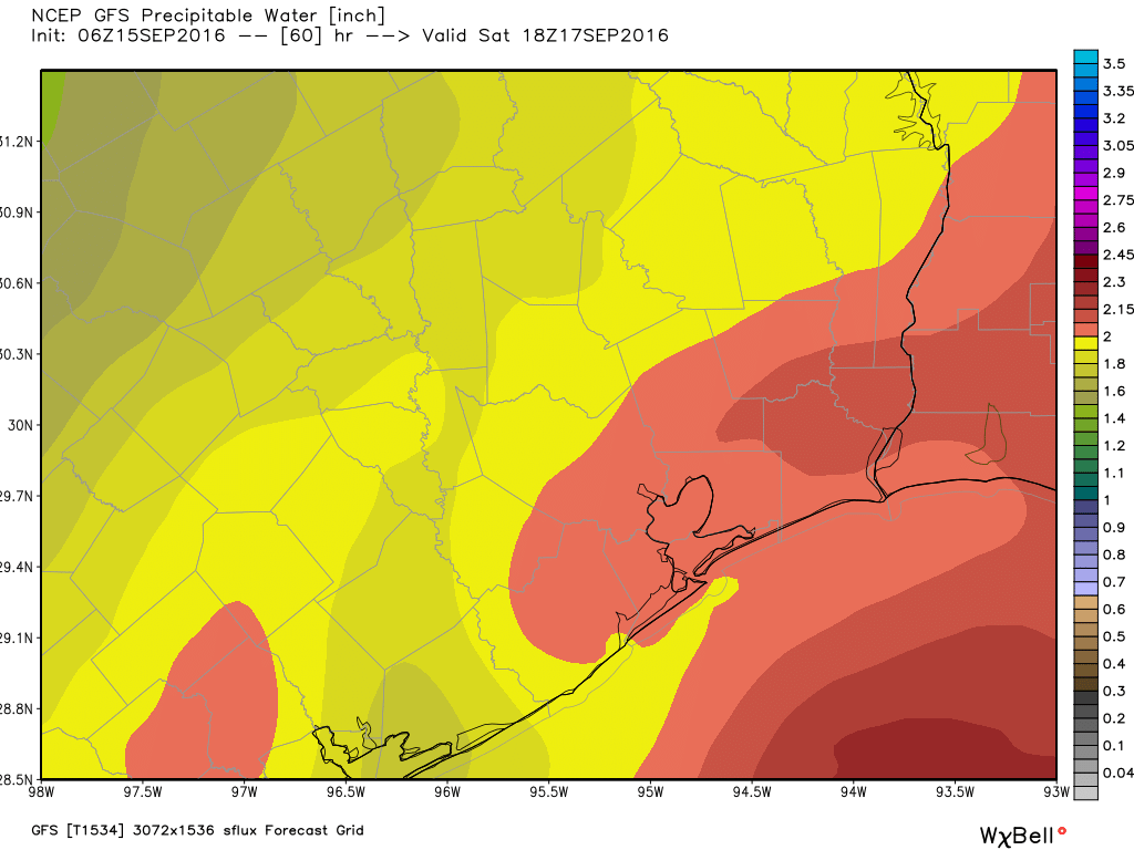
The National Hurricane Center continues to track a broad, disorganized area of low pressure that’s nearing the Texas coast and should come ashore today. Chances of development are near zero, but it is helping to usher in some moisture to the Texas coast.

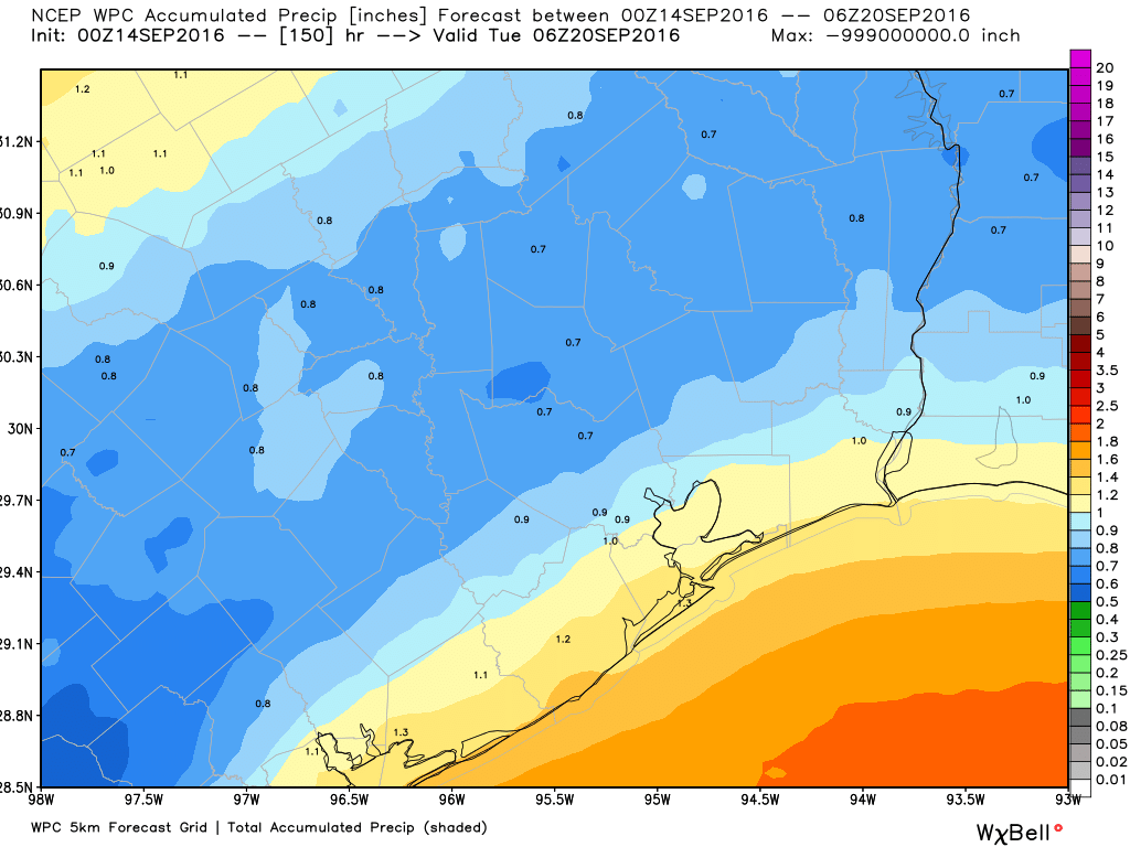
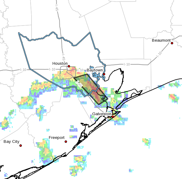
This is likely to produce scattered to widespread thunderstorms later today and on Saturday. Although there isn’t any great organization, moisture levels will be quite high and it seems likely storm motions will be slow. This means that where storms do develop there will be the potential for some heavy rains that could cause street flooding. However I do not anticipate widespread flooding concerns. Storms will be most likely during the warmer, afternoon and early evening hours. Highs will remain around 90 degrees.

The European model shows high pressure building over Texas next week. (Weather Bell)

See full post

Tropical moisture to bring a wet, mostly gray weekend to Houston

It’s quite warm, in the mid-70s, and muggy across Houston as we reach the midpoint of September. The radar is also dry, but that won’t last too long with tropical moisture looming offshore.

Thursday

Most of the moisture isn’t going to arrive just yet, and enough lingering high pressure should limit showers and thunderstorms today, especially for inland areas. I’d only expect scattered to isolated storms, with highs around 90 degrees.

Friday through Monday

You may have noticed that the National Hurricane Center has started to track a blob of tropical moisture that is moving toward the Texas coast. Due to significant wind shear this system is highly unlikely to develop into a depression or tropical storm, but Galveston and other coastal regions should nonetheless see some effects, such as stronger than normal waves and tides 2 to 3 feet above normal levels. Rain chances will also be highest along the coast.

On Saturday precipitable water levels will rise across the region as tropical moisture moves in from the Gulf. (Weather Bell)

See full post

Scattered strong thunderstorms likely to continue for Houston

On Tuesday afternoon some strong storms developed over the central Houston area and then migrated to the northwest, causing temporary street flooding issues near downtown and over the Cypress area. This pattern of isolated to scattered showers and heavy thunderstorms will continue for the next couple of days, before more widespread rain is possible on Friday and through the weekend.

A view of downtown, looking east from Eldridge at the Katy Freeway. (shared by cannonfodder002 on Twitter)


Wednesday and Thursday

Some modest high pressure should limit showers and thunderstorms on today and Thursday, allowing for partly sunny skies and highs around 90, or in the low 90s. Storms probably won’t develop inland until the afternoon hours when daytime heating nears its peak.

Friday through Monday

As pressure fall slightly, and access to moisture from the Gulf of Mexico increases, I expect more widespread showers and thunderstorms for this weekend, and early next week. As we’ve been seeing this week, heavy storms will develop in some areas of town, but not others, so it’s difficult to pinpoint exact rain chances. Still, most of the area should see about one inch, with isolated areas seeing double or triple that, and other areas less.

NOAA rainfall accumulation forecast for now through Monday. (Weather Bell)

See full post

Moisture returns, and so does unsettled weather for Houston

Good morning. It’s the eighth anniversary of Hurricane Ike, which made landfall on the eastern end of Galveston Island and moved into the bay. The storm produced a tremendous 15-foot storm surge, and 10 to 20 inches of rain over Harris County. For anyone in the region at the time, it was a harrowing experience. But since then we have largely been free of tropical storms and hurricanes, and it’s looking increasingly likely that will be the case for 2016—although we’re not there quite yet.

In any case, let’s take a look at our rather unsettled weather pattern for the next week or so.

Tuesday and Wednesday

The moisture is back, and we’re seeing evidence of that from a narrow band of thunderstorms that moved in this morning from the Gulf of Mexico, into parts of the southeastern Houston metro area. A flood advisory is in effect for areas just east of Interstate 45 through 7:45 am this morning.

Area of flood advisory in effect until 7:45am CT (National Weather Service)

See full post