Last gasp of rainfall later today in Houston, for now at least

Summary: We have one final round of rain showers to get through today, although this will be a mere drop in the bucket compared to what fell earlier this week. We then have an extended stretch of dry weather through probably next Thursday or Friday before rain chances re-enter the forecast. Temperatures will be fairly temperate, with a couple cooler days through the period.

Rainfall summary

For Houston, this will officially be at least our 8th wettest January on record. Bush Airport has picked up 8.28″ of rain this month so far. Hobby sits at 7.48″, making it the 6th wettest January. Galveston is at a more meager 5.20″ of rain officially at Scholes Airport, though a rain gauge near The Strand is up over 9 inches this month.

A sampling of rain so far this month as of last night across Harris County and the immediate surrounding areas. It’s been a soggy, soggy month. (Harris County Flood Control)

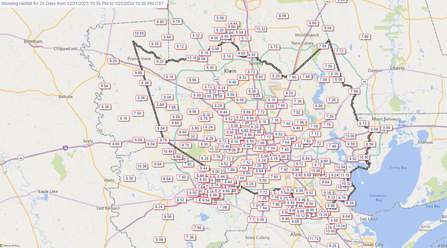
Many larger rivers remain in moderate to even major flood (West Fork of the San Jacinto & Trinity). The National Weather Service has an interactive map with gauges across the region that you can check out for more details.

Today

Watch for some dense fog around the area this morning which could slow you down a bit heading out the door. Otherwise, we will just see clouds through midday. Scattered to numerous showers should crop up this afternoon, after about 1 or 2 PM. The good news is that rain totals are expected to be less than a half-inch and probably closer to a quarter-inch in most cases. Thus, we do not anticipate any flooding concerns today. Showers will exit the area by about midnight or so tonight.

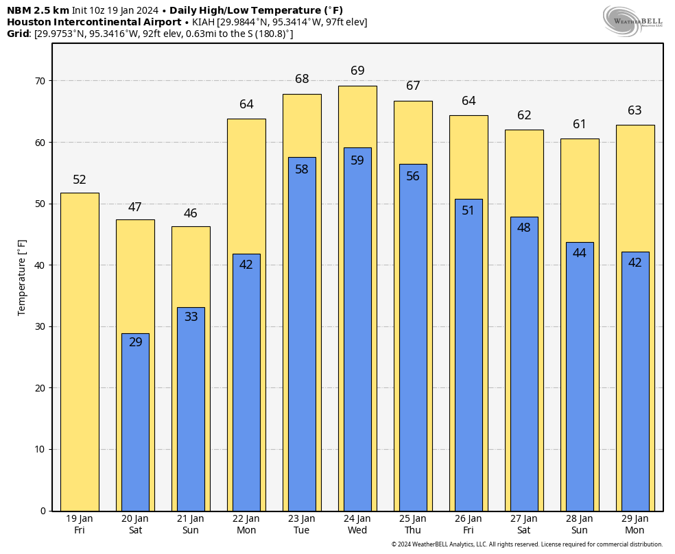
It will be a bit cooler today with highs in the mid-60s, after we hit 71 degrees yesterday officially.

Weekend

Saturday looks like a cooler sort of day with temperatures warming from the low to mid-50s into the upper-50s to low-60s and a good deal of cloud cover. I wouldn’t be shocked to see a few spotty (inconsequential) showers or some light rain for a brief time in spots, especially north and east of Houston. Otherwise, just mostly cloudy.

We dip into the 40s in most spots on Saturday night and Sunday morning before a very nice day Sunday, Sunshine and mid to upper-50s are on the menu.

Monday morning should be the coldest of the next several days, with 30s in much of the area to near 40 in the city of Houston. (Pivotal Weather)

Monday through Wednesday

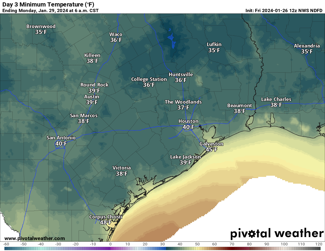
Monday will be the coldest morning of this batch of days, with lows in the 30s over a good chunk of the area and around 40 in Houston proper. We’ll have another nice day Monday with sun, some high clouds, and highs in the lower half of the 60s.

Tuesday and Wednesday should see sunshine, although high clouds may spoil that at times. Remember early December, when we had all those spectacular sunsets and an almost permanent deck of cirrus clouds streaming by? We may be setting up in a similar sort of pattern again. Either way, expect highs in the mid-60s Tuesday and upper-60s Wednesday, with lows in the 40s.

Late next week

The pattern begins to change later next week, as another vigorous disturbance emerges out of the Pacific Ocean. This one should crash ashore in California, move through the desert, and emerge over the Southern Plains around next weekend.

A map of the forecast about 20,000 feet over our heads between next Wednesday night and Sunday showers a disturbance hitting California and working eastward toward Texas. This will bring increasing rain chances back to the area, though we cannot pin down details yet. (Tropical Tidbits)

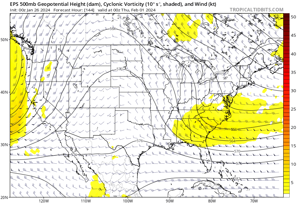
The exact intensity, timing, and orientation of this upper level system will determine exactly how significant our rain chances will be. But there is good model agreement on something barging through here next weekend with a round of rain. Ahead of it, probably continued 60s, lows in the 40s and 50s, and perhaps some coastal sea fog.

Back to a slightly less harsh, rather brief dose of winter in Houston before next week’s rain

Summary: A hard freeze is likely north of Houston tonight, while much of the area sees 20s for lows. A light freeze is possible tomorrow night before we warm up. Next week’s rain chances are coming into better focus, with Monday and perhaps Wednesday seeing the most rain, but chances persisting all week long. Localized flooding is something we’ll be watching for, but we’re hopeful the rain is spread out over a long enough period to avoid anything too serious. We’ll have another update on this by Sunday.

Today & Saturday

We’re back at it today, with gusty winds and chilly temperatures, as a second plunge of cold air descends on Texas. This one is much more moderate than the one we saw earlier this week, but still after yesterday’s mid-60s, today’s blustery 40s will feel cold. But, we have the sun, so that counts for something. Winds will be 15 to 25 mph, with gusts to 30 mph, stronger over the water.

In terms of tonight’s freeze, as winds settle and skies remain clear, temps should drop efficiently into the 20s virtually everywhere away from the coast. For the city of Houston and most areas south or east, this will be a light freeze. Northern and western outlying areas are at risk for a brief hard freeze tonight, with lows expected in the mid-20s for The Woodlands, Conroe*, and Brenham. (*Conroe is always an interesting case given that they consistently record the coldest temps in the region, likely due to the location of the airport. So it’s possible they dip into the upper teens tonight)

Overnight lows will be in the 20s away from the coast, with low to mid-20s north and a hard freeze likely up that way. (Pivotal Weather)

This will still be about 6 to 10 degrees milder than the hard freeze earlier this week but certainly still capable of hazards to exposed plants (and pets).

Saturday will be breezy and chilly but a little less harsh than Friday. We should see highs in the mid to upper-40s with breezes of 10 to 15 mph or a bit gustier at times. Expect sunshine as well.

Sunday

Expect one more risk of a freeze Sunday morning, mainly north and northeast of Houston. A hard freeze is unlikely anywhere in our area. We will see increasing clouds with a chance of a few showers as early as Sunday afternoon, as high temperatures slow-climb into the low-50s (40s again north).

Next week

The rain we expect next week continues to show up in the forecast rather substantially. We’re starting to hone in on when the worst of it may be now. It looks like we have one pretty strong disturbance that moves through the area on Monday, which should mean numerous to widespread showers and thunderstorms.

The entire region between Victoria and Matagorda through Lake Charles is highlighted under a slight (level 2/3) risk of excessive rainfall on Monday. (NOAA)

This could deliver us anywhere from 1 to 4 inches of rain, and locally higher amounts can’t be ruled out. I would probably say the highest totals may fall to the south and east of Houston, but that is a very low confidence forecast call right now.

Tuesday should see isolated to scattered showers and storms. Rainfall should be a bit more erratic here, with some places seeing a quarter-inch or less and others another 1 to 2 inches perhaps. Then Wednesday may see another strong disturbance with the potential for at least another 1 to 2 inches over a broad area, with higher amounts.

Additional shower chances will follow Thursday and Friday, but it’s tough to say what those look like right now. When all is said and done, the rainfall amounts will tally 3 to 8 inches by Thursday, with higher amounts possible.

Does this mean flooding? It may. With the ground rather firm after this week’s freeze and the subsequent one this weekend, a lot of this water will be quick to run off, which means ponding and street flooding are a good bet in the usual trouble spots. The hope is that the total rainfall will be spread out over a long enough period with enough breaks in between that we avoid any more serious flooding, but it’s something we’ll continue to monitor this weekend. We’re going to especially watch to see how watersheds like Cypress Creek, Spring Creek, the San Jacinto River, and other slower responding basins handle this. This will also impact the Beaumont and Lake Charles areas to some extent. Which location wins the rainfall derby is still TBD.

After a cold weekend, a very mild week is in store. (Weather Bell)

What about temperatures, you ask? We should see high temperatures well into the 60s most of next week with lows generally in the 50s to low-60s. This may also lead to periods of sea fog on Galveston Island, Bolivar, and along the bays. Maybe some cooler weather resumes by next weekend.

We will have another update for you by Sunday regarding Monday and next week’s rainfall, and I expect we will be implementing our flood scale then as well.

After a fairly mild Sunday in Houston, the cold will ooze into the area tonight

One of the challenges we face as forecasters during Arctic air events is that often times the models are too slow to push in the cold. This type of cold air is shallow and dense (go ahead and insert your jokes here). If you look at a vertical profile of temperatures from Dallas this morning, you can see just how shallow it is. The red line indicates temperature from the surface (bottom of the chart) to the top of the atmosphere. The temperature scale is tilted (skewed) on these atmospheric soundings (called Skew-T plots). But you can see that in Dallas, it was in the teens this morning at the surface. The line that corresponds to “850” on the left says that temperatures were about 34 or 35 degrees at that height, which is about 5,000 feet up. The line skews warmer about halfway there, so the coldest air is only about 2,500 to 3,000 feet deep.

A Skew-T diagram from Dallas this morning shows that surface temperatures were in the teens, while only about 5,000 feet above that, it was in the mid-30s. Cold air masses like these are extremely shallow. (NOAA)

Since the air mass is so shallow, it’s hard sometimes for modeling, particularly the global models we use 3 to 7 days in advance to pick up on how quickly that dense cold air is going to arrive. So based on our experience, we try to account for this by speeding up the arrival time of cold in our forecasts. Every now and then, however, you get a day like today. Temperatures dropped in Houston to about 37 degrees this morning. Meanwhile, as I write this at 3:45 PM, it’s 50 degrees outside. Weren’t we supposed to be cold today? Yes, we had the front stalling at the coast. Instead, it was as warm as 57 in Galveston, 53 at Hobby, 49 at Bush, but only 40 in Conroe and 29 in College Station.

So, the obvious question most of you have is: Does this mean we aren’t getting as cold? No, it does not mean that at all. In fact, very little has changed, forecast-wise today. Once the sun sets, the cold air will resume its southward push, and by tomorrow morning, you can expect temperatures in the 30s in and around Houston and 20s north.

Forecast lows on Monday morning will be just above freezing in Houston and in the 20s north and west of here. (Pivotal Weather)

The problem tomorrow is that temperatures will go nowhere. We will stay in the low 30s with some light showers around, and yes that continues to suggest that light icing will be possible. That could begin as early as overnight north and west of Houston, continuing or expanding south and east during the day tomorrow. So, for the Monday holiday, watch for patchy ice north and west in the morning, across the entire area away from the coast during the afternoon and evening. This will not be a widespread major ice storm by any means, but bridges and overpasses will likely have patchy ice across the area tomorrow and tomorrow night, so please exercise extreme caution on the freeways.

Total NWS forecast ice accumulation will be very, very minor but that’s enough to produce patchy ice on bridges and overpasses in particular for Monday and Monday night, so please drive cautiously. (Weather Bell)

I do not want to speculate much at all on Tuesday morning’s commute and school issues right now. That’s above our pay grade, and I would just sort of plan at this point on Tuesday going normally for most folks but have a backup plan in case it does not.

Forecast temperatures are virtually unchanged tonight, tomorrow, and Tuesday into Tuesday night across the area. So we aren’t looking any worse which is good, and this continues to look like a very cold but very manageable event. And if you want warmer thoughts, look no further than the National Blend of Models forecast over the next 10 days. Yes, another freeze is possible this coming weekend, but by all accounts it looks less significant than this first one. But several days in the 60s appear to be in our future. So take solace if you’re too cold.

It gets better. (Weather Bell)

We’ll have another update for you in the morning!

Light icing to slip up travel in parts of the region tonight & Monday

Good morning. I just want to open with a congratulations and good luck to all the marathon runners today. Especially our own Eric Berger!

Go get ’em, Eric!

We’ve been discussing the outlook for this event for a couple weeks now, so it’s nice that for the most part it’s not too bad for a run today. I hope it’s a good day for all!

Winter weather advisory

Weather-wise, we have a couple notable changes to bring up today, mainly in terms of travel tonight and Monday. The chances of patchy ice have increased enough in the Houston area for the National Weather Service to post a Winter Weather Advisory down to Harris and Fort Bend Counties. Essentially, winter weather advisories now cover areas north of I-10 east of Houston and north of US-59/I-69 southwest of Houston.

Winter Weather Advisories include much of the area away from the coast and east to Lake Charles (not including Beaumont and Port Arthur at this time). (NOAA)

We are not expecting an ice storm in Houston, so let’s be clear about that. What we are expecting is that as temperatures drop back tonight and stay cold on Monday, light rain may produce patchy ice on area bridges, overpasses, and freeway flyover ramps. Given that accumulation is expected to be under 0.05 inches, widespread, major travel problems are not currently anticipated. But if anyone will be out and about tonight, Monday morning, and Monday evening in particular, please take it slow on the roads in case you run into some patchy ice. We don’t want to overstate anything here, but we really do hit on this because it’s not a typical concern we deal with here in southeast Texas. So just drive slowly and cautiously.

Tonight

Our first night of cold is tonight, and from a “winter so far” point of view, it does not look like anything special here in Houston. North and west of Houston is another story.

Temperatures tonight are expected to bottom out in the mid to upper 30s at the coast, low 30s in Houston, upper 20s to the north and west, and mid 20s in the Brazos Valley through Huntsville. (NWS Houston)

This will be the coldest air of the season so far tonight, with temperatures into the 20s north and west and low 30s in Harris County, slightly milder south and east toward the coast. With light precipitation falling, we’ll see some of that freezing rain or freezing drizzle producing light icing in our area, with some sleet mixed in well to the north and west.

Monday

Temperatures will move very little on Monday. Look for highs to be maybe a handful of degrees warmer than those low temperatures shown above. Precipitation will continue, periodically and lightly, through the day. Light icing risk will continue on bridges and overpasses, especially north and west of Houston.

Monday night

The coldest night of winter so far will settle in here tomorrow night. Look for lows in the mid-20s in Houston proper, low to mid-20s in the suburbs, and milder at the coast/colder north and west. Overall, this is a little bit less cold than initially expected but it’s still plenty cold.

Low temperatures Monday night into Tuesday morning will be in the mid-20s in Houston, near 30 in Galveston, and low 20s or upper-teens north and west of Houston. (Pivotal Weather)

In terms of duration, the city of Houston will probably see about 16 hours of temps near to below freezing Monday night into Tuesday morning. Look for a few hours less than that south and east and more than that north and west.

In addition, brutally cold wind chills will accompany this, with “feels like” temps in the low teens and single digits Monday night and Tuesday morning. Bundle up the kiddos Tuesday morning!

As of right now, icing is not expected to be a serious concern Tuesday morning, but with some lingering precipitation Monday night, I would not rule it out entirely. More on that later and tomorrow.

Tuesday

After the cold morning, the daytime won’t be a ton better. But we should manage low to mid-30s, briefly above freezing. You’ll see the sun on Tuesday too. So that’ll be nice. Wind chills will remain unpleasant all day, but the wind should begin to die off in the later afternoon.

Tuesday night

The coldest night of the event will be Tuesday night. Houston will bottom out in the low to mid-20s, with the suburbs in the low-20s. Areas north and west should dip into the teens. Cold, but manageable is how we described it yesterday, and that’s how I would describe it today as well.

Lows Tuesday night and Wednesday morning will be in the 20s almost everywhere, with teens to the north and west of Houston (Pivotal Weather)

Despite the stronger cold, the duration of temperatures below freezing may be a little less Tuesday night just because we’ll warm up faster Wednesday morning. So look for about 14 or 15 hours in Houston proper. Add to that north and west and subtract from that south and east. Either way, cold preparations need to be in place Monday night and Tuesday night for a hard freeze in the entire area away from the immediate coast.

Wednesday

Break out the shorts, as we’ll see highs well into the 40s and even warmer than that Thursday. More on that tomorrow or Tuesday.

We will have another brief update on things for you later this afternoon, focusing on any forecast changes to the icing risks.