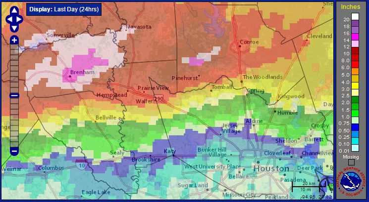
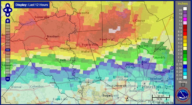
We’re nearing the end of an incredible rain event over the northwest and northern Houston metro area. A final line of major storms moved through the northern half of the metro area this morning, a little before sunrise, and now it seems like the organized activity is finally ramping down. Here’s a look at rainfall totals between 5am CT Thursday, and 5am CT Friday:
Just an incredible evening of heavy rain north and northwest of the city of Houston, with 6 to 8 inches of rain falling across much of western Montgomery County, and 8 to 14 inches coming down over an area from Brenham to Montgomery. Many roads are impassable, including some locations of Highway 290 northwest of Harris County.
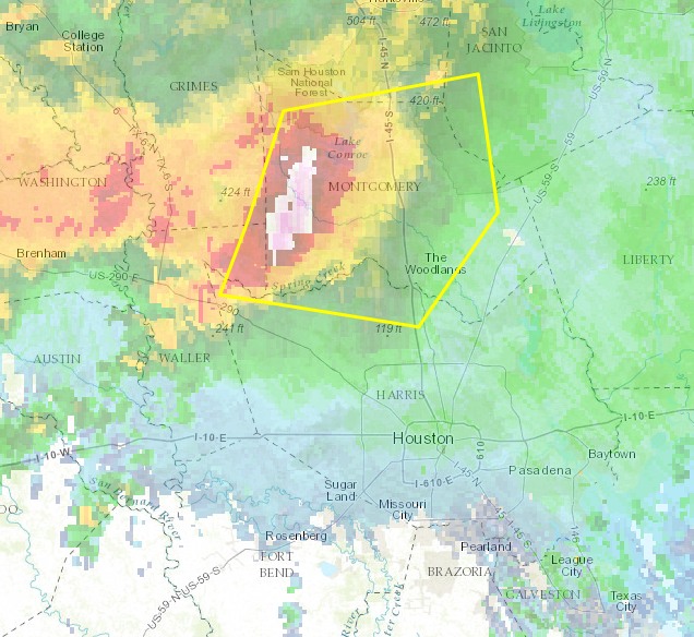
The National Weather Service has issued a Flash Flood Emergency for Washington and northern Austin Counties tonight due to extremely heavy rains in those areas. This is the highest level of flood warning. Multiple high water rescues have occurred in these areas.
Satellite estimates of rainfall between 10am and 10pm CT on Thursday. (NOAA)
Unfortunately storms are continuing to develop along a west-to-east boundary north of Interstate 10 tonight, and I think we’ll see continued development of storms for the next few hours. A flash flood warning is in effect for pretty much all of the northern half of the Houston metro area until at least 2:45am CT. Some homes along Spring Creek, in southern Montgomery and northern Harris County, have already flooded as the creek has risen several feet out of its banks.
The forecast is far from clear, but I think we’ll see additional storms move in from west during the overnight hours, with more widespread showers moving into the central and southern Houston metro area by, or around sunrise on Friday morning. I’m hopeful the heaviest rains will exist the region by mid-morning, or noon at the latest, but the entire Houston metro is under a flash flood watch through at least 7pm CT on Friday.
Very heavy rains that developed over the Brazos Valley earlier today have moved ever so slowly eastward, into Montgomery, Washington, Waller and San Jacinto counties this evening. As of 6:30pm CT some areas in these counties have received in excess of 6 inches of rain in the last couple of hours. For example, a location along Lake Creek between The Woodlands and Conroe picked up 6 inches between 4:30pm and 6:30pm. With heavy rains like these watersheds will fill up quickly. This is a serious flooding situation.
INTENSE RAINS
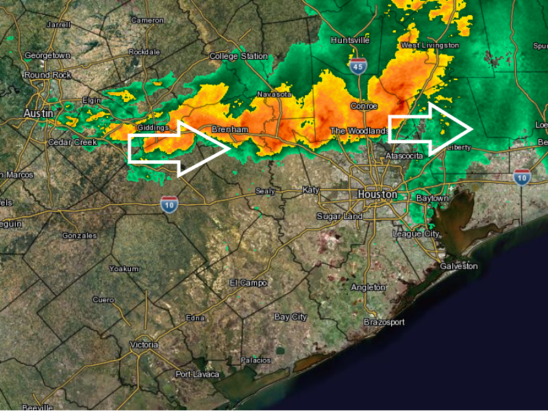
Unfortunately there’s a long line of storms stretching from north of Houston all the way to Austin. Based upon radar trends and short-term model forecasts it appears this line of storms will progress slowly to the east, likely through Montgomery County and northern Harris County for at least the next few hours.
The radar at 6:45pm CT Thursday didn’t offer much solace for waterlogged areas. (Intellicast)
The major storms that developed over the Brazos Valley today are slowly moving toward the metro Houston area. Parts of northwest Harris County and Montgomery County are included in the latest severe thunderstorm warning from the National Weather Service.
Area of Severe Thunderstorm warning in effect until 5:15pm CT. (National Weather Service)
In addition to heavy rain, these storms are capable of producing wind gusts in excess of 60mph and hail. If you are on the north side of Houston this evening please do not drive into high water and remain indoors if possible. The warning is in effect until 5:15pm.
It still seems likely the bulk of these storms, which are moving slowly to the east, will remain over the northern half of the Houston metro area this evening, north of Interstate 10.