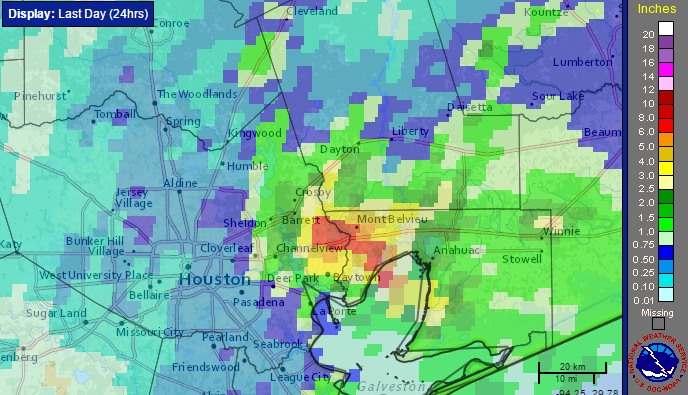
Good morning. How pleasant it is to wake up to a clear radar and partly sunny skies!
Low pressure is moving away from the upper Texas coast, and as a result so the likelihood of organized storm activity is fading. And thank goodness. I’ll have a more comprehensive wrap-up on Monday, but even yesterday, when most areas saw less rain, parts of the eastern Houston metro area near Mont Belvieu saw in excess of 10 inches of rain in six hours. This was a nasty system and I’m glad to see it go.

For the rest of today we’ll likely see some scattered thunderstorm activity, particularly during the afternoon and early evening hours as a result of daytime heating. The atmosphere is still moist enough, especially near the coast, for some areas to see as much as 2 inches of rain where these storms stall. But for the most part I expect today’s rain to be more of a nuisance than a threat.
This pattern is likely to be similar to start the work week, with daytime heating bringing at least the chance of some scattered thunderstorm activity. However I’d expect coverage and intensity to diminish further, so this shouldn’t be something to be concerned about as we settle into a more summer-like pattern.
Thanks, guys!
Eric:
The chance of rain is less than 40%, isn’t it?