Following a wet Halloween night and soggy start to Wednesday, Houston should dry out some later today as a storm system moves off to the east of the region. However, we cannot rule out a few lingering storms this morning for central parts of the area, and into the early afternoon hours for the eastern side of the metro area, including the slight possibility of a tornado. After today, rain chances fall, and Houston warms quite a bit for early November.
Wednesday
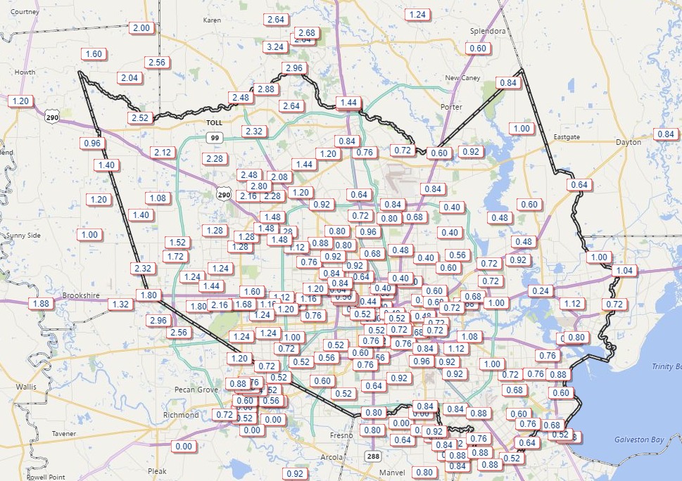
As anticipated, about 0.5 to 2.5 inches of rain fell across the Houston region, but fortunately we did not see any of the really heavy rainfall that might cause street flooding—or worse.
The stalled front and associated instability will move off to the east today, and I expect rains to end in Houston by or before noon. But for areas to the east of Interstate 45 we can’t rule out a tornado today given the potential for some rotation. Any twisters that do form should be short-lived. Highs should reach about 80 degrees for most of Houston, with a correspondingly warm night.
