Today marks our 18th straight day of heat advisories or heat warnings. We close June on the same note we’ve been singing (with rampant falsetto) since mid-month. Heat waves are often judged by how many temperature records are broken. So have there been many temperature records broken the last couple weeks? The answer is not really.
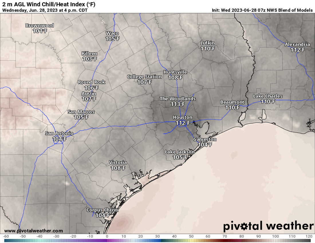
For the month of June, through yesterday, we set or tied a total of zero record highs at Bush, two at Hobby, none at Galveston, and none in College Station. Despite the general lack of record highs, we’ve managed to reach a frequency and consistency of 110+ heat index values that is rare for this region. It’s why we emphasized that this would be an abnormal heat wave for us.
Nighttimes have been more intriguing, with seven record warm minimum temperatures set or tied at Bush, seven at Hobby, none in Galveston, and five in College Station. The lack of any nighttime relief really contributes to defining how rough this has been.
Fortunately, we are past the peak of things it seems and we can start discussing how this will change.
Today and tomorrow
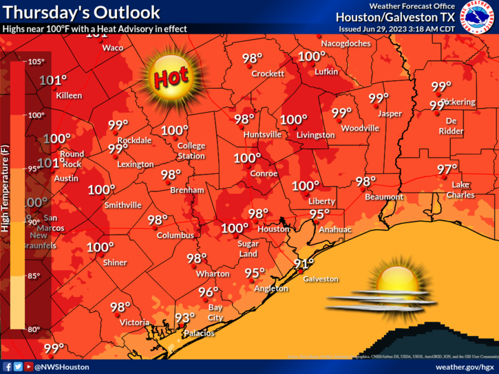
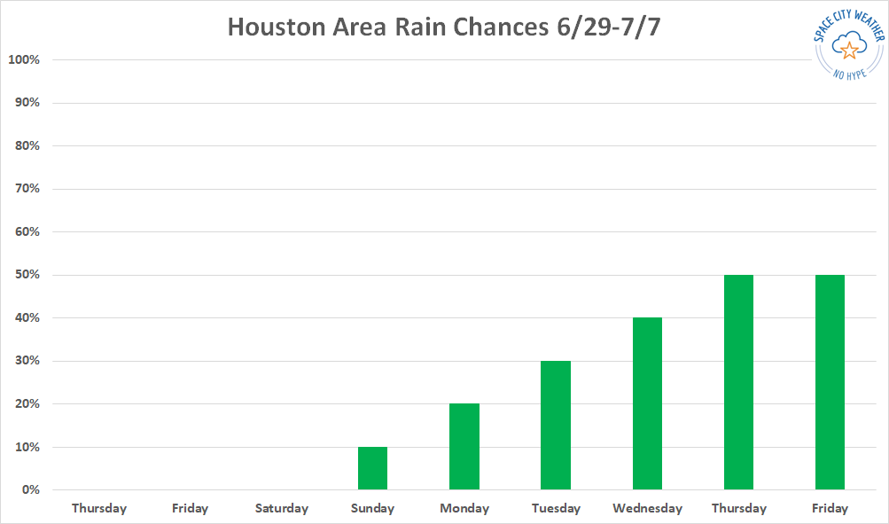
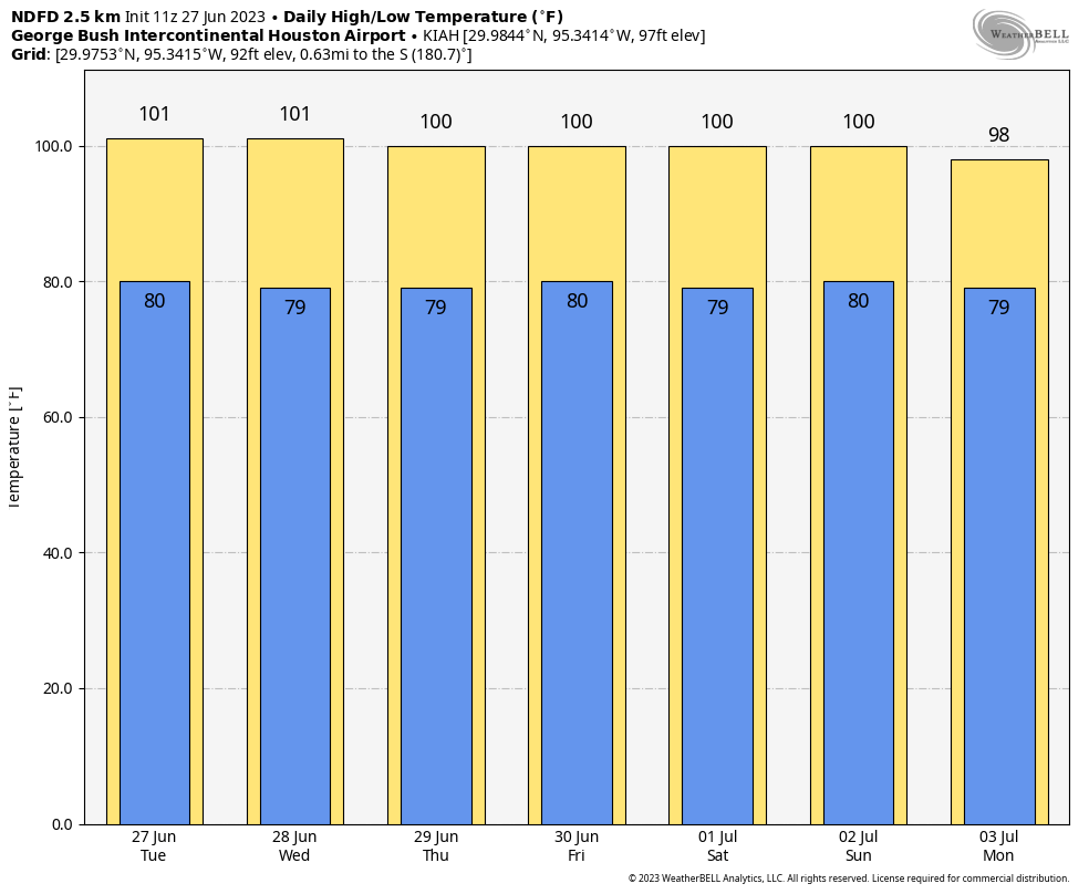
More of the same. Sunny and hot, with highs in the upper-90s and lows near 80, and a near zero chance of rain. Heat advisories will likely be needed for one more day tomorrow.
Sunday & Monday
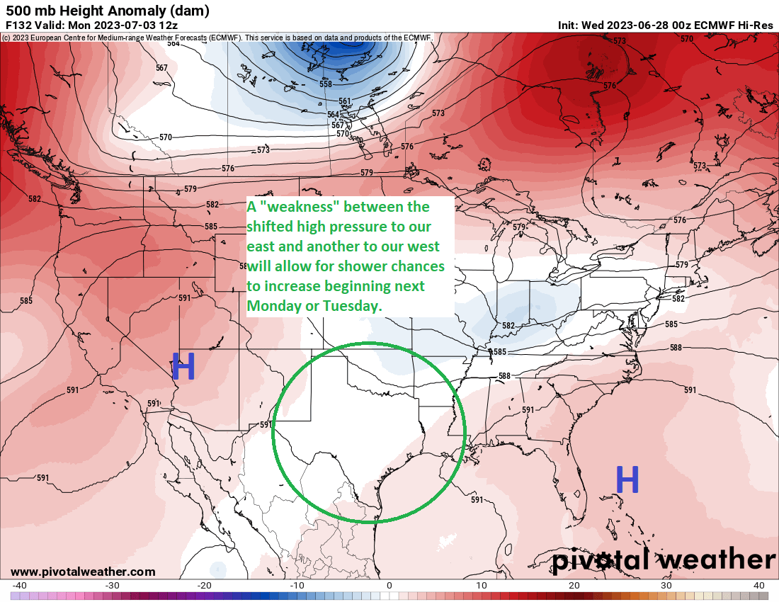
This will be the transition period. Look for generally more of the same again. Expect mid to upper-90s for highs and upper-70s to near 80 for lows. However, the new wrinkle on these days will be rain chances. Sunday looks meager at best and mostly south and east of Houston. Let’s call it a 5 to 10 percent chance of a shower Sunday. That’s better than zero, but the odds remain stacked against you. By Monday, that rain chance should improve to 20 percent or so. Better!

Fourth of July Tuesday
This will be the trickiest day, because I could see our rain chances fizzling here or being something like 10 to 20 percent again. Or, coverage could increase a fair bit during the afternoon hours, with not everyone seeing rain but some folks needing to scurry indoors for a time. Let’s call it about a 30 percent chance of rain on Tuesday afternoon, with the highest odds south and east of Houston; higher chances than Monday but still relatively low. As of now, I’d expect that most evening events will be able to go off without issue.

Look for mid-90s or a little hotter on Tuesday with evening temperatures generally dropping back into the mid to upper 80s for fireworks or other activities.
Wednesday through Friday
We get a big boost in moisture beginning Wednesday, and this should translate to more scattered to numerous showers and storms through the late week period. While it’s tough to pin down the exact timing of rain chances each day, I would say that the chance is at least 50 to 60 percent on all three days. So there’s a good chance your neighborhood should see at least some rain at some point later next week.
Due to the clouds and showers, we should see high temperatures ease back into the low (!) or mid-90s at worst, more seasonable for early July. Nighttimes should be more firmly in the 70s. Eric will be back in the saddle Monday. Until then, stay cool!