Fog, smoke from fireworks could make for very poor visibility tonight

Happy New Year’s Eve! I’m just jumping in with a quick post this morning to highlight the possibility of poor seeing tonight due to fog and smoke. Unfortunately it could coincide with the start of the New Year, when people are coming home after festivities tonight.

The issue is this: Before the arrival of a cold front on Monday morning, we are going to see near ideal conditions for the formation of fog. On top of that we can expect to see smoke and particulate matter from New Year’s Eve fireworks in the air. This may create very poor visibility on roads tonight, especially after midnight, and most likely closer to the coast.

Winds at 2 am CT will be very light on New Year’s Day. Note the approaching front to the northwest. (Weather Bell)

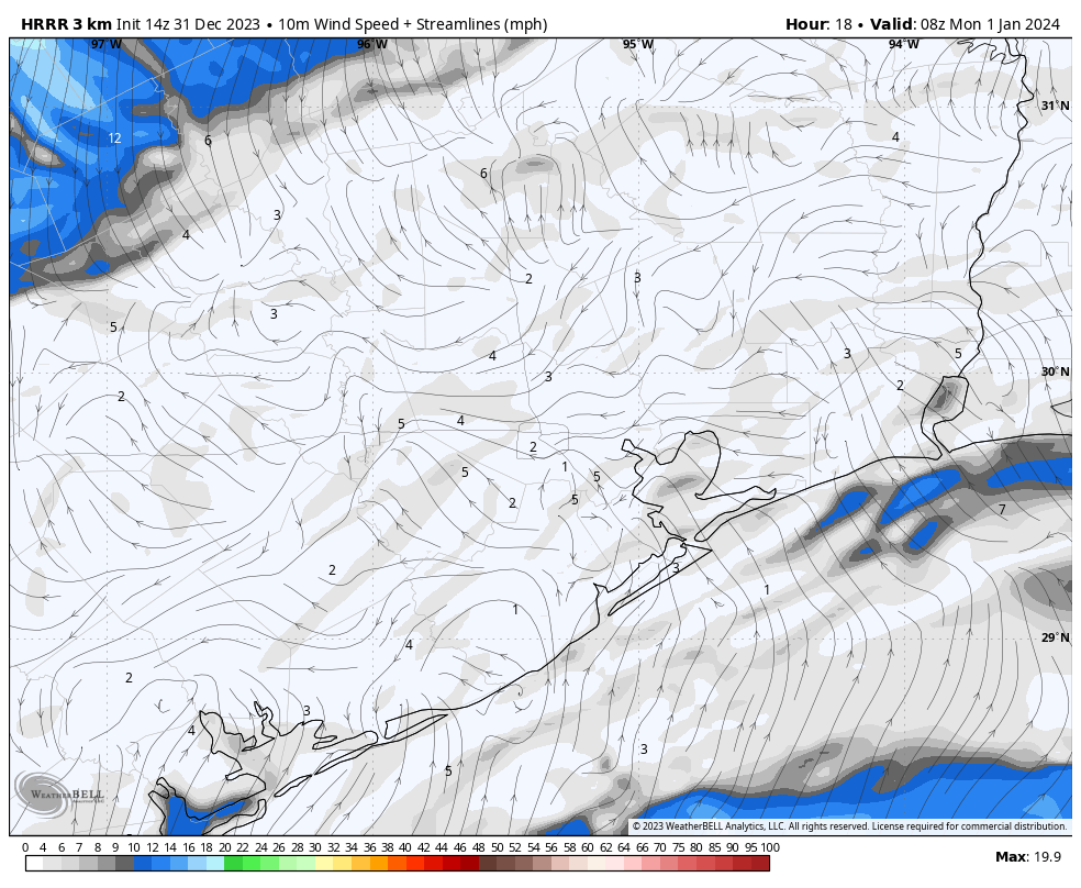
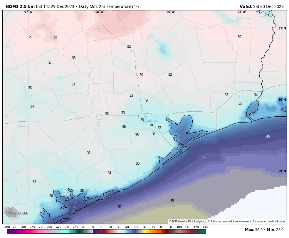
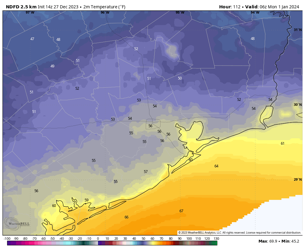
The latest outlook for wind speeds is just 1 to 5 mph tonight after midnight. In addition, there is likely to be a stout capping inversion in place, which will prevent air near the surface from rising and mixing. And finally, air temperatures will very nearly match dewpoints in the upper 50s after midnight, creating ideal conditions for the formation of fog. All of this could combine to form thick air with poor visibility. Please take this into consideration with your plans to be on roadways after midnight tonight, and drive with extra care.

As expected, a cold front will push through Houston on Monday morning, bringing northerly winds that will quickly disperse the fog and smoky air. However, this front is unlikely to reach the Houston metro area until around sunrise, give or take, on New Year’s Day. The holiday will be partly to mostly cloudy, with high temperatures in the 60s. We’ll be back with a full update on Tuesday, January 2nd.

For our final post of 2023: Some cold, some warmth, and some rain in the new year

Good morning. Lows have bottomed out in the upper 30s across most of Houston this morning, giving us cold but not freezing weather. The pattern we’ve been talking about for several days now will hold through the holiday weekend, with a warming trend through Sunday, followed by a cold front overnight leading to chillier conditions on New Year’s Day. Also, please check the end of today’s post for a note regarding some issues with our app and its display of current conditions.

Friday

Today will be sunny and cold, with high temperatures only reaching the mid-50s for most areas. Winds will be light, from the northwest, at perhaps 5 to 10 mph. With clear skies, low temperatures will again drop into the 30s tonight, to about the same level reached Thursday night. So most of the Houston region should again remain comfortably just above freezing.

Low temperature forecast for Saturday morning. (Weather Bell)

Saturday

We’ll see the beginning of a bit of a warming trend, with highs reaching the mid-60s as winds turn to the west and then southwest. Skies remain sunny. Overnight lows will drop into the 40s.

New Year’s Eve

The year will end on a high note for temperatures, with mostly sunny skies and highs reaching around 70 degrees or just a tick above. The evening should be mild, in the 60s, leading up to the new year. There’s a slight chance, perhaps 10 or 20 percent, of some very light rain near or after midnight as a front approaches. The best chance for showers will be close to the coast. The front itself should move through the metro area after midnight.

New Year’s Day

This will be a mostly sunny day, with highs in the upper 50s or so. Winds will be noticeable from the north, perhaps gusting to 15 or 20 mph. Lows on Monday night will drop to around 40 degrees in Houston, with temperatures a bit cooler further inland.

Next week

Tuesday should be mostly sunny as well before rain chances increase during the evening and overnight hours as a trough of low pressure moves in. There’s still some fuzziness in the details, but I think most of the area will pick up 0.5 to 1 inch of rain through Wednesday morning. Temperatures remain on the chilly side throughout the week, with highs in the 50s, and lows generally dropping to 40 for most of next week. Some additional rain chances look to return Friday and Saturday.

NOAA rain accumulation forecast for now through Wednesday morning. (Weather Bell)

Unless the forecast for early next week takes a sharp turn, with respect to rainfall totals, our next post will come on January 2 so that Matt and I can enjoy the holiday weekend with our families. We wish you all a safe, happy, and wonderful end to 2023, and start to 2024.

App note

You may have noticed that forecast data isn’t showing up in the Space City Weather app. That’s because the National Weather Service isn’t providing the feed the app relies on for forecasts. An error message indicates that data will return on Jan. 1.

However, we are getting current conditions info, and developer Hussain Abbasi tweaked the app after the NWS feed went south to make sure that shows up. Once the NWS feed returns to normal, so will our app. 

We’ll warm up briefly on New Year’s Eve before starting 2024 with a series of cooler days

Good morning. Much of the region outside the inner urban core of Houston is starting the day in the 30s, and we’re going to see a pair of even chillier nights before a warming trend this weekend. A front that will move through right around the opening of the new year will return us to winter-like weather, and later next week we’ll also see decent rain chances return.

Thursday

Today will be sunny and cool, with high temperatures in the 50s thanks to prevailing high pressure. Winds will be from the northwest, at about 10 mph, with the potential for some higher gusts. Lows tonight will drop into the 30s for pretty much the entire area, with the possibility of a light freeze for outlying areas. However, it still looks like most of the metro area surrounding the Houston area will remain just above freezing. As I noted earlier this week, Houston has not recorded a freeze this calendar year.

Low temperature forecast for Friday morning. (Weather Bell)

Friday

This day will be almost a carbon copy of Thursday in terms of sunshine, winds, temperatures and another cold night.

Saturday

Temperatures start to moderate some this weekend, with sunny skies and highs in the low to mid-60s. Winds turn more west and then southwesterly. The air remains dry. Lows on Saturday night will drop into the 40s for most.

New Year’s Eve

Winds will briefly turn southerly on Sunday, and this should allow temperatures to pop up to around 70 degrees, or a tick warmer. A few clouds will also form as atmospheric moisture increases. This should all make for a mild evening to ring in the new year, with temperatures in the low 60s. The only real question is the timing of the front, and whether there will be enough moisture to squeeze out some rain showers. At this point I’d say there’s about a 20 percent chance of light rain to the east of Interstate 45, and lesser chances to the west late on Sunday night, and early on Monday morning, as the front passes through. This frontal passage should push lows for Monday morning down to around 50 degrees.

The new year will start out colder for the Southern United States. (Pivotal Weather)

Next week

New Year’s Day should be partly sunny, with highs in the low 60s. It should also be dry. But that changes by Tuesday as the overall pattern turns more favorable for rainfall. Tuesday and Tuesday night should see the best chances, but each day next week after Monday should have at least a shot of rainfall. Total accumulations for the week, for most areas, probably will be on the order of 0.5 to 1.0 inch of rain. In terms of temperatures, we’re looking mostly at days in upper 50s or lower 60s, and nights in the 40s. So a chilly start to 2024.

Houston faces a stretch of colder weather before conditions turn milder to ring in the new year

Good morning. This post has come out a bit late because Matt is traveling, and I needed to complete my final long training run for the Houston Marathon. So I awoke at an unseemly hour. The upside is that I can attest that it’s a lovely winter morning outside—I was out there for several hours getting to mile 20. The downside is that I’m pretty wrecked. Also, to the truck driver on 646 who laid into your horn pretty good early this morning, I’m gonna assume that honk was an ‘attaboy’ rather than a ‘get off the road a-hole.’ Because it’s the holiday season and all.

Wednesday

After starting out in the 40s, the region will warm nicely today with mostly sunny skies. Highs generally should get into the low- to mid-60s with plenty of dry air. Winds will be light, from the northwest. Temperatures on Wednesday night will drop into the upper 30s, so a little cooler due to clear skies and a bit of a reinforcing front.

Low temperature forecast for Friday morning. (Weather Bell)

Thursday and Friday

These will be a pair of chilly, winter days. Both will see sunny skies and northwesterly winds with highs in the 50s. The question in regard to the forecast comes with low temperatures on Thursday and Friday nights. It still looks like the Houston metro area will remain just above freezing, with lows in the range of 35 to 38 degrees. But outlying areas, including Montgomery County and other inland regions, face the distinct possibility of a light freeze.

Saturday, Sunday, and Monday

The holiday weekend will see a warming trend. Skies should be mostly sunny on Saturday, New Year’s Eve, and New Year’s Day, with respective highs around 60 degrees, upwards of 70 degrees, and then back down to around 60 degrees to start 2024. If your plans including celebrating the New Year, I’d anticipate temperatures in the 50s in the hours leading up to midnight on New Year’s Eve. There is a slight chance of rain, perhaps 10 or 20 percent, as a front rolls through Houston late on Sunday night, or early Monday morning. It probably will be a dry front as there isn’t much atmospheric moisture to work with, but we’ll have to see. All in all, conditions like fine to start a new year.

Temperature forecast for midnight, on New Year’s Eve, as we ring in the new year. (Weather Bell)

Next week

Most of next week looks to have highs of around 60 degrees, give or take, with lows generally in the 40s. A storm system will likely bring some showers on Tuesday and Wednesday, but as of now accumulations aren’t anything to get worked up about—probably a few tenths of an inch.