After today’s front, Houston will see some splendid spring weather this week

Summary: A front will move through Houston this morning, leading to some beautiful weather through Friday. The weekend turns warmer and more humid, with some showers possible on Sunday, and likely on Monday and Tuesday. That may well spoil the eclipse viewing in Houston.

Houston radar at 6:54 am CT showing light to moderate showers. (RadarScope)

Tuesday

We’re seeing a broken line of showers, with a few isolated thunderstorms, across the region this morning as a cold front moves through the area from west to east. These showers should move east of Houston by 8 or 9 am, with drier air moving in behind. As a result we’ll see clearing skies by late this morning or early afternoon at the latest. This sunshine should allow highs to reach the lower 80s this afternoon before the region cools off nicely, with lows dropping into the low 50s tonight. It will be breezy this evening as winds gust up to about 30 mph from the north-northwest.
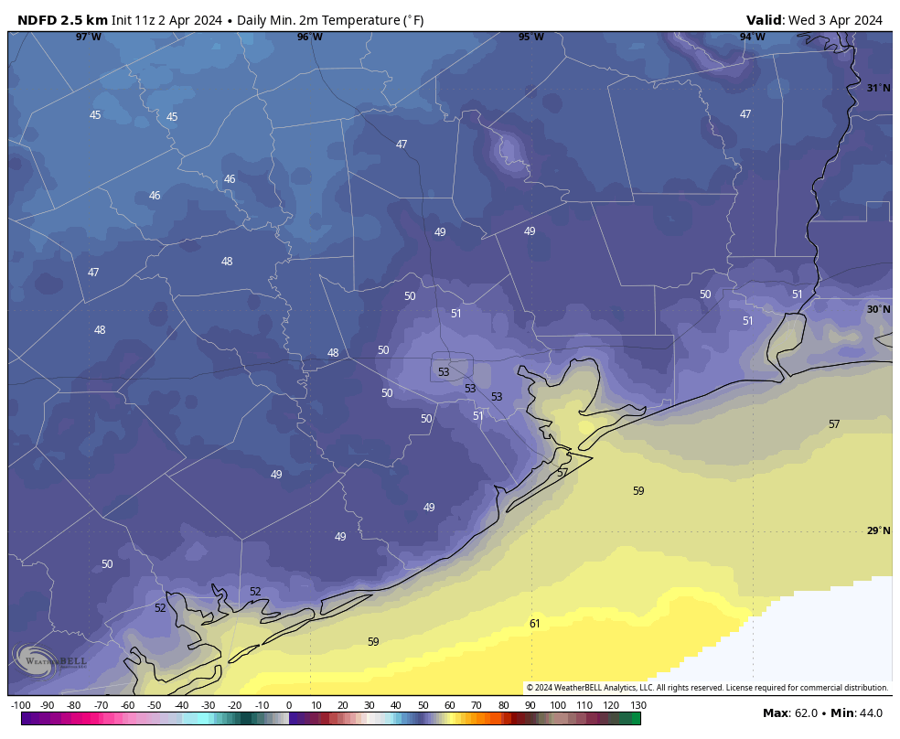
Wednesday

This will be a fine spring day, with highs likely in the mid-70s and lots of sunshine. It will be a bit windy, with gusts of perhaps 20 mph, as more dry air moves in. Conditions settle down overnight, with clear skies and lows in the 50s.
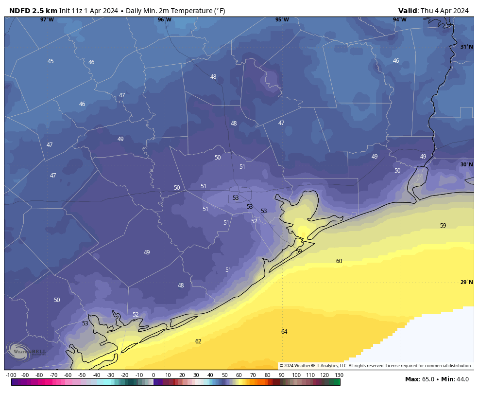
Forecast lows for Wednesday morning. (Weather Bell)

Thursday

This will be another exceptional day, with highs around 80 degrees and lots of sunshine. Winds will be light. Lows on Thursday night will drop again into the 50s.

Friday

While the onshore flow will start to reestablish itself, this should be a mostly sunny day with highs around 80 degrees and fairly dry air. Overnight lows will, however, be a bit warmer, only dropping to around 60 degrees overnight.

Saturday and Sunday

The weekend will see a transition to warmer, and more humid weather. We’ll see some clouds on Saturday, and increasing southerly winds. It could be gusty at times. Highs will be around 80 degrees. As atmospheric moisture levels increase, Sunday will be a mostly cloudy day with a chance of light showers. Highs will again be around 80 degrees. Lows on Sunday night will only drop to around 70 degrees.

Eclipse Monday

A dying front will stall over the region this weekend, and it will lead to increased rain chances to start next week, on Monday and Tuesday. In terms of accumulations, most of the area is likely to see 0.5 to 1.5 inches of rain, but of course details are difficult to parse this far out.

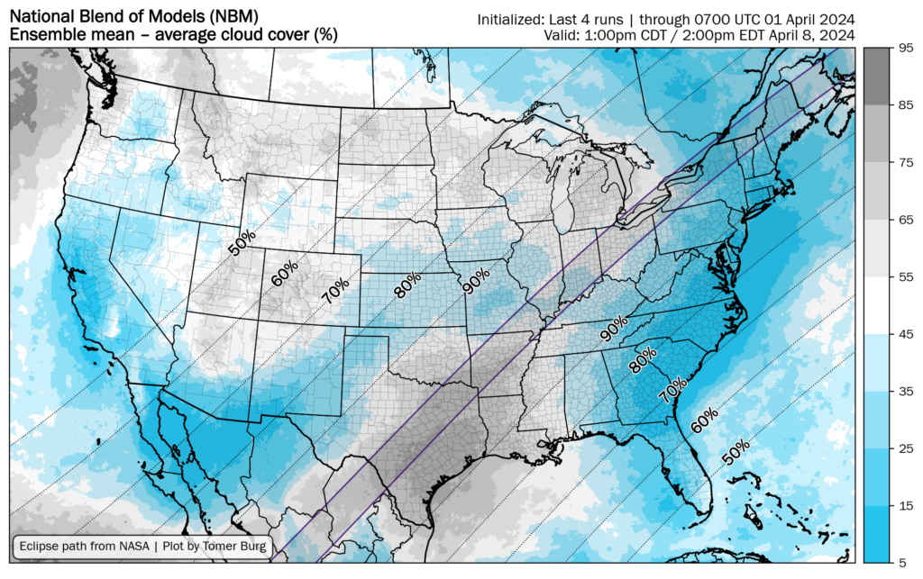
What that means for our skies on Monday is that clouds are likely at the time of the eclipse, which will peak at 1:40 pm CT over Houston with 94 percent of the Sun covered by the Moon. I can’t say for certainty that it will be cloudy during the early afternoon hours on Monday, but we’re continuing to trend that way.

Percent of cloud cover expected for April 8 at 1 pm CT. (Tomer Burg)

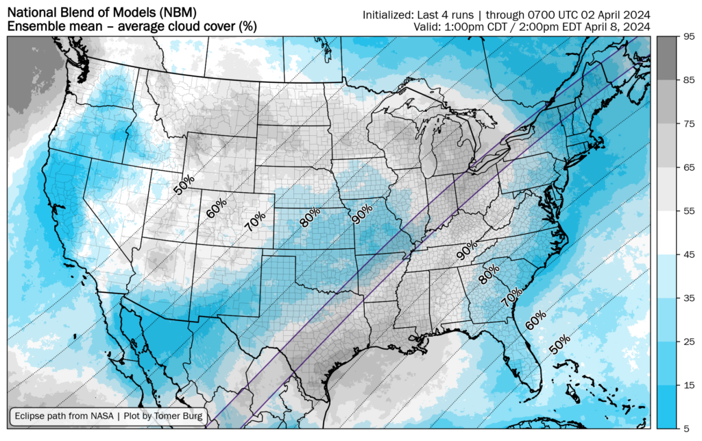
What about the line of totality, where the Sun is completely obscured by the Moon? This runs from South Texas to Northeast Texas. At this time much of the state is still likely to see partly to mostly cloudy skies along the path of totality, but there is some chance that areas of north Texas might see clearing skies as the aforementioned front pushes down to the coast. We’ll see. The outlook is still fairly grim, but perhaps not so grim as yesterday.

Unfortunately, the eclipse forecast for Texas is fairly grim

Summary: In today’s post we dive into the eclipse forecast for next Monday, which for Texas is frankly not very good. As for our weather in Houston, we’ll see a warm day ahead of a front on Tuesday. That should bring us lovely, spring-like weather for the rest of this week.

Total solar eclipse

Although we are still a week away from the total solar eclipse on April 8, which will take place at approximately 1:30 to 1:40 pm CT for much of the line of totality across Texas, the forecast is pretty grim. Locally, in Houston, about 94 percent of the Sun will be covered on Monday at the peak of the eclipse. My preliminary forecast for next Monday is scattered to widespread rain showers with mostly cloudy skies. For areas along the line of totality in Texas, the outlook is not much better. The operational runs of both the GFS and European models have, consistently, shown nearly 100 percent cloud cover across much of the state during the early afternoon hours on Monday. There is a fair amount of support for this in the ensembles as an upper-level system crosses the southern plains. Many of these areas could see rain on Monday.

The map below shows the ensemble forecast for percent of the sky covered in clouds on Monday at 1 pm CT. For nearly all of the totality path in Texas, the value is about 75 percent. However, given the consistency in the operational models, I would lean toward a value higher than that at this time.

Ensemble forecast for percent of the sky covered at 1 pm CT on April 8. (Tomer Berg)

About this I would say a couple of things. First of all, we’re still a week out. Forecasts can and do change. But this is not a good place to be seven days from the total eclipse. If you really want to see the eclipse with clear skies, the northeastern United States looks like your best bet. Secondly, if you’re staying in Texas, the eclipse will still be quite a treat even with poor weather. Along the line of totality the sky will still get completely dark in the middle of the day, which will be an eerie experience indeed.

We’ll continue to track the eclipse forecast in the days ahead.

Monday

Today will be warm, but not quite as warm as we’ve been anticipating. Mostly cloudy skies should help to limit highs to the mid-80s for much of Houston. It will be a breezy day, with southerly winds at about 15 mph, and gusts up to 25 or even 30 mph. Low temperatures tonight will only drop to about 70 degrees. There will be about a 20 percent chance of showers tonight, and an even lesser likelihood of isolated thunderstorms ahead of an approaching front.

Tuesday

The front should push into Houston during the morning hours on Tuesday, reaching the coast by around noon. We’ll see an additional, low chance of rain with the front’s passage, but then we’ll see quickly clearing skies and drier air moving in with northwesterly winds. These clearer skies will allow highs to briefly reach the lower 80s, but lows will drop into the 50s on Tuesday night.

Wednesday and Thursday

These will be a pair of gorgeous spring-like days. We’re talking highs in the low- to mid-70s, plenty of dry air, and lots of sunshine. Lows on both nights should drop into the low 50s in Houston, with cooler conditions for outlying areas. Seriously, these look like A+ days.

Thursday morning should be the coldest of the week. (Weather Bell)

Friday

This will be another nice day, with highs of about 80 degrees. A few scattered clouds will be possible with the return of the onshore flow, and lows on Friday night will drop to around 60 degrees.

Saturday and Sunday

Both of these days should see highs of around 80 degrees, with partly sunny skies. Sunday will see a decent amount of humidity, and we cannot entirely rule out some light rain showers later in the day. But for the most part, the weekend looks excellent for outdoor activities.

Next week

As mentioned above, rain chances start to increase on Monday, and through the early part of next week, in response to an upper-level system. It’s still too early to have too much confidence, but we’re talking days in the low 80s before a weak front (probably) arrives in the middle of the week.