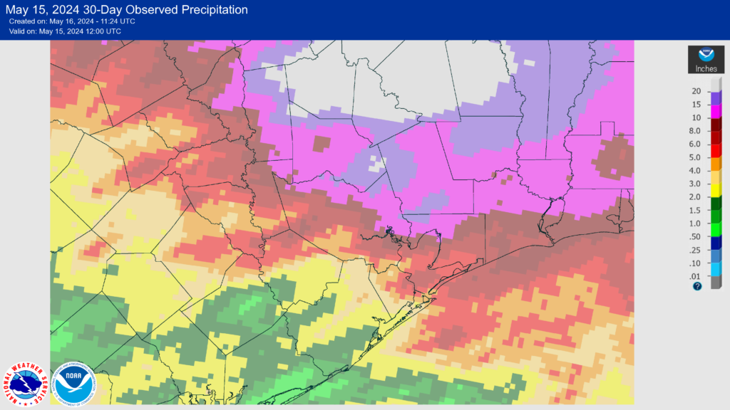
In brief: A line of severe storms moved through Houston on Thursday evening bringing heavy rainfall, and instances of damaging winds and tornadoes. We’ll have a full rundown tomorrow, but it has been a wild few hours. The point of this post is to let you know that that’s it for the night. And after some residual showers tomorrow, that’s it for spring storm season in Houston.
Wow, that was strong
Yes it was. We expected some severe weather this afternoon and evening, and forecasted as much this morning. But it’s fair to see we did not quite anticipate the severity of what developed. There are widespread reports of trees downed, damaged fences, and other significant problems associated with straight-line winds and a couple of tornadoes that developed this evening. On the excitable dogs scale from 1 to 10, this was an 11.5.
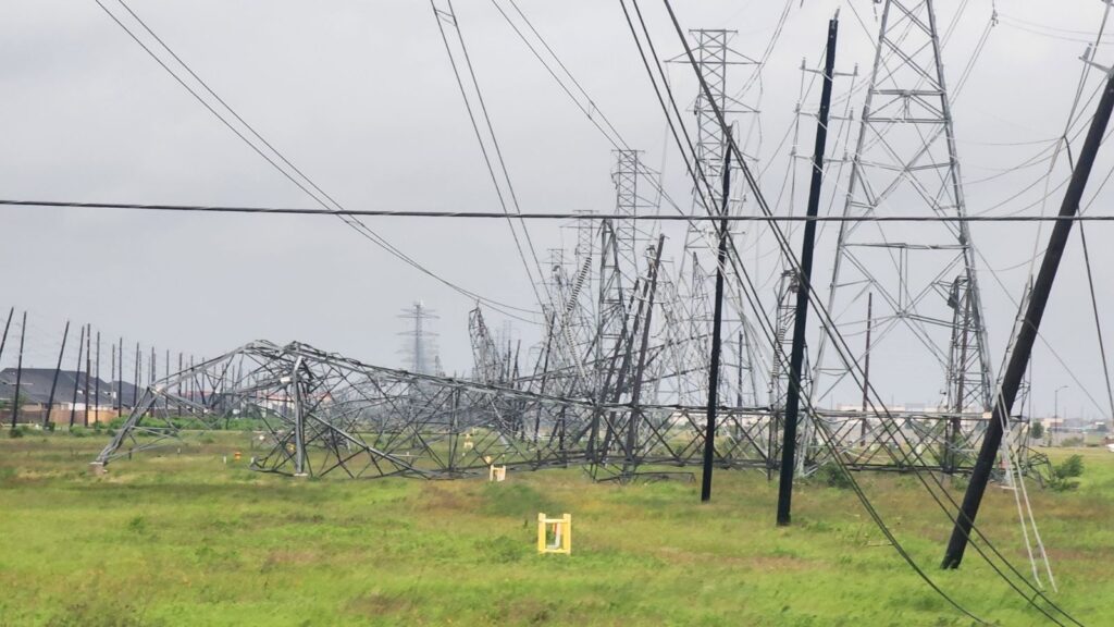
Electricity remains a significant casualty. In Harris County, as of 7:30 pm CT, 40 percent of customers are without power. These storms actually weakened as they tracked across the region, so the outages are even worse just to the west of Houston, where power is out to 75 percent of customers in Waller County. It is beyond the scope of what we can forecast to predict when the power will come back on, but the storms are clearing the area relatively quickly. Crews should be able to respond to outages beginning this evening, and work overnight.
So what happened? Some of the parameters we look at to gauge severe weather, including instability, convective available potential energy, shear, and helicity all came in at or above expected levels as the storms approached the Houston metro area late this afternoon. This allowed them to bloom and produce destructive storms.
What comes next
The major line of storms has already moved through central Houston, and it is steadily weakening as it as moves toward the coast. If it has stopped raining at your location, that is basically it. We may see a few trailing showers in the next couple of hours, but nothing serious. Tonight looks quiet.
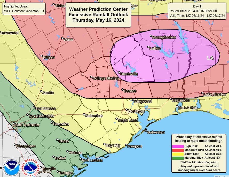
Tomorrow a final low pressure system will pass Houston, and may bring some additional showers to locations along and south of Interstate 10. I don’t expect these to be particularly severe, and they should develop mostly south of where the strong storms were today.
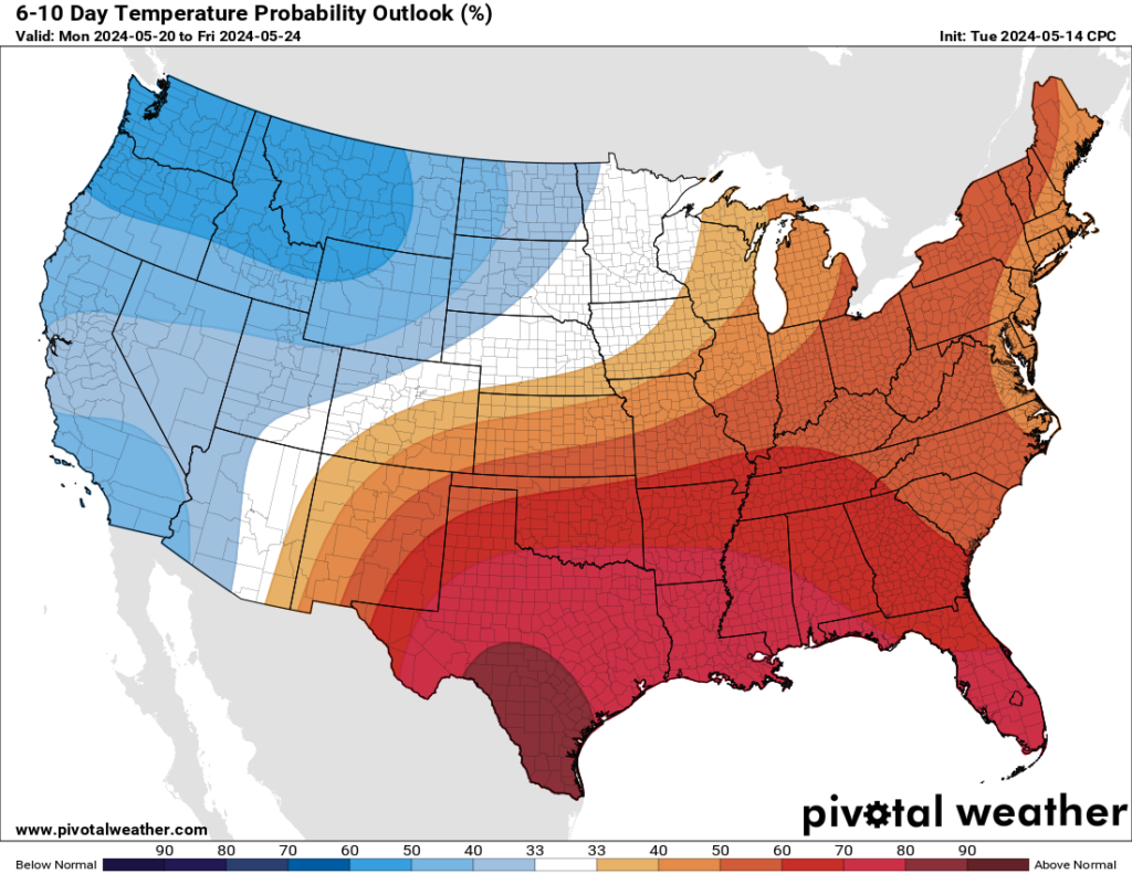
And then? That’s it. Spring is over. High pressure begins building over the area this weekend and we’re unlikely to see significant rain for days, if not weeks. Spring storm season ended with a fiery finale today.