In brief: As expected, the Houston region will continue to see healthy rain chances and lower temperatures for the Labor Day Weekend. With the heaviest rains mostly concentrated near the coast, a Stage 1 flood alert remains in effect for coastal counties. Also, could we really see our first fall front about a week from now?
This is just a short post on Sunday morning to say that our forecast for Labor Day Weekend, and beyond, is more or less on track. A large area of low pressure offshore will continue to push showers and thunderstorms inland for the next several days.
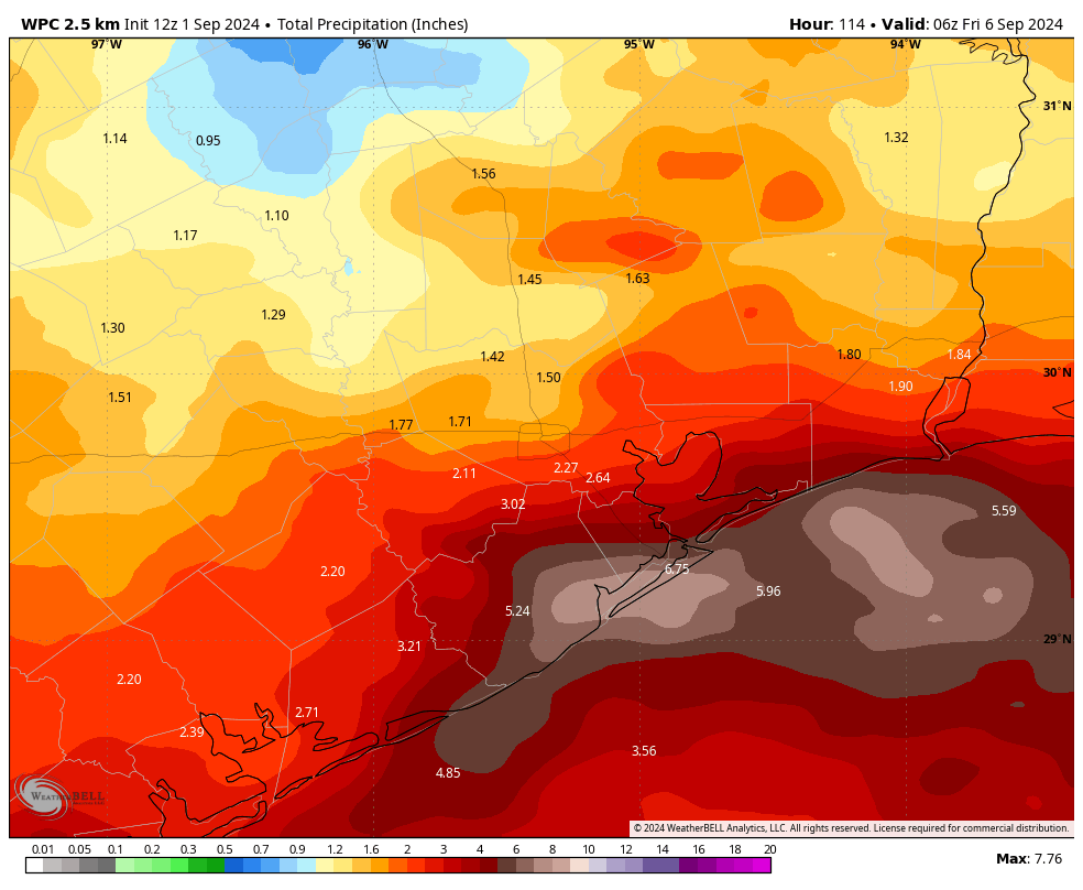
These rains will likely be most intense right along the coast, in places such as Galveston Island and points eastward to Port Arthur. For this reason, we are continuing to maintain a State 1 flood alert for coastal counties. This simply means that, in the stronger storms, there is the potential for some street flooding. We do not anticipate widespread, significant issues.
Rain chances will be lower for areas located inland of Interstate 10, but the entire metro area will have the possibility of seeing showers and thunderstorms into the middle part of next week as the pressure system continues to wobble near the upper Texas coast.
This means that our skies will remain partly to mostly cloudy, and this should keep daytime high temperatures in the vicinity of the upper 80s to 90 degrees through next Wednesday or Thursday. Sunnier weather should arrive by the end of this week, with diminished rain chances.
I don’t want to sell this too hard, but much of our model guidance is continuing to advertise the possibility of a cool front arriving by next Sunday or Monday. It’s far enough away to still have some doubts about whether this will happen, but it’s not impossible that we’ll see a couple of nights in the 60s with some drier air. I almost hate to write about it, because I don’t want to jinx it. I’ll have more on the likelihood of this front in tomorrow’s post.
Tropics
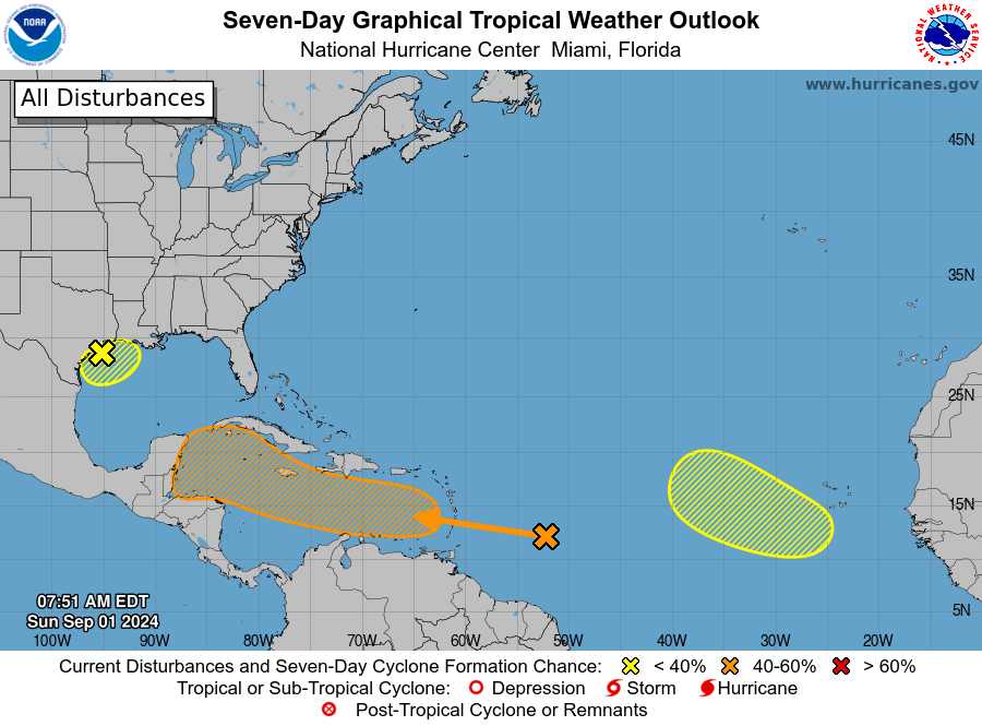
As for the tropics, we’re continuing to watch the Gulf of Mexico low pressure system. Because of its proximity to land, further development into a tropical depression is unlikely, but possible. There’s also a tropical wave the Atlantic Ocean nearing the Caribbean Sea. Not much has changed with this system. It’s possible that a tropical low eventually gets into the Gulf of Mexico, or it’s possible that nothing ever comes of this tropical wave. We’ll just need to keep watching for a few more days to see what happens. Matt will have more on this on The Eyewall this afternoon.
