Sunny weather continues until the weekend, with Saturday bringing at least some scattered showers

In brief: The overall forecast remains the same. We’ll see hot and sunny weather for a couple of more days. Saturday still should bring a decent shot of rain into the region, especially for areas closer to the coast. Then we’re back to sunny and warm until some sort of front arrives early next week, perhaps on Tuesday. A little fall weather would certainly not be unwelcome.

High temperature forecast for Wednesday. (Weather Bell)

Wednesday and Thursday

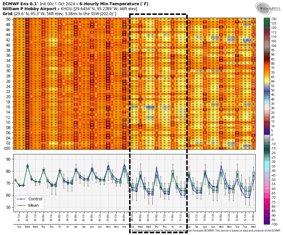
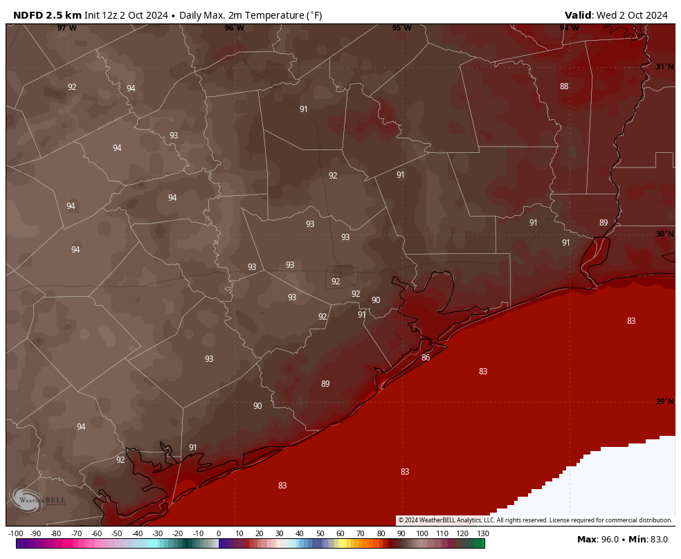
Clear skies and warm temperatures will continue for the next couple of days across the metro area. We’ll see nearly 100 percent sunny skies, with no chance of rain, through Thursday evening. High temperatures, for the most part, will be in the low 90s. Overnight lows will drop into the lower 70s for most locations not immediately along the coast. With dewpoints remaining in the 60s, the air will feel marginally drier than typical summertime conditions in Houston. Winds remain light, generally from the east at 5 to 10 mph.

Friday

We’ll start to see a few clouds by Friday as the upper-air pattern becomes more unsettled. However, skies will still be at least partly sunny, and rain chances are only likely on the order of 20 to 30 percent. For areas inland of Interstate 10, they’re even lower. High temperatures will reach about 90 degrees for most locations, or perhaps a touch warmer.

NOAA rain accumulation forecast for now through Sunday. (Weather Bell)

Saturday and Sunday

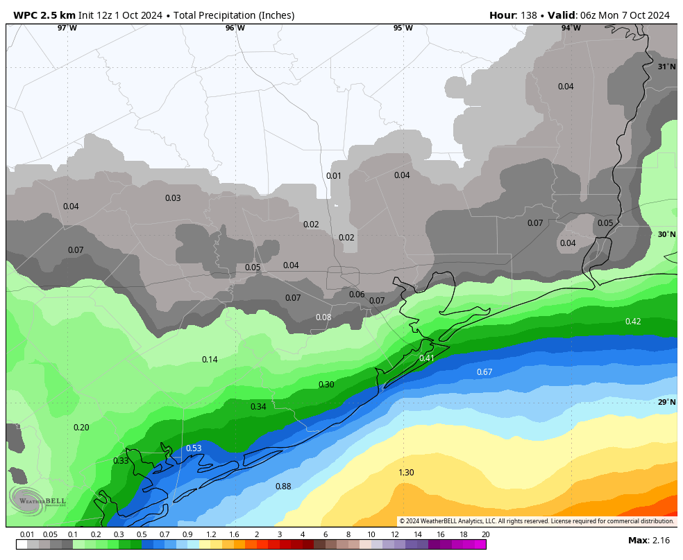
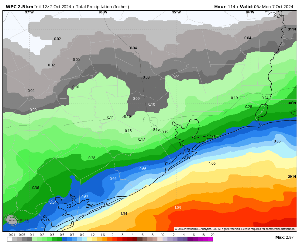
We should see more cloud cover for the first half of the weekend, as well as our best rain chances for the forecast period. Locations along and south of Interstate 10—closest to the source of moisture—will probably have about a 50 percent chance of showers during the daytime, with lesser chances further inland. I do not expect a deluge, but rather a series of scattered showers pushing through. Accumulations for most locations will likely be on the order of a few tenths of an inch of rain. Highs, due primarily to the clouds, should be in the upper 80s.

By Sunday we’ll be transitioning back to a more sunny pattern. However, I still expect to see at least some partly cloudy skies, with perhaps a 20 to 30 percent chance of rainfall. High temperatures will get back into the lower 90s.

Next week

Monday should bring more clear skies and high temperatures in the low 90s. However, at some point on Monday night or Tuesday, we should see the arrival of a front, with some drier and cooler air following it into the region. There’s still quite a bit uncertainty as to how much drier air will arrive, given that our region will be receiving a glancing blow from the front rather than a full on push out of the north. Nevertheless, I expect highs to at least drop into the 80s, with lows in the 60s. It’s possible we’ll get a bit cooler than this, but determining that six days out just isn’t possible with this kind of front.

Tropical outlook from the National Hurricane Center.

Tropics

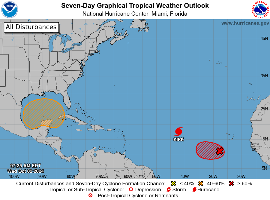
Although some sort of tropical system may develop in the central or southern Gulf of Mexico over the next week, it is not likely to have a significant effect on our weather in Texas.

Cooler weather is probably coming to Houston next week, but where’s the rain?

In brief: Today’s update digs a little deeper into our lack of rainfall during the second half of summer, and whether we’re going to see relief any time soon. The answer is maybe, and that especially coastal areas have a healthy chance of rain this weekend. Then, by early next week, passage of a decent fall cool front looks increasingly likely.

Drying soils in late summer

Houston started out this summer with plenty of rain. You may remember Hurricane Beryl in July? But by the end of that month conditions turned notably drier. And but for a wetter spell in late August, the last two months have been quite dry. Our soils feel the lack of rain especially keenly during August and September, as these are often the hottest months of the year, which dries things out much more quickly. Looking at the last 60 days, we can see that much of the Houston area received less than 50 percent of normal rainfall, and some western areas less than 25 percent.

Percent of normal rainfall over the last 60 days. (HPRCC)

So far this has not resulted in drought-like conditions—something for which we can thank Beryl. However, in the latest update from the US Drought Monitor, the northern two-thirds of the Houston region are classified as being “abnormally dry.” This is just a step short of falling into a drought. I write all of that to say we could use some rainfall this month. Our next chance comes this weekend, but unfortunately it looks like the highest odds for rainfall will be closer to the coast, areas which generally are doing OK with rainfall. Would that I had better news.

Tuesday, Wednesday, and Thursday

Warm, but calm, weather will continue through much of this week. We can expect sunny days, high but not excessively so humidity levels, and sunny skies. Daytime temperatures will be in the low 90s, with overnight temperatures in the low 70s. Winds will be light all three days, from the north and east, typically not getting much above 5 mph. You probably won’t believe me, but we’re coming to the end of the time of year when we see long strings of 90-degree days, so if you like pool or beach time, this is a good week, and weekend for that.

NOAA rain accumulation forecast for now through Sunday. (Weather Bell)

Friday, Saturday, and Sunday

As noted above, our region will see some better rain chances starting Friday and lasting through the weekend. In the absence of high pressure, and with increasing levels of moisture in the atmosphere, we should see some clouds start to build on Friday, with partly to mostly cloudy conditions on Saturday, before more sunshine on Sunday. The models have gotten a little more bullish with rain chances for the weekend, especially on Saturday. However, you should set your expectations accordingly, especially if you live inland of Interstate 10.

My sense is that there is still a lot of uncertainty in the rainfall forecast so expect some change. However, if you live in a coastal county your chances of rain are probably higher than 50 percent on Saturday, and a bit lesser on Friday and Sunday. Further inland, along Interstate 10, rain chances are probably about 40 percent on Saturday, and the further you go from the coast, the lower things get.

High temperatures this weekend will be on the order of 90 degrees during the daytime, with a decent amount of humidity, and lows generally in the mid-70s.

There is a lot of support in the European models for a cool front early next week. (Weather Bell)

Next week

Confidence is increasing in the arrival of a cool front early next week, likely some time on Monday or Monday night. It is not guaranteed, but there is now support in a lot of our modeling guidance for a decent push of drier and cooler air. I would expect mostly sunny weather next week, with highs in the 80s and lows in the lower 60s, but this is going to depend on the extent of the frontal push. A majority of the colder air with this system is going to get shoved east, rather than south, so we’ll have to wait and see how much relief we get. Despite those caveats, however, I’m optimistic. A little fall weather would hit the spot.

Tropics

There’s a lot going on out there, and if you want all the details we’ve got them on The Eyewall. But if you’re simply wondering, “What does this mean for Texas?” the answer is, not much. It’s been a week since we called a halt to the Texas hurricane season, and I still feel pretty good about that prediction.