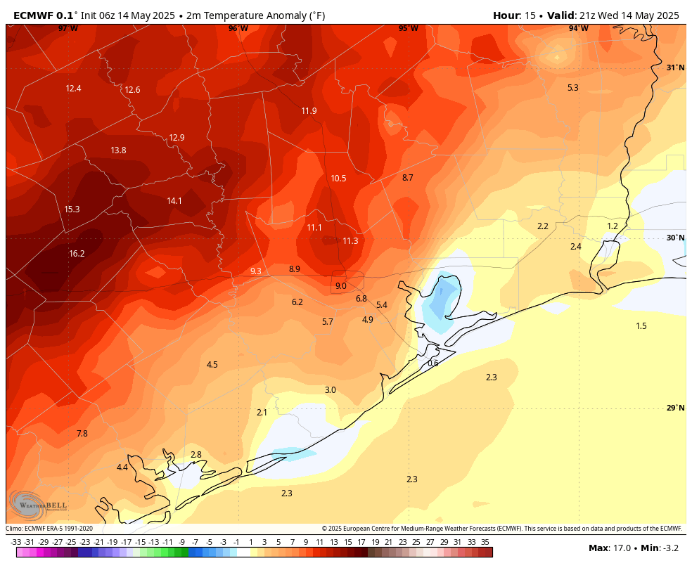
In brief: Heat records are continuing to fall across the region as Houston (and much of Texas) falls under the sway of high pressure. In today’s post we explain just how abnormal this is for May, and look ahead to a hot weekend. There is a modest chance of some relief next week.
Heat records fall
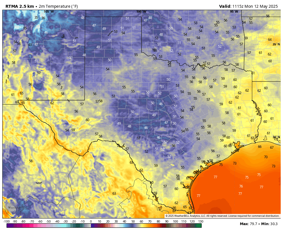
As expected, the city of Houston broke its high temperature record on Wednesday. The new mark of 96 degrees surpasses the old record of 93 degrees, set back in 2018. The local office of the National Weather Service also provided some additional nuggets of information to put this May heat wave into context:
- The average date of the city’s first 95-degree day is June 13, this year we did it on May 13
- Before this year, the last time Houston was this hot, this early in May was 1967 (96 on May 8)
- This year’s mark of 95 on May 13 is the fifth earliest we’ve been that hot it in a calendar year
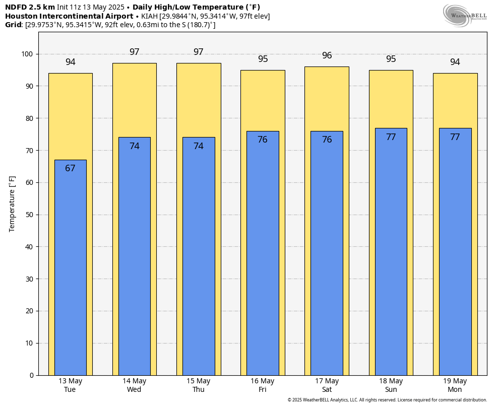
In addition, we are likely to tie or exceed the city’s record high temperature today (94 degrees, set in 2018) and possibly on Friday (94 degrees, 2022) although by then we might see a very slight moderation in temperatures.
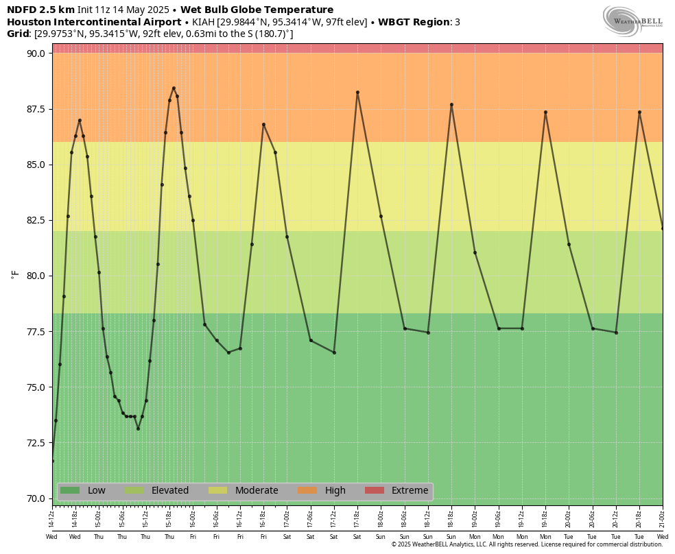
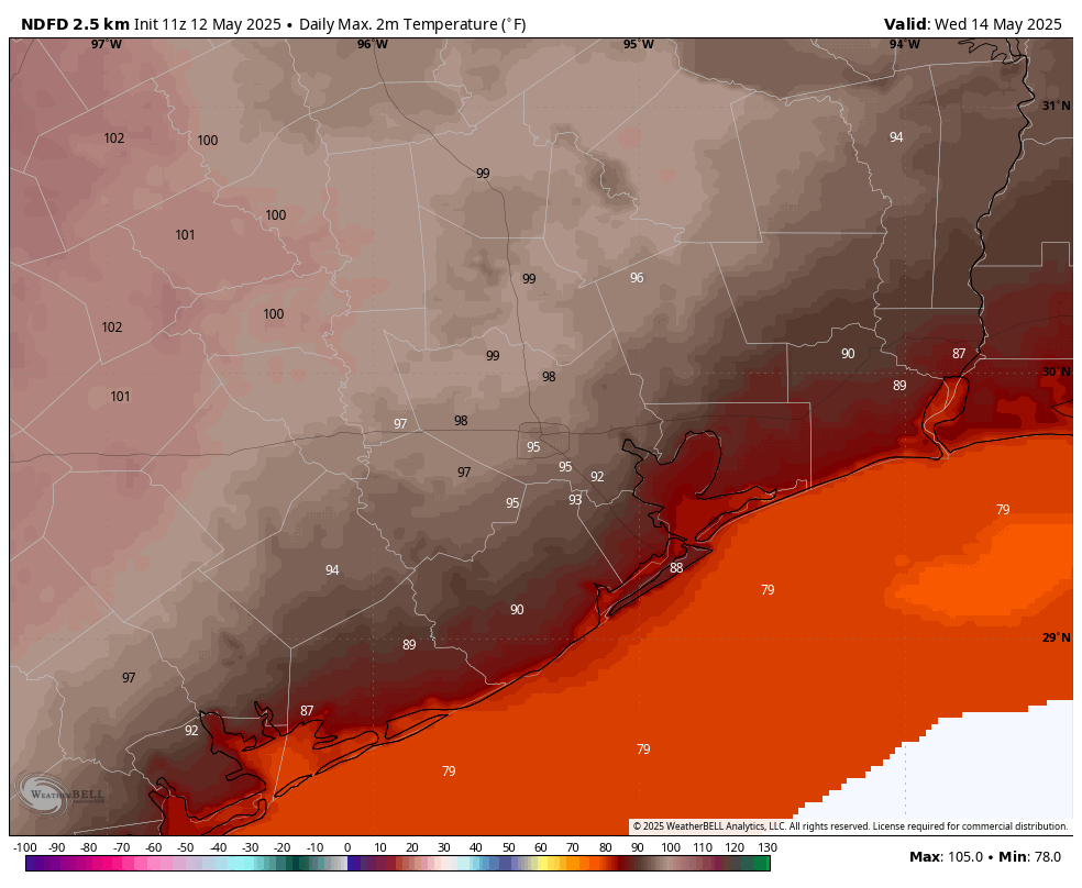
Thursday
If you’ve stepped outside during the last couple days, you have a pretty good idea of what to expect for Thursday. Partly cloudy skies this morning will give way to a sunny afternoon, with high temperatures generally in the mid-90s in Houston, with upper 90s possible further inland, and slightly cooler highs closer to the coast. Southerly winds will, again, be gusty from the south at up to 25 mph. Lows tonight will only drop into the upper 70s.
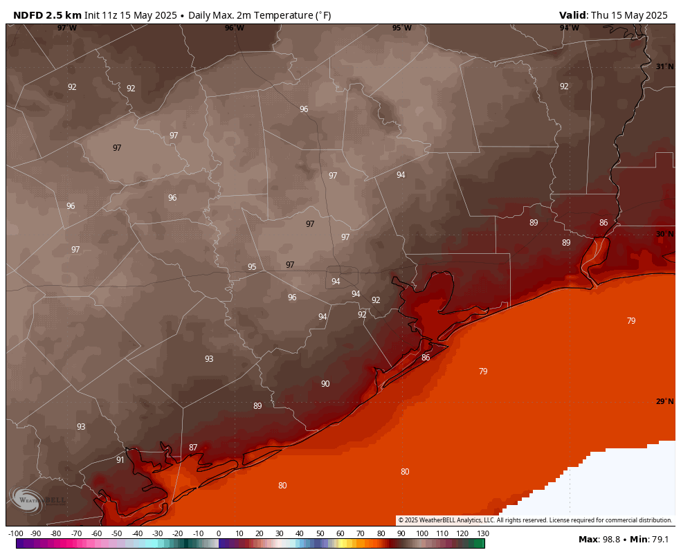
Friday, Saturday, and Sunday
Not much changes this weekend, when most of the area should see highs in the low- to mid-90s. There may be some variance in cloud cover, with a few more clouds on Friday and Sunday, but in general I still expect there to be a fair amount of sunshine during the daytime hours. We can expect that persistent southerly breeze through the weekend, with gusts peaking during the afternoon hours. Nights remain the same, warm and muggy. Rain chances are close to, but not quite zero.
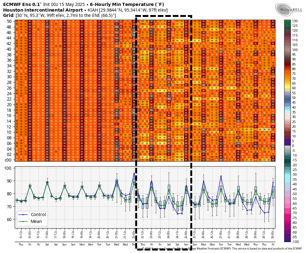
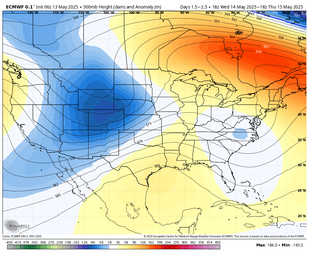
Next week
The first half of next week starts out warm, essentially a continuation of this week’s weather. However much of our model guidance is now hinting at a weak front approaching, and possibly pushing into the area by mid-week. This certainly is no guarantee, and its impact should be limited. But at least it may spark some showers, and give us a bit of drier air. We’ll just have to see how the forecast evolves over the next few days.