Good morning. A low-pressure system in the Gulf of Mexico will wobble a bit closer to the Texas coast today, bringing a chance of showers to coastal counties this afternoon and evening. Otherwise our weather looks to be fairly calm, with a warming trend heading into the weekend before a front arrives on Saturday night. This system may bring a more widespread chance of showers and thunderstorms.
Wednesday
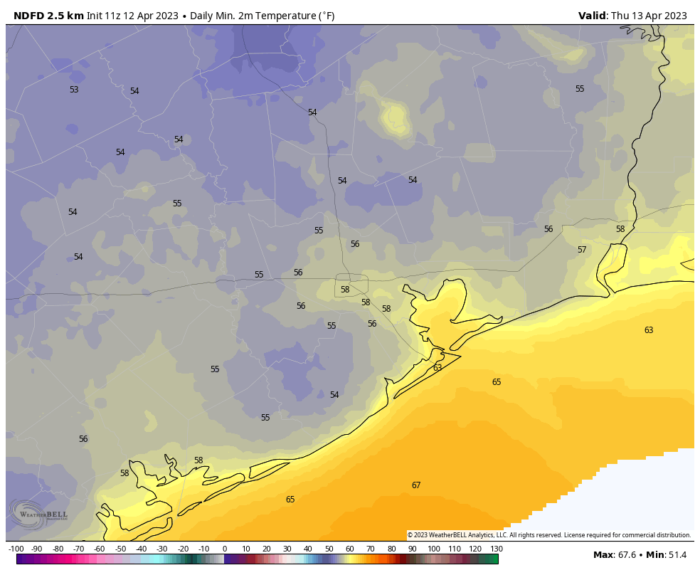
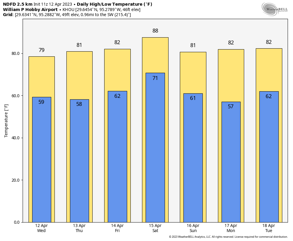
Winds are light this morning, out of the north, and we should continue to see a light northeasterly flow for much of the day. This should help to hold temperatures in the upper 70s despite mostly sunny skies. We should start to see the development of some scattered showers by mid-afternoon due to the Gulf low, and these will remain possible through the late evening hours. A few thunderstorms are possible. Rain chances are still only about 30 percent, with the most likely locations along and south of Interstate 10. Lows tonight will drop into the upper 50s in Houston, with cooler conditions inland.
Thursday
This day will be a lot like Wednesday, albeit with highs a few degrees warmer, about 80 degrees. Rain chances also will be near zero as the aforementioned low drifts away. Expect one more cool-ish night in the upper 50s to around 60 degrees in Houston.
Friday
As the onshore flow resumes, Friday will be more humid with highs in the low 80s and a mix of sunshine in the morning and clouds building in during the afternoon. Overnight lows will only drop to around 70 degrees.
Saturday
The first half of the weekend will be warm, likely in the mid- to upper-80s, with mostly cloudy skies. Shower and thunderstorm chances will increase during the afternoon and evening hours, but again we don’t quite have enough information about the atmosphere to really say whether some strong storms will develop. So for now, the best I can say is that there is the potential for these storms ahead of the front, which will move in late Saturday night.
Sunday and beyond
Sunday and Monday should be pleasant, sunny days with drier air and high temperatures around 80 degrees. Lows should be in the upper 50s. Any outdoor activities look just fine.
By Tuesday the onshore flow will be bringing clouds and humidity back to the area, and this may combine with an atmospheric disturbance to bring a healthy chance of rain to Houston by as early as Tuesday night. Temperatures during the second half of next week look reasonably warm, in the mid-80s for the area with fairly humid air. So it goes as we get into the second half of April.


Looks like our cool weather is finally slipping away. No fronts other than the one this weekend are in the cards.
weather can be unpredictable, you never know stranger
We usually see a few cool fronts in late April and early May that can bring some nice crisp air. Most years we see at least one or 2 nights in the 50s in May. But as far as true cool weather with highs in the 60 and 50s, yeah that’s most likely over now. November’s coming.
Pouring in Montgomery. Not quite the 30% chance south of and along o-10