In brief: Houston’s weather will largely deliver sunshine and humidity through the holiday weekend, although we cannot entirely rule out a few sporadic showers today and Thursday. Rain chances start to improve early next week.
Big picture overview
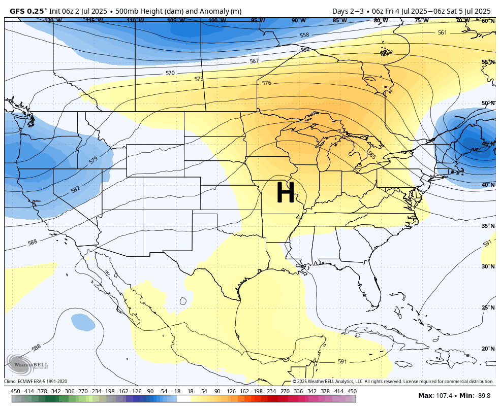
A ridge of high pressure is building over the region, and it will remain in place through the Fourth of July holiday weekend. That is not to say we are going to see no variation, but the next five days are likely to consist of mostly sunny skies, temperatures in the mid- to upper-90s for most areas away from the coast, and plenty of humidity. Aside from the heat, which is a little bit warmer than normal for early July but far from atypical here, wind and other conditions look mild. If you’re planning a BBQ or other gathering for the holiday weekend, you’ve got no concerns aside from the potential for sunburns.
Wednesday and Thursday
Skies will be mostly sunny today and Wednesday, with high temperatures in the vicinity of the mid-90s. There is enough moisture in the atmosphere to squeeze out a few showers and thunderstorms during the afternoon and evening hours (primarily driven by the sea breeze), but I would rate these chances at about 10 percent. So possible, yes. But unlikely. You may also see a bit of Saharan dust in the atmosphere, but the amount is less than we had last month. Winds will be light most of the day, but may rise to about 10 mph with higher gusts during the afternoon and evening hours. Lows likely will not fall below the upper 70s.
Friday, Saturday, and Sunday
The holiday weekend will bring pretty much standard July weather to the area: hot, humid, and mostly sunny. Temperatures for fireworks on Friday night will still be solidly in the mid- to upper-80s with plenty of humidity. Rain chances are virtually zero on Friday and Saturday, but we may see the return of some sea breeze-driven showers by Sunday. We’ll see.
Next week
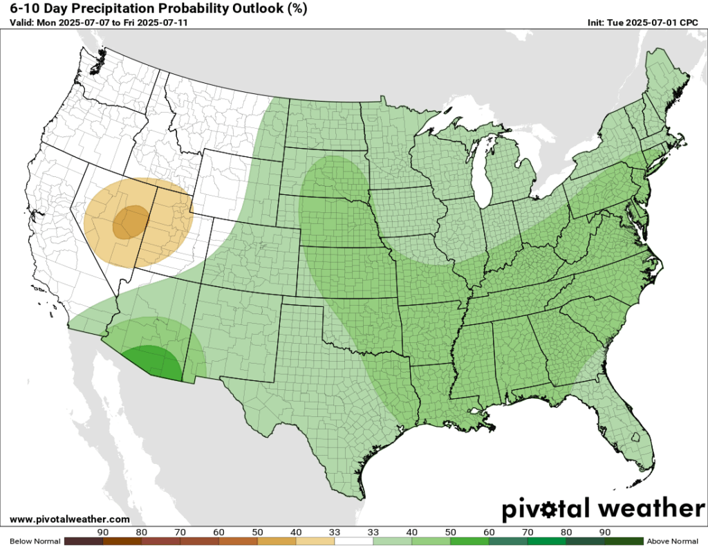
Our global models continue to indicate high pressure dominating our weather this week will start to weaken by Sunday or Monday, and this in turn should open us back up to the possibility of more widespread showers and thunderstorms, and perhaps high temperatures a degree or two lower. I’m not sure whether that will happen by Monday or Tuesday or a little later next week. But given that there is zero mystery in the near-term forecast for Houston (hot and sunny, rinse and repeat) it is nice to have at least something to bring you back to the website, dear reader.

Even during the boring times I always check up everyday for posts. I never leave lol
I do, too.
I’m always happy to see/read you here 🌻
Lol same
It may be “rinse and repeat” but I suspect many SCW fans like me “tune in” because we simply enjoy it. Where else can one go to find dedication of the kind the SCW team consistently brings to such a fickle thing like the weather? Chaos theory guarantees that the weather will always have a bit of a mind of it’s own at times and can be full of surprises. Regardless, SCW douses their analysis of this topic with detailed information, consideration for their readers and delivers it come hell or high water with good writing sprinkled with local flavor and topped off by an occasional sense of humor. Thank you and please keep up the great work! I sound like a commercial. Now where’d I put my coffee?
As a bicycle commuter and relatively new Houstonian (2023), I am sad to see this mild June go. Only 4 months till November!!
4 very long months. For me, time moves the slowest this time of year because I am counting the seconds until cooler weather finally arrives. The November through April period flies by super fast because I enjoy walking outside during the day without melting. Time flies by fast when you are having fun and the things you dread arrive very quickly.