In brief: We’ll see a short reprieve in humidity today, but then we are back to hot, and mostly sunny weather through Saturday. The second half of Memorial Day weekend could see the onset of some scattered showers, and by next week a pattern change should bring cooler temperatures and more widespread precipitation.
Front status
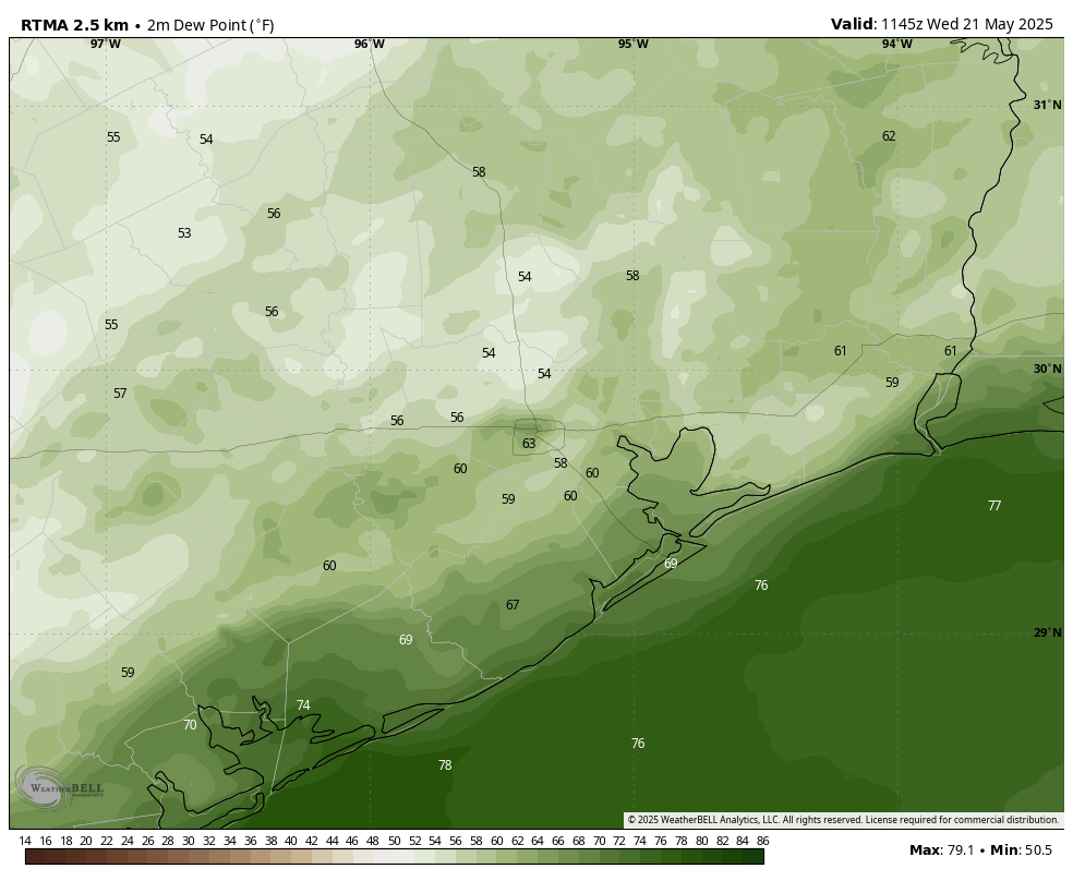
A weak front moved into Houston overnight. It produced some stray showers and thunderstorms near downtown Houston and the Liberty area, but for the most part it was a dry passage. The front has now stalled near the coast and should allow for showers (mostly offshore) this morning before lifting back north as a warm front. Therefore, if you’re enjoying the slightly lower humidity levels this morning, don’t get too attached. Humidity levels will begin to climb this afternoon, and we’ll be back to sticky status this evening.
Wednesday
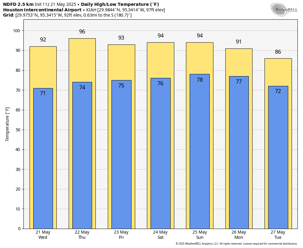
Skies will be mostly sunny for most of Houston today, with high temperatures in the low 90s. Winds will start out from the northeast this morning, but return to come from the southeast by this afternoon or evening—hence the rapidly recovering humidity levels discussed above. There likely will be some showers offshore, and a few of these may impact coastal areas today, but most likely they mostly remain over the Gulf. Lows temperatures tonight will drop into the mid-70s.
Thursday and Friday
These will be a pair of mostly sunny and humid days, with high temperatures in the low- to mid-90s for most locations and nights in the 70s. Rain chances are near zero. Winds from the southeast, generally, will be light.
Memorial Day weekend
It’s hard to believe we are already at the Memorial Day weekend stage of things, but here we are. Saturday should, more or less, see a continuation of the hot, humid, and mostly sunny weather of Thursday and Friday. Sunday may see a few more clouds, but will still be rather hot and humid. There may be a 20 percent chance of rain. By Memorial Day, however, we are likely to see the impacts of an advancing front. Highs may be around 90 degrees, with partly to mostly cloudy skies, and perhaps a 50 percent chance of light to moderate showers.
Next week
The details remain sketchy, but that front is likely to move into Houston and bring a period of moderately cooler and wetter weather. Most of next week should see highs in the 80s and lows in the 70s, with healthy rain chances. It’s difficult to pick a day with the greatest likelihood of rain, but we do look to be headed to a pattern in which showers are more abundant. We could use the break after a mostly hot, and mostly sunny May so far.

Is it possible to explain the recent day after day morning to early afternoon gloomy overcast conditions? It’s getting old! Thanks!
I think it’s smoke from the fire’s in Mexico.
Picked up a nifty 3/4″ of rain last night in the Atascocita area near Lake Houston. A good watering for the plants.
It’s pretty sad when dew points in the low 70s feels like a relief but that is where we are at now.
Is the wwather in Texas on Sunday and Monday expected to be severe based on what we know today?
weather. I can spell.
I have a question, is it possible to add a widget to the site that ties in the NWS radar like the SCW app has? It is quite useful