A strong cold front will cross our region this morning, bringing very cold and blustery conditions to our area through the weekend. However, much fairer weather is on tap for much of next week, with Spring Break for most Houston-area students feeling quite a bit like spring, lots of days in the 70s, and a fair amount of sunshine.


Friday
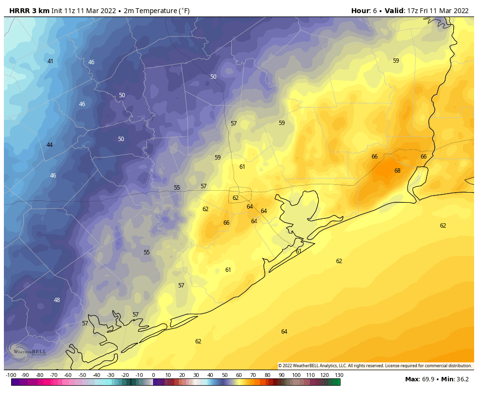
The front is a little bit ahead of schedule, having already reached College Station and pushing quickly toward Houston. It should reach the city during the mid- or late-morning hours, and will likely be near or off the coast by around Noon. Once the front passes, winds will pick up pretty quickly out of the north, and temperatures will start to plunge. Winds should peak overnight, gusting to 35 mph or even higher. For most inland areas, the front’s passage should be a fairly dry one, in terms of rainfall, but there’s enough moisture on the coastal side of Highway 59/Interstate 69 to expect some shower activity this afternoon as the front passes and in its immediate wake. Some coastal areas could pick up as much as an inch of rain before sunset. Temperatures tonight will drop to below freezing for some inland areas, and possibly parts of Houston itself, as skies clear allowing for optimal cooling.

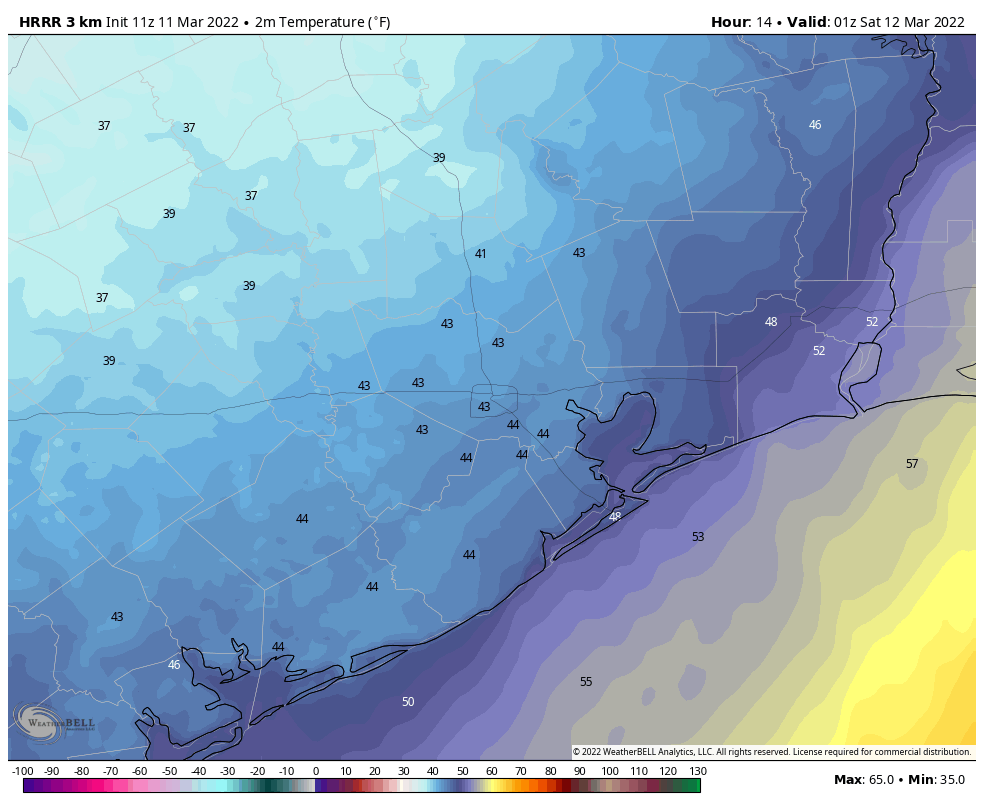
If you’re heading out to the rodeo to see Bun B’s H-Town Takeover, please dress warmly. Temperatures will be in the upper 40s this evening. And while I don’t think rainfall will be an issue, winds will be blowing pretty good through the area at this time, making for rather unpleasant conditions outdoors. Temperatures will drop into the low 40s after the show, with plenty of wind still out there.

Saturday
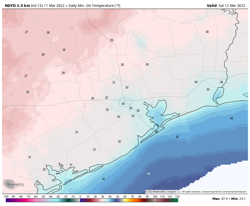
The first half of the weekend will bring brilliant blue skies into the forecast, but with a cold northerly flow highs will only get into the mid-50s. While northerly winds will have died back some, we can still expect to see some gusts of 15 to 25 mph. Expect another chilly night in the 30s for most of the area, although lows probably will be a couple of degrees warmer than Friday night.
Sunday
Don’t forget to spring forward an hour this morning for Daylight Saving Time. This should be a mostly sunny day, with highs in the 60s. As winds shift to come from the southeast, we can probably expect clouds to develop Sunday night, and temperatures to moderate quite a bit into the mid-50s.

Next week
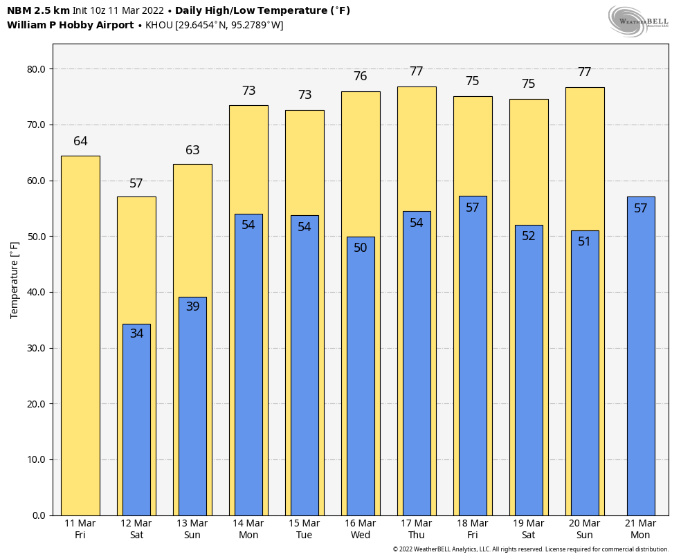
If you’re taking some time off for Spring Break next week, but staying in the Houston metro area, you’re in luck. Monday will probably be gray, with lot of clouds and perhaps a smattering of rain showers, but after that a weak front should put the region’s weather back on track. Look for highs in the 70s, nights in the 50s, and a fair amount of sunshine for the rest of the work week.
Starting to rain already near Ellington (just before 7 AM).
The Houston Chronicle website has a headline saying that temperatures could “plunge into the teens.” What hype! The actual article then says that it will be in the 30s overnight. Maybe with wind chill it will feel like lower 20s or high teens. But the real low will be in the 30s. Fortunately this cold snap is not going to last too long.
Pretty clear to me that weather models have a lot of trouble with the timing of cold fronts in this area; maybe this has something to do with our proximity to the Gulf. Right now it’s 4 degrees warmer than the NWS’s 6:30AM forecast for today’s high. Last week on the day a front came through (can’t remember the specific day), they forecast a high of 53 but the actual high was 64.