In brief: Saturday’s forecast in Houston has some perplexity to it in terms of when and where storms will occur, but we’re leaning toward a quieter first half of the day, with storm chances increasing Saturday evening and overnight. Hail is possible in a couple of the strongest storms. Sunday could see locally strong storms with heavy downpours. Don’t forget to “spring forward” Saturday night!
We’ve got some more active weather in the cards for this weekend but nothing that’s too scary. It’s mostly going to serve as a reminder that we still get storms here sometimes!
Today
No real concerns today, as we’re likely to see clouds, some sun, and highs in the 80s. There could be a passing pocket of light rain or a shower. Even a rogue thunderclap can’t be entirely ruled out this afternoon, especially north and west of Houston. Continue to be mindful of dense, erratic sea fog near the coast. We may see that break up some today and return tonight.
Saturday and Sunday
The forecast gets busier for this weekend. While an isolated shower or storm can’t be ruled out overnight, especially off to the northwest of Houston, it doesn’t appear much will occur before tomorrow morning. However, on Saturday, we expect showers and thunderstorms to develop later in the afternoon or evening. The entire area away from the coast is under a slight risk (2/5) for severe thunderstorms on Saturday.
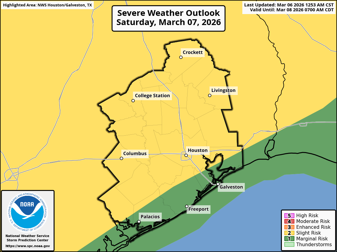
Based on what I can tell from forecast models and the NWS discussions, the primary driver for the slight risk is potential for isolated large hail. Storms could still carry lightning obviously or isolated strong wind gusts, but from a “severe” perspective, hail seems to be driving the risk. That said, we do not expect hail all over the city…I just want to make that clear. Any large hail would probably be confined to a few neighborhoods only in the strongest storms.
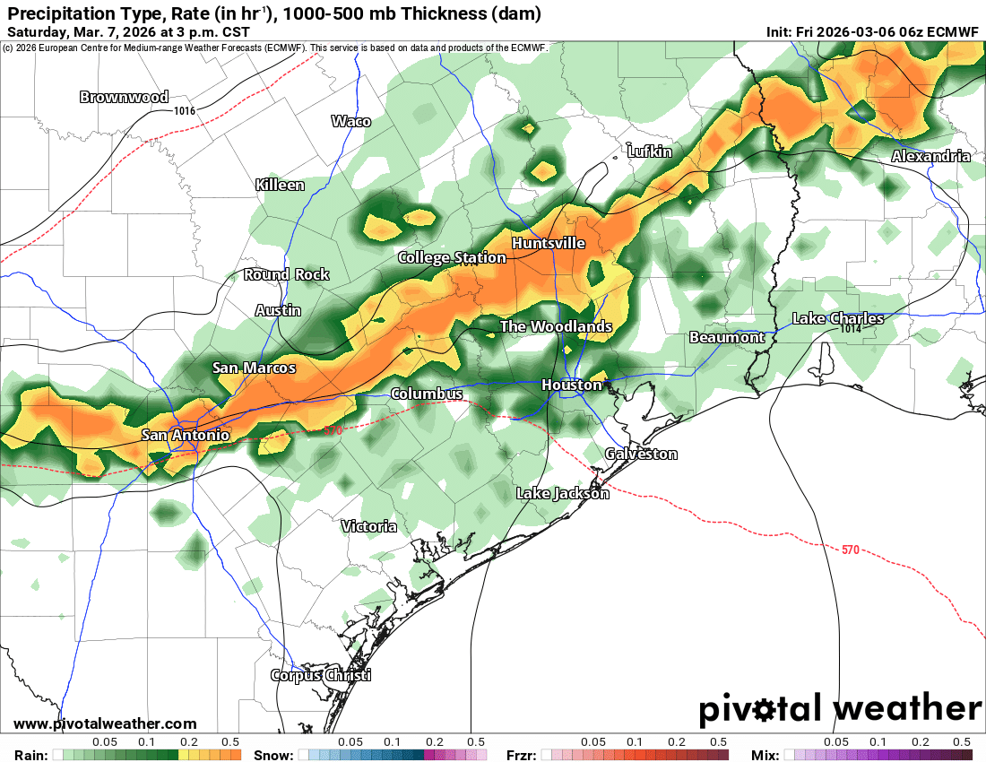
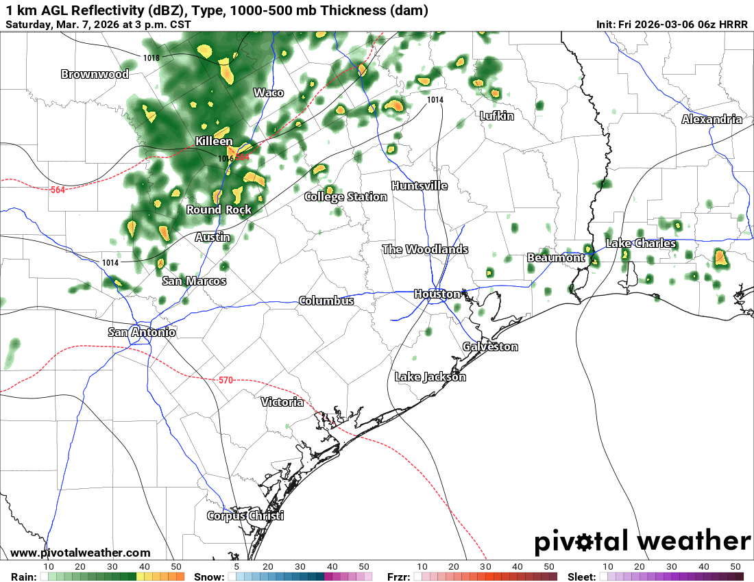
But what about timing? Well, the European model has insisted for days now that a squall line of storms would push through Houston in the afternoon hours. Now that we’re in range of higher resolution model guidance, the picture is a lot murkier. Most high-res models keep most of the area storm free during the daylight hours Saturday. You can compared the Euro to the HRRR model above. However, by later Saturday evening, that may be when you’ve got the chance for stronger storms in a few spots, especially north and west of Houston. So there’s some inherent uncertainty tomorrow, but for the most part I don’t think you’ll have too many issues in the morning or early afternoon. Storm chances will perk up in the later afternoon and evening hours, especially north and west of Houston I think. We’ll update you on this tomorrow morning.
For Sunday, right now I would say scattered thunderstorms throughout the day, with perhaps a focus north of I-10 in the first half of the day and south of I-10 in the second half of the day. Locally strong storms are possible, and one or two could put down some significant rainfall in a short amount of time, so be mindful of street flooding in areas that see the most persistent storms Sunday.
Rodeo forecast

If you’re headed to the Rodeo this weekend, you’ve got few concerns tonight for Lizzo. It looks good. There will be that chance of a thunderstorm on Saturday, especially upon exiting Dwight Yoakam. Just be aware of the potential, but as noted above, storms will at least be possible. Temps will be in the low to mid-70s each evening. Sunday may be the highest odds of showers and thunderstorms, along with locally heavy rain. Even if it isn’t raining when you leave, if you’re headed to see Forrest Frank, you’ll want the raincoat and a little extra time to get to and from NRG Stadium just in case. Temps should be in the mid to upper-70s.
Early next week
Monday and Tuesday look sufficiently quiet right now with nothing worse than a rogue shower. Highs will be in the 80s and lows in the upper 60s and low-70s.
Wednesday
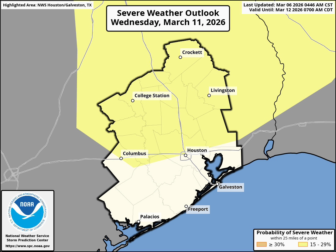
After those quieter days Monday and Tuesday, it does look like we get a quick but potent storm system in the area on Wednesday. It’s too soon to speak with much confidence about this system or its potential, but early indications are that there will be at least some strong to perhaps severe storms, especially the first half of Wednesday, especially north of I-10. The SPC has highlighted the north side of the city in Wednesday’s severe weather risk, which is akin to saying a slight risk (2/5) this far out.
More to come on this next week.