In brief: A lovely day today in Houston will give way to a warm up tomorrow and fog and shower chances on Saturday. Our next front Sunday morning may knock temps back close to freezing in spots on Monday morning before we begin what could be a prolonged, serious warm up leading into Christmas.
Today
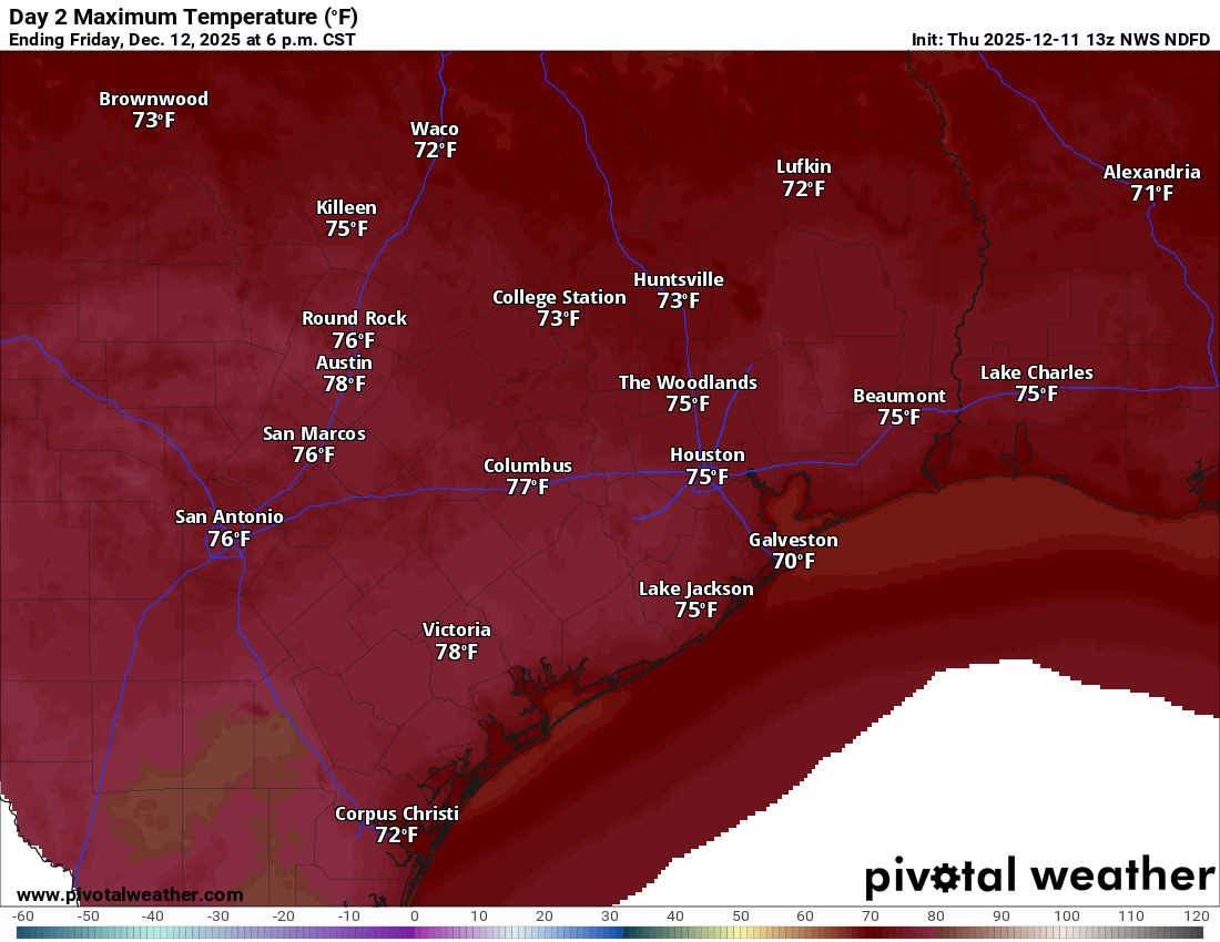
It’s a crisp start to Thursday with temperatures in the 40s and some pockets of 30s in northern fringes of the region. It will be a lovely day today with highs in the 60s to perhaps near 70 in spots south and west of Houston. Lots of sunshine.
Friday and Saturday
Tomorrow looks like our transition back into warmer temperatures. With clouds and sun, we should manage to warm from the 40s and 50s in the morning to the 60s and 70s in the afternoon. Some areas near Downtown or just southeast of there will push the mid to upper-70s.
Friday night will be milder with lows the 50s to low-60s mostly. Saturday does feature a return of shower chances, though if you have outdoor plans I’m not quite sure it’s anything you need to plan around just yet. The day will start gloomy with areas of perhaps dense fog and some drizzle. Gradually, skies should brighten, and with that will come the shower or isolated thunderstorm chance.
Sunday
On Saturday night, a cold front will push through with another chance at showers or a thunderstorm. The front is currently timed to hit around sunrise on Sunday. Temperatures may actually drop through the morning on Sunday back into the 50s across the area for most of the afternoon. Our high temperature on Sunday may be around or just after Midnight. It will turn blustery too with 10 to 20 mph winds across the area, higher on the coast.
Could parts of the area freeze Monday morning?
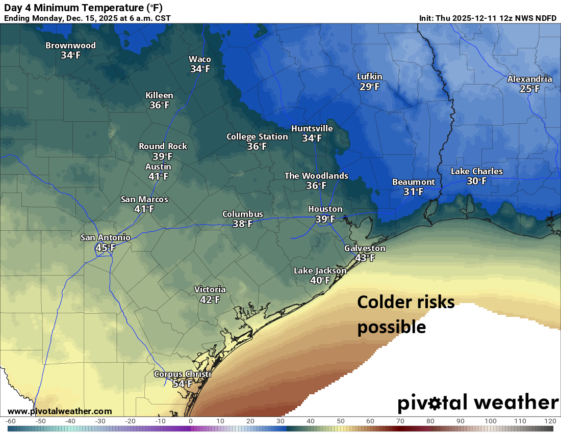
As Eric noted yesterday, temperatures falling into the 30s was possible on Sunday night. Recent model trends have gotten more aggressive with bringing colder air into the area. To be clear, this won’t be a hard or particularly dangerous freeze. However, inland, rural, sheltered locations could nudge back close to 30 degrees. In Houston proper, I doubt we get much below 34 degrees right now, but it will be quite chilly on Monday morning.
Stay tuned!
Next week
Monday itself will be cold with highs only in the 50s. Tuesday should warm into the 60s with milder morning lows (40s mostly). By Wednesday we are in the 70s. Beyond Wednesday, the question will become how warm it gets. As Eric alluded to on Wednesday, the run up to Christmas looks quite warm. In fact, over 50 percent of model ensemble members are calling for a high temperature above 80 degrees by next weekend. It appears that it will not feel like Christmas this year in the days leading up to the holiday. More to come.
