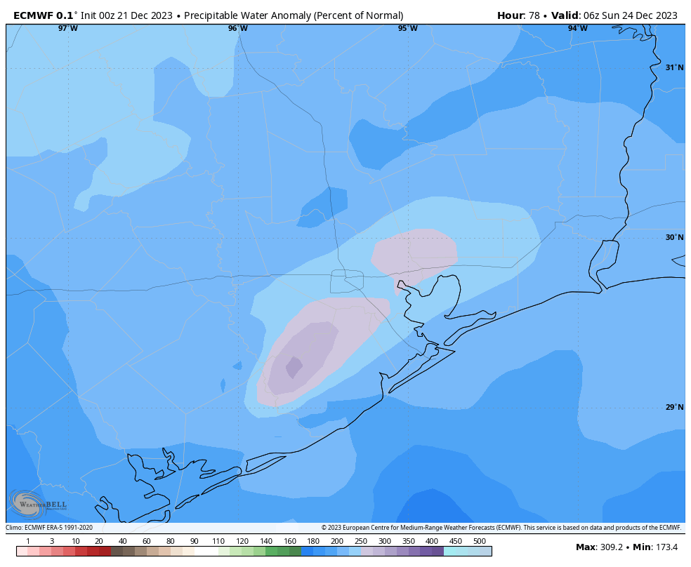
Good morning. We finally have clarity on the forecast for the Christmas holiday, and the short version is that this weekend looks messy, but Christmas Day should be partly sunny, dry, and seasonal with highs in the 60s. Before that, however, we’re likely to see a wet weekend with widespread accumulations of 1 to 3 inches, and even higher isolated totals.
Thursday
Temperatures have only fallen to 60 degrees this morning, and this will probably be the ‘coldest’ we get until after the next front rolls through on Christmas Eve. This will also be the last day we can be reasonably confident that it won’t rain until Christmas Day. Skies will be mostly cloudy, however, with highs in the upper 60s to 70 degrees. Winds will be out of the east at around 10 mph, with higher gusts. I can’t entirely rule out some very light showers today, but most of us should stay dry. That could change this evening, and during the overnight hours, when some light, misty rain will be a bit more likely. Lows drop to around 60 degrees again in Houston, with cooler conditions further inland.

Friday and Saturday
These will be similar days, with highs of around 70 degrees, and decently high humidity. Both days will be cloudy with rain chances on the order of 50 to 70 percent. The overall dynamics for both days don’t favor severe weather, so we’re likely looking at some on-and-off, mostly light to moderate rain showers. If you’re going to be out and about, conditions should be fine, just know there may well be some nuisance showers.
Christmas Eve
The story is a little bit different for Sunday. As a front approaches we’re going to see atmospheric lift, which spells R-A-I-N given the ample moisture available in the atmosphere. Pretty much everyone is going to get some rain on Sunday, but the amounts will be variable, with some areas perhaps getting 0.5 to 1 inch, and others 3 to 5 inches. I think the latter totals will be fairly isolated, but the setup does favor some heavy rainfall.
Fortunately the conditions won’t be quite right for severe weather, so while there may be some thunderstorms, the odds of them turning intense—with damaging hail and winds—is fairly low. Highs on Christmas Eve will be about 70 degrees. I’m thinking we’ll see a frontal passage at some point during the evening hours, or so, with drier air moving in overnight behind the front. Once the front pushes in you can be pretty confident the rain showers are over.

Christmas Day
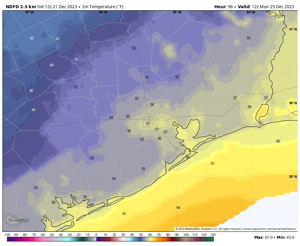
Depending on when the front goes through, most of us should be waking up to temperatures in the 50s, with clearing skies. Northerly winds will be gusting to about 20 mph, but it doesn’t look like one of those howling, wild blue norther fronts. Highs will be seasonable, in the mid-60s. Lows on Christmas night will drop into the 40s. So all in all, it should be a pleasant Christmas Day weather-wise. It’s just that getting there that is going to be kind of messy.
Next week
At this point it looks as though we’re going to remain in the 60s for all of next week, with cool nights in the 40s. Skies will be sunny, and winds reasonably light. If you’ve been pining for a stretch of winter, you’re in luck!


Be prepared for a Rain Apocalypse forecast tomorrow morning on TV. Rest assured, the stations will have their mobile response units out to catch the first drop falling.
Along with the daily murders and crash reports that is breaking news.
And what does that say about a city that has “daily murders”?
Is says that the city is large, nothing new.
KPRC cracks me up every time. They’ve decided the best thing to do in “severe” weather is to send a van out with a reporter to…drive in the rain. In case you didn’t know what that looked like.
Riveting stuff.
13 does the same thing. Silly.
But rest assured, they are keeping you and your family safe.
Like it’s not your job to do that.
While 60 degrees was noted as the coldest we’ll get until the next front, I’m very happy to take that.
I just realized that my AC has been hibernating for almost 10 days now. It deserved a long rest after months of hard work.
A “long rest” should be like three months.
Take it or leave it, you don’t want 80s.
Does anyone know how to unsubscribe from the daily email? The link at the bottom brings me to a WordPress account, where it says I’m not subscribed. In fact WordPress tells me they have nothing to do with Space City. Very strange that the link goes there
They suggested I contact Space City directly, which I’ve done several times but I get no response and the unwanted daily emails keep coming.
Anyone out there know how I can get this resolved?
Thanks!
If the unsubscribe link doesn’t work, as a work-around you could block the email address it’s coming from.
Yes, thanks, I can do that. I’m surprised at how difficult it is to do the normal way (click on a link and it’s taken care of)
What parts of Houston are more likely to see the 3-5 inches of rain you mentioned? Any ideas?
Probably the east side, but it looks to me that the models are pretty conflicting.
Assuming SCW will issue a SCW Flood Alert. What level will the Alert be?
“Thursday” This will also be the last day we can be reasonably confident that it won’t rain until Christmas Day.”
That’s confusing, odd wording. Meaningless?
Means they’re reasonably confident it won’t rain today while reasonably confident it will rain Friday, Saturday and Sunday.
Happy Winter Solstice! 12/21 @ 10:27 pm!
We got married on this day 11 yrs ago 12/21/12…it was the end of the Mayan calender too!
“I’m thinking we’ll see a frontal passage at some point during the evening hours, or so, with drier air moving in overnight behind the front” Well, as usual it looks like the front again will be arriving here when we’re all asleep. Wonder if we’ll ever get to witness one arriving during the daytime hours. I’ve been wondering if there’s a viable reason for this.
It looks like if there is a squall line it will come through during the daytime. Unfortunately, some models are showing a strange dissipation of the line as it approaches Houston. It certainly doesn’t make sense.
Models are hinting at a near or light freeze (31-35) around the Dec 30 to January 6 timeframe, still far out but I think this should be looked at a bit.