In brief: Winds will really kick up on Wednesday as the onshore flow gets going, and this will lead to very warm conditions on Thursday. A weak front will bring us back to slightly milder conditions this weekend.
What’s with the alliteration?
Well, to be honest, I’m trying to add a little fun to what is otherwise a pretty boring forecast. We are going to see a spike in temperatures on Thursday, but for the most part our weather over the next 10 days is going to bring a lot of the same type of conditions: partly to mostly sunny days, highs in the vicinity of 80 degrees, lows in the low 60s, and medium-level humidity. I’m starting to have some hope for the eventual return of rainfall, but that is still more than a week from now, so I don’t want to offer anyone anything concrete yet on that front. Also, if you missed it on Monday, be sure and check out our monthly Q&A.
Wednesday
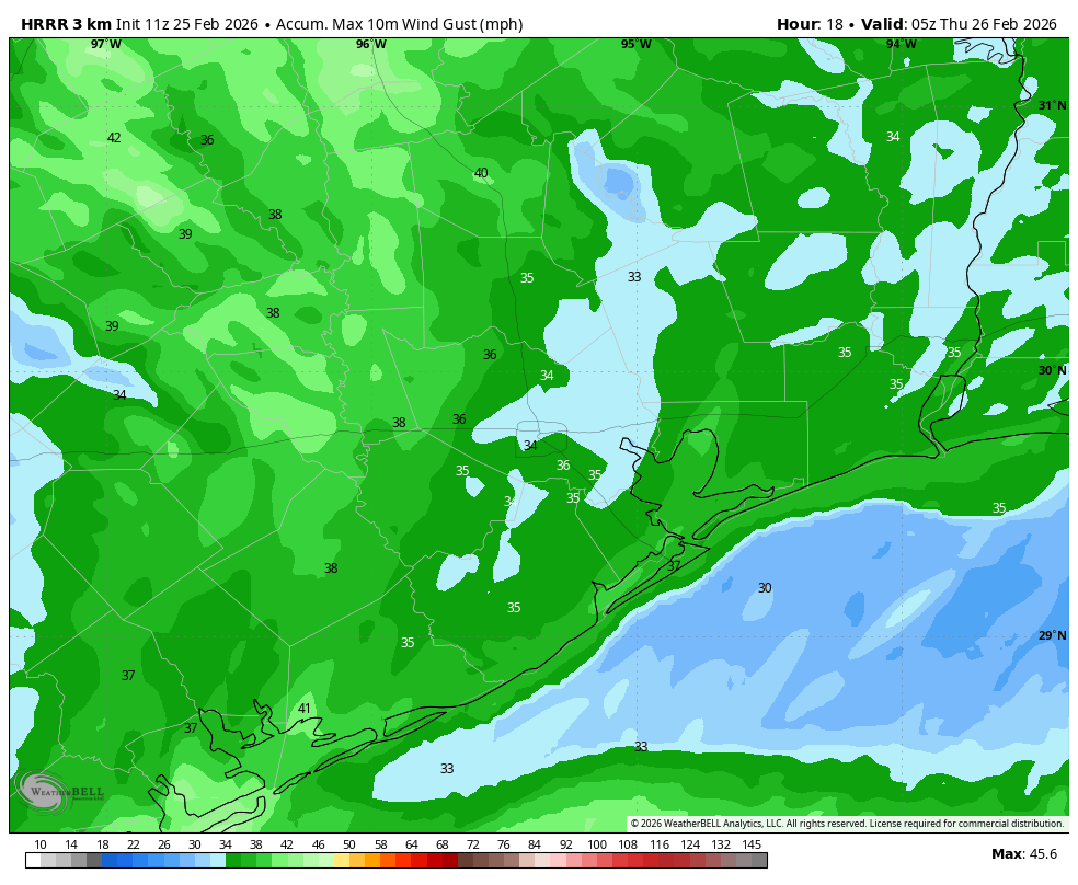
Temperatures today will reach about 80 degrees, with mostly sunny skies. What will differentiate today is a potent onshore flow that will really start ripping by late morning. Most of the Houston area will likely see wind gusts up to 30 mph, but some locations could even briefly see 35 mph for a couple of hours this afternoon. Winds will start to slacken a bit this evening, and overnight lows probably will only drop into the mid-60s.
Thursday
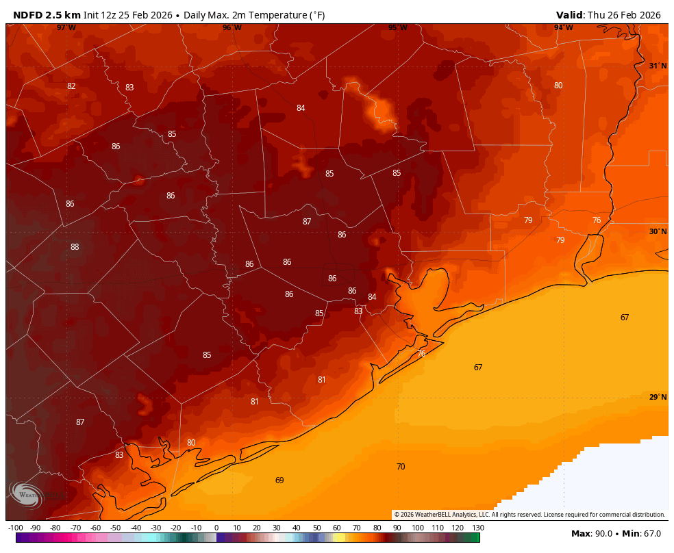
All of this warm air blowing in will make Thursday feel unseasonably hot outside. Temperatures should push into the mid-80s in Houston, with higher temperatures possible to the west of the city. Houston’s record high temperature for February 26 (set in 1986) is 86 degrees, and I think there’s probably a 50-50 chance that we beat that. Anyway, it will be close. Lows on Thursday night will only fall into the mid-60s for most locations, as a weak front won’t arrive until Friday morning.
Friday, Saturday, and Sunday
This front, which is likely to move into Houston and stall out, will be the driver of our weekend weather. It probably will be the case that if you’re in Tomball or The Woodlands you’re going to see longer stretches of drier air than, say, a League City or Alvin. I am not fully confident in how far the drier air will push, but overall I don’t expect Houston to feel too humid. Each day should have mostly sunny skies, with highs around 80 degrees (give or take) and lows near 60 degrees or a bit above. It won’t feel cold, but it also won’t be too hot and humid. In short, it will be one of those weekends where you can undertake almost any activity outdoors that you’re interested in.
Next week
This 80-60s weather likely continues at least into the middle of next week. What may change is that our environment becomes more favorable for rainfall by Wednesday or Thursday of next week. Whether this includes a frontal passage remains unclear.
