In brief: In today’s post we discuss our transition from turbulent weather to a calmer vibe. We bring you tidings of a tranquil entry into the year 2026, a brief warm-up, and then a truly gorgeous weekend. Happy New Year, everyone!
New Year, calm vibe
Good morning, everyone. I hope you celebrate a safe and fun New Year’s Eve. In terms of weather, there’s not too much to worry about, which is a nice change from the high winds observed Monday (gusts to 40 mph and higher) and this morning’s light freeze across much of the region. Rather, we will see calm conditions today, tonight, and into the new year. Our mild and calm weather will persist into the middle of next week when things could turn a bit more turbulent. Given the tranquil conditions ahead, I feel comfortable in taking the New Year holiday off, so look for our next update on Friday morning. Happy New Year!
Wednesday
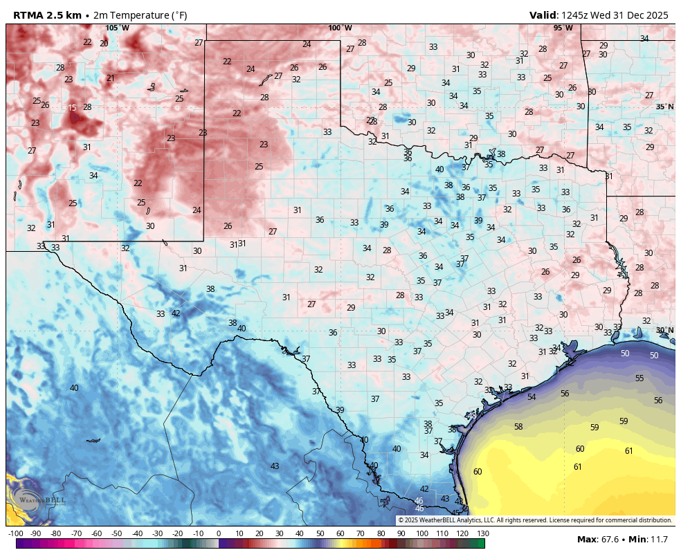
Temperatures this morning range from the upper 20s north of Houston, in typically cold areas like Conroe, to just above freezing in the urban parts of the city, and about 40 degrees right on the coast in Galveston. This will be our coldest morning for quite some time, and with winds turning west our temperatures will soon moderate. And it’s not just Texas that’s cold and dry, in the map below you can see that very low dewpoints prevail across the entire Lower 48 states this morning.
Of course it won’t last. With ample sunshine our temperatures today will climb into the mid-60s. For those out and about ringing in the new year, temperatures should fall into the upper 40s late this evening, but I don’t expect much in the way of a breeze to add additional chill to the air. Lows on Thursday morning will drop to around 40 degrees for most locations.

New Year’s Day
We start the new year with a fine, partly to mostly sunny day, with temperatures in the 70s. Dewpoints (and therefore humidity) will be rising, but they don’t look excessively high. Lows on Thursday night will only fall to around 60 degrees.
Friday
This is going to be a warm day as southwest winds really get going ahead of an advancing, albeit weak, front. We’re going to see gusty winds up to about 25 mph, and this influx of warmer air will push highs into the low-80s for much of the region. The record high for Houston, on January 2, is 81 degrees. I anticipate that we’re going to break that comfortably. However that front will eventually ride into Houston on Friday night, or early Saturday, to bring milder weather back into the picture. At this point I expect a dry passage.

Saturday and Sunday
The first weekend of 2026 looks like a real splendid one. Days will be sunny, and nights clear. Highs will likely be somewhere in the mid-70s with moderately dry air. Nights probably in the low 50s. Seriously, this will be fine weather for any outdoor activities you have planned.
Next week, and the Houston Marathon weekend
The first half of next week looks warm, with highs in the upper 70s to lower 80s, and nights in the 60s. So we probably will see the return of some fog (dreaded by most, but loved by some). We might see a weak front during the middle of the week, or maybe not. There is some slightly better agreement in the models that a stronger front will drop into the region around next Friday, Saturday, or Sunday. This front is likely to bring some rain with it (although at this far out, who can say for sure?) Anyway, the weather for Sunday, January 11th (marathon day) will depend on a) whether this front makes it, and b) when it does. A passage on Friday or Saturday morning would set up clear and cool conditions for Sunday. A passage on Saturday night or Sunday morning could mean rain and wind. For now I’d expect a passage before Sunday, but that is not something I am remotely comfortable predicting with confidence. More when we know something!
