In brief: Invest 93L is kaput, and now we will look for some heavier downpours in spots today. Rain chances begin to dwindle on Saturday and Sunday as a hotter, less unsettled pattern establishes over our region for much of next week.
Today
Our best chance of rain will come today. The radar as of early Friday morning shows widespread rain north of Liberty and in Louisiana. Additional, more isolated thunderstorms are popping up along I-10 near Beaumont and on the Bolivar Peninsula.
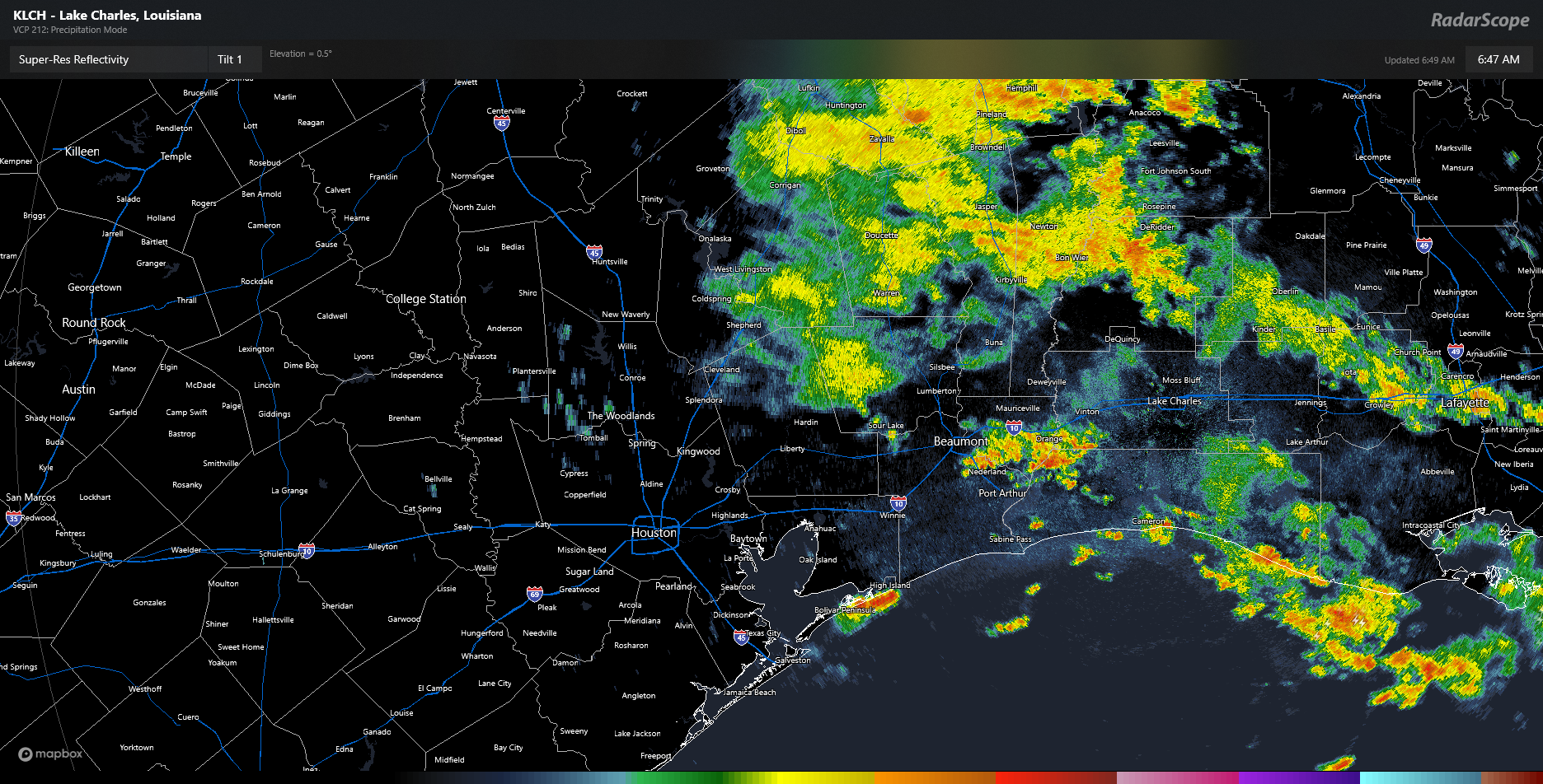
As we go through today, a lot of that steadier rain north of I-10 will probably dissipate. Even some of the thunderstorms this morning may fizzle. But a new round of scattered thunderstorms is likely this afternoon. For the most part, this will be like any other summer afternoon in Houston. Available atmospheric moisture will be a bit higher than usual though, so just be on the lookout for a downpour or two that could briefly flood streets in some parts of the city. Storms should fade after sunset.
Saturday
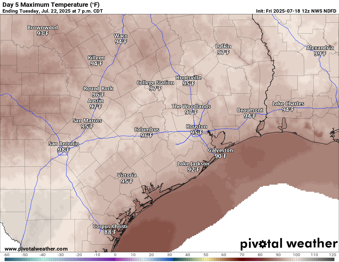
There should be a somewhat decent lingering shower chance here, but for the most part, any added moisture from the Invest 93L (RIP) would be exiting. I wouldn’t be floored to see a couple heavier downpours in the area though. Look for highs in the mid-90s.
Sunday through Tuesday
We’ve had very few days this summer that carried virtually zero rain chance. It would appear that Sunday through Tuesday carry good chances for that to be the case, however. Look for mostly sunshine. Another bout of Saharan dust could come our way Monday and Tuesday. For now, I’ll say mid-90s, but if the Saharan dust is minimal Monday and Tuesday, we do have a decent shot at upper-90s on those days in some parts of the area.
Late next week
The heat should stay cooking for later next week, with highs in the mid to upper-90s continuing. We may even see a stronger surge of heat later next weekend or the week of the 28th. Rain chances may pick back up a little by Friday or next weekend. Overall, it looks fairly dry next week across the region.
