As is often the case with these kinds of storms, Tuesday’s rainfall totals were hit or miss. Some southern parts of the region barely saw any rainfall, whereas a few locations around town picked up 2 to 4 inches of precipitation today and saw some street flooding. Things will now quiet down for the evening, and a few hours after midnight. However, after this time we expect an additional pulse of showers and thunderstorms to move into this area on Wednesday morning.
While this is subject to change, generally a fat line of storms should move into areas west of Houston a few hours before sunrise, push into the central part of the region just before, or during sunrise and the morning commute, and slowly continue moving to the east. The storm system will probably be clear of the area by around noon, or shortly thereafter.
The bottom line is that these storms will be pushing into Houston around the time of the morning commute, the time you’ll be dropping kids off at school or daycare, or both. Some locations will see heavy rainfall that, briefly at least, floods streets and creates traffic issues. Please be aware of weather conditions tomorrow morning, checking the radar before you leave home or work, and so on. Please also do not drive into high water.
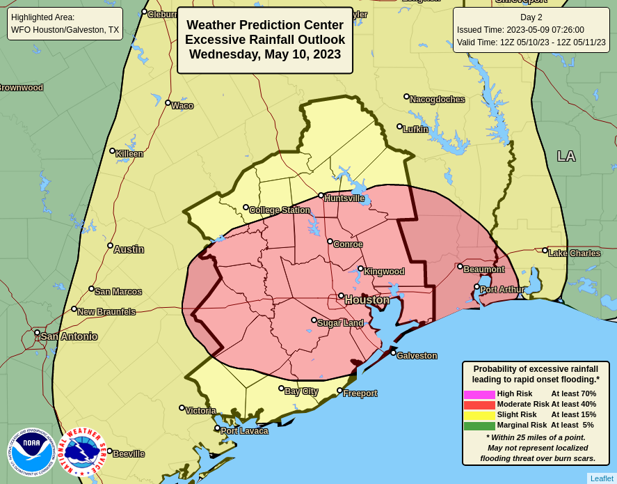
Most of the area probably will see an additional 1 to 2 inches of rain through tomorrow afternoon, which is fine for roads. But we’re concerned about more isolated areas that see bullseyes of 4 or more inches. For this reason we’re keeping a Stage 2 flood alert in place through noon tomorrow, after which time we expect to be able to lift it. Although rain will be possible for the remainder of the week, this should be the end of the particularly threatening, heavy rainfall.


Appreciate the update about the early Wednesday forecast now instead of waiting until the morning.
Thanks, SCW team!
Mostly dry here in League City (ESE Quadrant). Any ideas on Texas City Dike? Thinking of fishing…
Thanks!
Could you/would you possibly add a line about Galveston Island weather? Our weather is SO different than that of the Mainland & no one -ever -gives us a clue. Thanks
Thank you!!
Thank you!!
Stage 2 seems a bit dramatic. Stage 1 more appropriate
Not if your in one of the areas that got flooded earlier today stranger
One of the few areas. Stage 1. Most of Houston metro had five minutes of rain and that was it.