In brief: Tropical rains brought flash flooding to a belt of the region south and east of the city of Houston overnight, but the worst of these storms is ending. We still have some rainfall concerns this weekend, but we are getting through it. Next week looks sunny and warmer.
As anticipated, we saw a another round of heavy rainfall develop near the coast after midnight, and these storms have dropped a significant amount of rainfall for some areas south and east of Houston. During the last 12 hours, for example, locations such as Dickinson and Baytown have recorded 5 to 7 inches of rainfall, and parts of Pearland and League City have recorded 4 to 6 inches. These heavy rains produced flash flooding consistent with our Stage 2 flood alert for these locations.
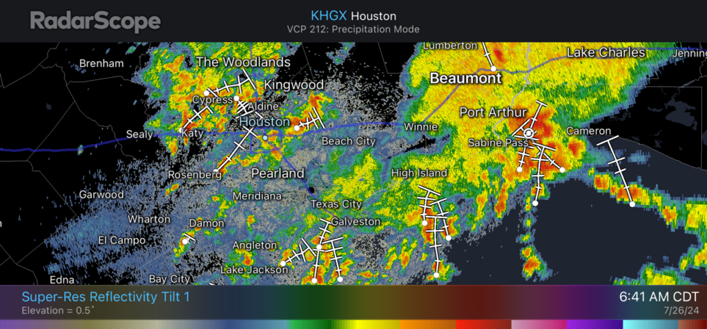
The strongest impulse of these storms has now cleared the area, but we are continuing to see some high water locations on streets and feeder roads in parts of Galveston and eastern Harris County. Please take a little extra care heading into work this morning from impacted locations. For the majority of the Houston metro area, overnight impacts were far less significant and there are no issues.
It appears that this was the last mass of truly organized storms for the region, however that does not mean we are done with the rain. We can probably expect fairly widespread showers and thunderstorms to develop near the coast early on Saturday morning and propagate inland. Due to the potential for these storms to hit already water-logged areas, I am going to maintain a Stage 1 flood alert through Saturday noon.
Friday
In the wake of the overnight storms, we’re seeing a fair number of showers and thunderstorms across the Houston metro area. Generally, we should see these storms move toward the northeast later this morning, with things quieting down later this afternoon or evening.
However, we could see an additional impulse of heavy rain right along the coast today, pinpointing locations such as Galveston Island and Bolivar Peninsula. I’m hopeful that these rains will develop to the south of Dickinson, Baytown, and other areas hard hit overnight. But radar trends will be something we should watch today for coastal areas.
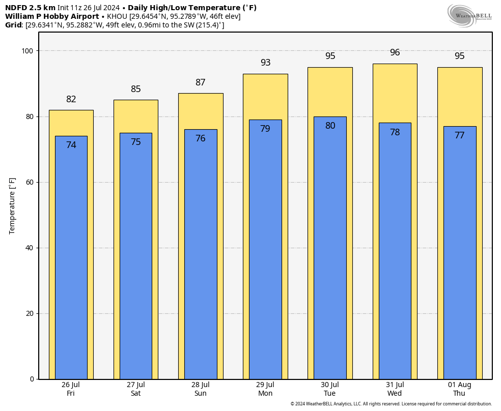
For the majority of Houston, however, Friday should be mostly business as usual, with totally manageable accumulations and few impacts. With mostly cloudy skies, we can expect highs to top out in the low-80s. Winds will be generally light, from the southeast. Overnight low temperatures will drop into the 70s.
Saturday and Sunday
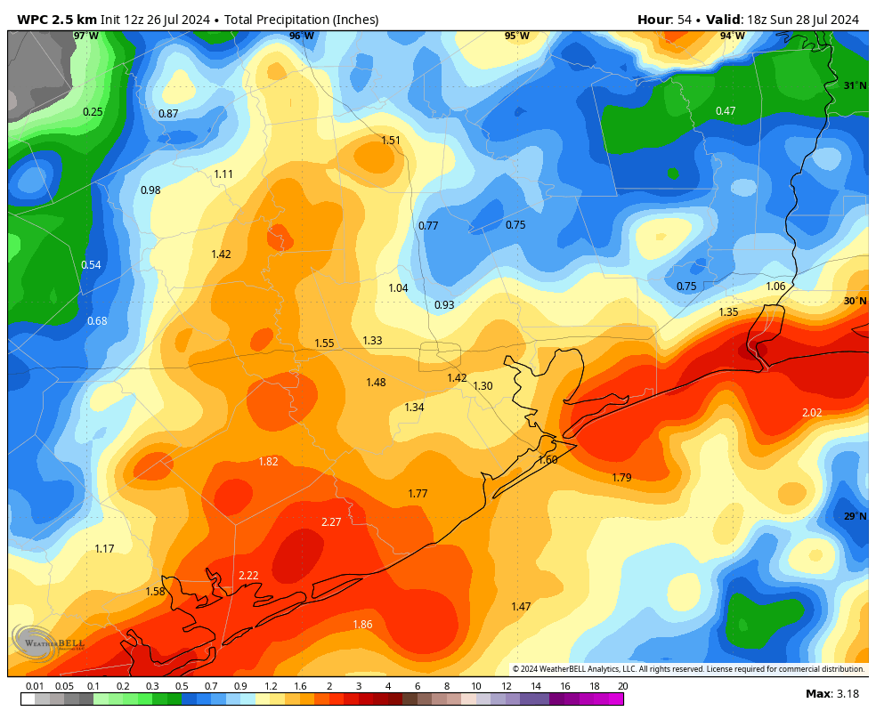
We are likely to remain in a pattern whereby we see storms develop during the overnight hours offshore and move inland. However, coverage and intensity should be lower on Saturday morning, and again on Sunday. Still, some isolated locations could see heavy rainfall, and both weekends could see a rainy start—especially south of Interstate 10. If any of this changes, I’ll pop in with a forecast update this afternoon, or over the weekend.
Highs on Saturday should be in the low-80s, with mid- or upper-80s possible on Sunday. As we’ve been saying, this weekend is fairly difficult for outdoor activities, especially anything involving the beach.
Next week
Our pattern shifts in a big way by early next week, with mostly sunny skies likely in place by Monday, and rain chances falling way back. Most of next week should see sunshine, highs in the low- to mid-90s, and give our area a chance to dry out. Pretty soon we’re going to realize that Houston’s highs at this time of year are not usually in the 80s, as we’ve experienced this week.

This was horrible. We had 5” in Hitchcock from 2:30-5:30. Water was less than a quarter inch from the weepholes on one side of my house.
Do you think rain chances will be high for saturday evening for southeast houston?
According to the Weather Channel, on July 27th, Saturday evening, for southeast Houston, there will be a 32% chance of isolated thunderstorms at 6 pm and 12% to 15% chance of rain from 7 pm to 12 am. I hope that helps,
Love having a very solid downpour for last 15 mins and AccuWeather radar says I’m not getting any rain.
I don’t use AccuWeather. I use MSN, Wunderground, and Ventusky weather websites.
This summer, it has been rain and storms with no 100-109 or drought to talk about yet and we are practically at the door step of August. I’ll take it!
Not much here around Ellington, did wake up around 3AM due to some rain.
Looking forward to another day without the A/C running much.
While I was asleep, I could hear the phones’ Notification beeps constantly – those were coming from the security camera app, because of lightning and thunder (motion and sound notifications). Normally I’d check the phone, but I knew it was because of passing storms.
I checked MSN and Wunderground past radar – early AM was / is a repeat of yesterday. I also checked their future radar (MSN thru 11am, Wunder thru 1pm). Seems we’ll see another round of passing storms, to include us up here in Magnolia.
I watched a bit of Fox26 News about 30 mins ago – they showed 45 South reduced to one lane (close to Galveston) because of street flooding.
Houston area rains have also been mentioned in segments on the “Fox 24 hr Weather” channel (channel 26.3 OTA and you can stream it via a browser or via app).
Overnight rains finally had some ooph to it for coastal counties. Flooding along 45 freeway is due to all the construction mess going on. That won’t be happening in future when completed. Dickinson area has high water as that community fails to do anything for Dickinson Bayou and its tributaries. Other than that, and the Mosquitos the rains are welcomed and needed after the drought and heat of last year.
45 has been under-construction for 50+ years and will be in the future 🙂
There’s an article at houstonpublicmedia dot org, titled “I-45 rebuild in Harris County expected to start in 2024 and end in 2042”.
And yes, we’re glad to have these rains vs the drought we’ve had in the past.
“Flooding along 45 freeway is due to all the construction mess going on. That won’t be happening in future when completed.
Hah! Never! The Gulf freeway has been under construction for the last 40 years, and as long as development of any remaining open land between Houston proper and the coast continues, the freeway will need to be widened and reworked.
I would call the morning commute anything other than business as usual. It was absolute nightmare on I10 this morning with street flooding where I don’t usually see it. We were alerted to flooding Tuesday through Thursday with the emphasis on Wednesday and supposedly waning into the weekend. Why is it that it barely even rained on Wednesday and this morning/ last night we’ve seen downpours across the area causing actual flooding and highway issues. It would be great if we could get an accurate forecasting in the Houston area at some point this year.
While the tone of this post did have a business as usual for Houston, you can’t possibly expect them to be able to predict every downpour in every location. While I did receive 3” in an hour in spring Branch this morning that’s caused bad street flooding, I’m sure there are areas that have received practically nothing. They are trying forecast an area that’s as big as some small states, to the point where they have to issue diff flood threats for different areas.
REGARDING RECORD JULY RAINFALL. The all time record for Houston for the month of July is 14.80” of precipitation in 1900. Surely Bush International is closing in on that record. Here in Oak Forest (near Spring Branch-Hilshire Village top rainfalls from Beryl) we also had some of the highest rainfall totals from Beryl. My monthly total is already 17.30”! The Harris County Flood Control gauges reflect a month of rain (currently showing June26-July 26) and these will be reflecting the rainfall for the month of July in a couple (5 or so) days. These are showing 16 inches or more so I know I’m not crazy. Personally speaking, our poor farmers down along the Gulf Coast are still waiting to harvest crops, the ones not lost to winds from Beryl. It’s a very Tough agricultural year.
So far Bush Airpirt has only had 9.10 inches this July. They still have a ways to go to beat the July record. I have picked up just over 20 inches of rain so far in Sweeny this month. The previous record July rainfall for most of Matagorda and Brazoria Counties are from 2007 and 1979. Some spots have surpassed the 2007 record already this month.
I opted to work from home yesterday and thought OK this morning to metro into the Med Center. Well……… there is not much of me that is now dry as I sit her in my office. This calls for another cup of warm coffee !! Be Safe Everyone as I don’t think we will ever know where these storms will pop up!!!
Apologies if this has been asked and answered already… Why don’t you guys put your AccuWeather and NWS stuff on this page like you have in the app?
Please remember all of us on Galveston Island who depend on you!
Mary, to be honest, once the Strand is explored and the rail museum visited, there really isn’t much to do there. The sea wall area is a bit of a drag and cross to Bolivar on the ferry a few times, and that’s it. Galveston can be a nice area to live, but to rely on tourists is a bit of a stretch. And then there is the Gulf Freeway: UGH!!!
It has been raining steadily and heavily all morning in the Nottingham West area (77079 – Kirkwood, between I-10 and Memorial Drive). In fact, my rain sensor shut my sprinklers off.
I’ve used my sprinklers on one day this year, and that was just to make sure everything still works. We’ve had 25 inches of rain since May 1.
Guess you haven’t been reading Space City this week…..been predicting or stating “Stage 1 and Stage 2” flooding for this week….
Bush airport had a record low high of 78 yesterday. Now that is the kind of record I like to see.
me too – like that paradox
Say what you want but 78 in the AFTERNOON without a HURRICANE is a win!
Well, I’m watching the “Fox 24hr Weather” channel … there is now a Disturbance in the lower mid-Atlantic.
I jumped to the NHC, and sure enough, there’s a yellow ‘X’ (< 40%)
This is discussed in todays post on the eyewall website
Thank you once again for your concise and no hype weather report. Last year was horrible with the heat dome, and this year, it has been somewhat of a blessing the lower temperatures, so there is a silver lining to a lot of these clouds that we’ve been getting.
Aside from Beryl, this has been the most tolerable summer in Houston in decades.