In brief: In today’s post we discuss our ongoing heat and decent rain chances, as well as a new tropical blob in the Gulf (which is not at all an issue for us). Also, we’re excited to share our first stab at a list of regional weather web sites, for other locations, that are similar in tenor to Space City Weather.
Regional weather sites (and other notes)
One of the most frequent questions we hear at Space City Weather goes something like this: “I’m moving to [insert destination] and I’m trying to find a weather blog there just like Space City Weather. Can you help?” Unfortunately, short of a handful of destinations we really could not.
So over the last few months our Dwight Silverman has been digging for independent, locally focused sources weather information. To qualify these sites also need to provide quality information (surprise, there’s a lot of junk out there) and be regularly updated. The end result of this is a page, which we will regularly update, that provides links to recommended regional weather sites. We welcome suggestions for sites to add, which you can provide at this Discourse comment thread.
While we are discussing site housekeeping notes, I also want to remind readers to make sure you’ve downloaded the latest version of our app. We think we have finally solved an issue that led to crashes on some iOS devices. Additionally, don’t forget that we’ve migrated our comment system over to Discourse. The goal is to make it easier for us to moderate conversations, highlight thoughtful contributions, and cut down on off-topic noise.
Tuesday
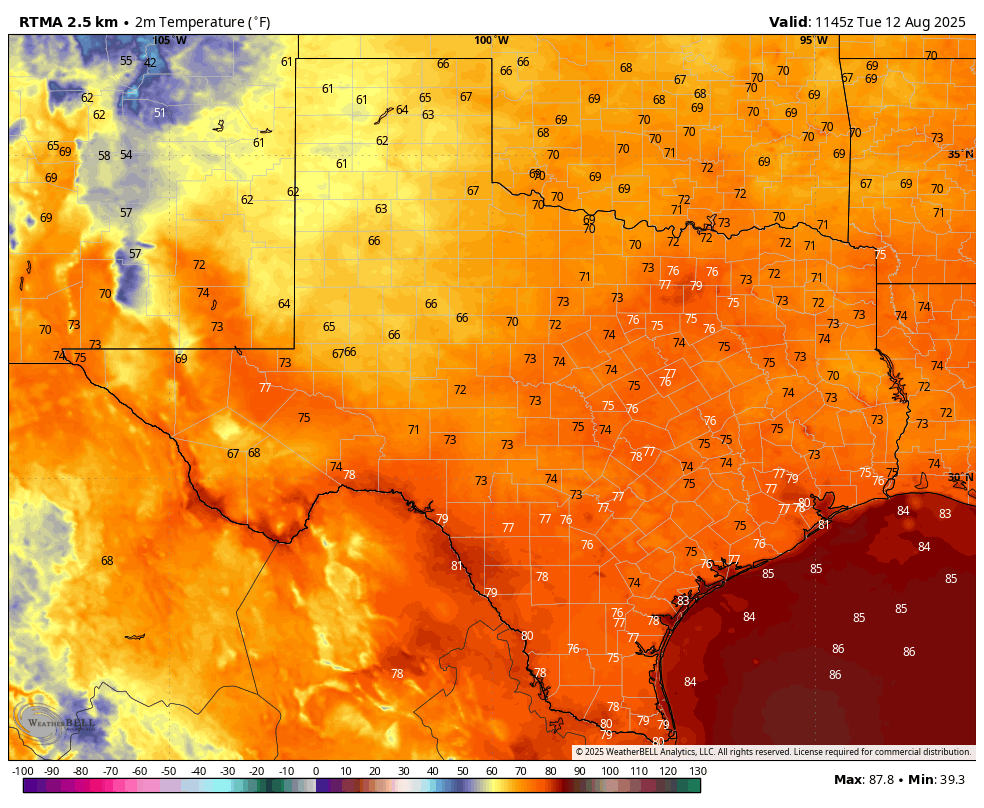
If your child is heading back to school today, rain showers have remained offshore for the most part this morning. So we’re left with a warm, and humid start to the school year—as is often the case during August. Skies will be mostly sunny this afternoon, allowing highs to reach the mid-90s for most of the region. Far inland areas may nudge up into the upper 90s, whereas coastal areas will top out in the lower 90s. Some scattered to isolated showers will be possible later this morning and into the afternoon hours, but I would put overall chances at only about 30 percent. We may see a few isolated downpours, but for the most part these should be light to moderate rains. Winds will be light. Lows tonight will only drop to around 80 degrees.
Speaking of tonight, the Perseid meteor shower peaks on Tuesday night, with the optimum time for viewing from 1 am to 5 am on Wednesday morning. We should be in luck with largely cloud-free skies, but a waning Moon will unfortunately provide some unwanted extra light. As always, viewing a meteor shower is best far from bright city lights.
Wednesday, Thursday, and Friday
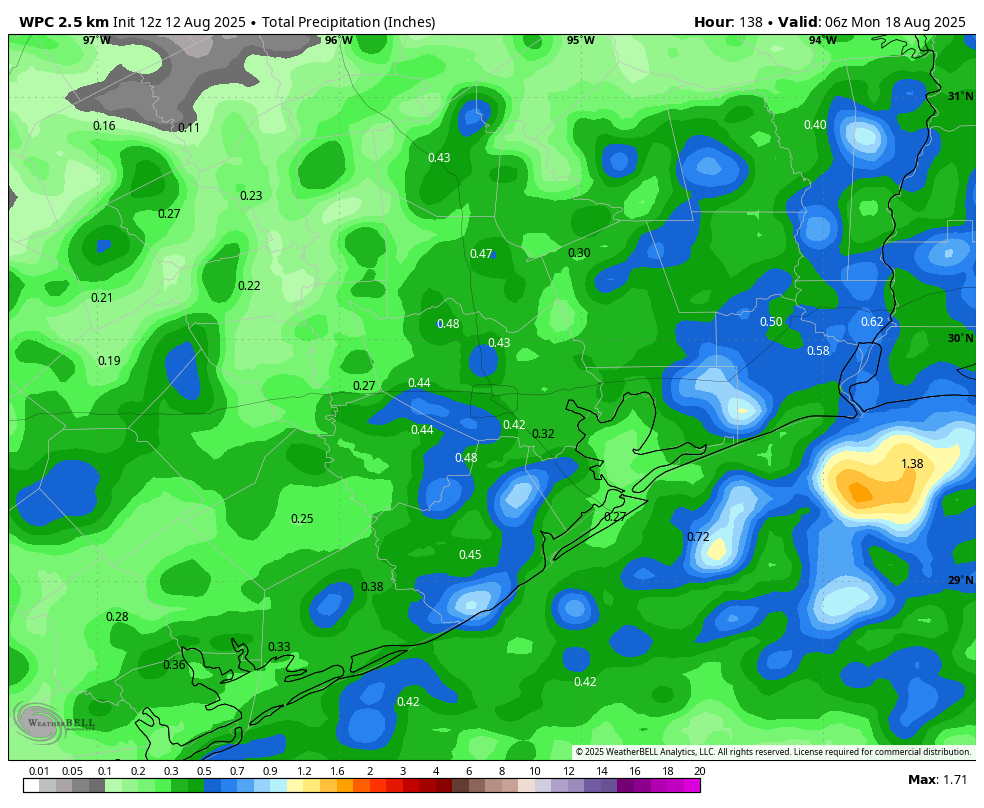
The story remains largely the same for the rest of the week, with high temperatures generally in the mid-90s, mostly sunny skies, and spotty rain chances. Most of us probably will see at least some shower activity this week, especially closer to the coast. But for most of us accumulations will be at or below 0.5 inch. Nights (of course!) remain warm and muggy.
Saturday, Sunday, and beyond
As high pressure expands westward this weekend, we may see a few more high temperature readings in the upper 90s. But we should also still see some scattered daily shower chances, perhaps on the order of 30 percent daily. All in all, it should feel like a typical August weekend, which is to say hot, mostly sunny, and very humid. This pattern will likely continue into the start of next week.
Atlantic tropics
As expected, we are seeing the tropics come to life. Tropical Storm Erin formed on Monday, and this probably will become the season’s first hurricane within a couple of days. Erin is expected to track north of the Caribbean Sea. And while there is a non-zero threat that the storm moves toward the southeastern United States (probably less than 10 percent), at this point the biggest concern I have is in regard to Bermuda about one week from today. To be clear: there is no threat to the Gulf from Erin.
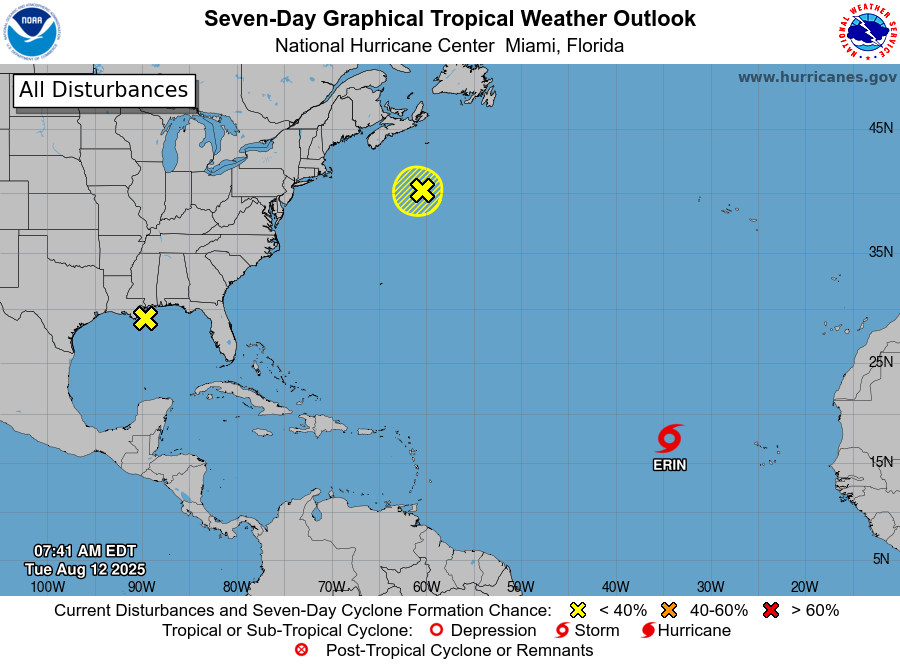
Speaking of the Gulf, there is a yellow X there this morning. However, as Matt pointed out on The Eyewall last night, there is a mountain of wind shear in the western Gulf right now, and the eastern Gulf isn’t exactly hospitable either. So this is just a run-of-the-mill surface trough interacting with warm water and hot, humid Gulf weather, producing lots of thunderstorms. It should slowly lift away from Texas toward the northern Gulf coast. So not at all a threat locally.
