In brief: In today’s post we review how rains on Tuesday evening helped with a drought that has persisted since late fall in our area. We also look ahead to two cooler nights before an exceptional weekend arrives in Houston.
Simmering drought
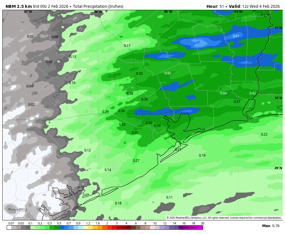
One of the quiet but persistent stories of the last several months in our region has been the development of a drought, particularly just to the south of the city. At one point about a month ago some of these areas reached ‘extreme’ levels of soil dryness. However the precipitation during the second half of January, in association with the strongest of the Arctic fronts, helped put a dent in things.
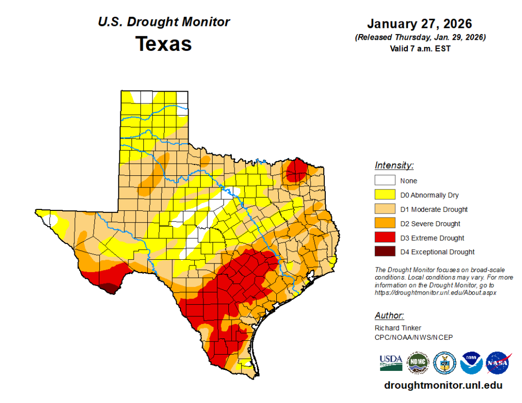
Even so, as of last week, large swathes of our region were in a ‘severe’ drought, and most of the rest of the region remained in a ‘moderate’ drought. That’s why I was pleased to see showers on Tuesday, and a line of showers and thunderstorms on Tuesday evening, over-perform expectations a little. During the last day or so most of the region picked up 0.5 to 1.5 inches of rainfall, with the higher totals tending to hit the driest areas. It now will not rain for awhile, so yesterday’s showers were a welcome thing for us.
Wednesday
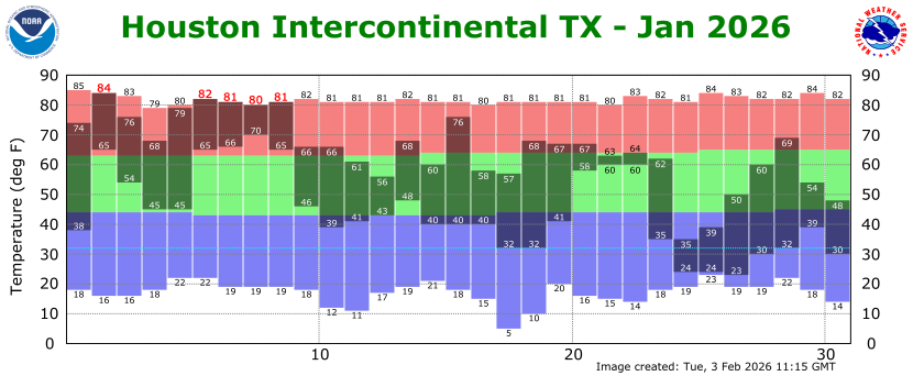
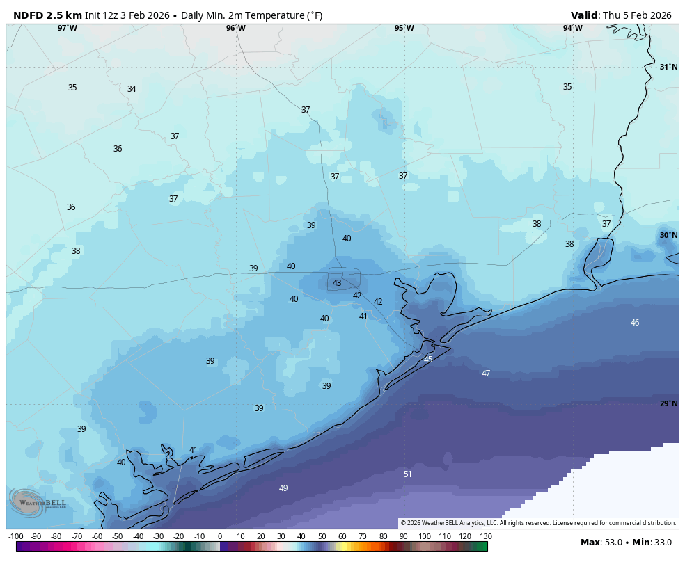
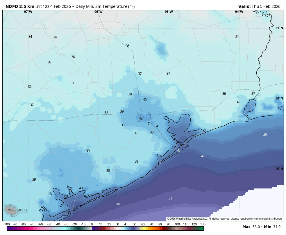
Temperatures are about 50 degrees across the region this morning, and despite sunny skies we’re only going to warm up to about 60 degrees. With a fairly brisk northerly wind, gusting up to 25 mph at times, it’s going to feel chilly outside. Tonight will bring our coldest temperatures for at least the next week, with lows falling to about 40 in urban parts of the area, and upper 30s for outlying areas. Still, I think everyone will remain a little above freezing.
Thursday
This will be a another sunny day, with temperatures in the low 60s. However with only light winds, it will feel ‘warmer’ outside. Lows on Thursday night will only drop into the upper 40s.
Friday, Saturday, and Sunday
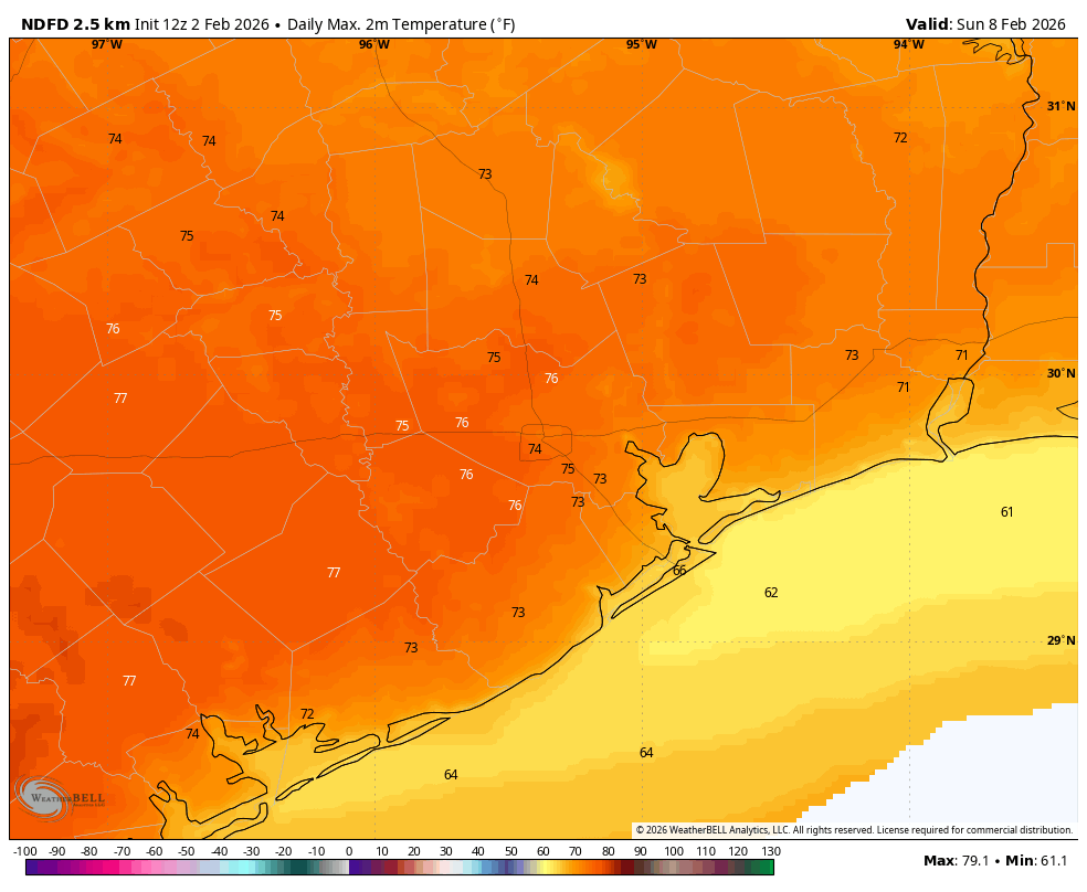
The weekend looks exceptional, with highs in the low- to mid-70s and plenty of sunshine. Only by Sunday afternoon may we start to see the incursion of a few clouds. Overnight lows will generally fall to around 50 degrees, with low humidity. Winds, generally will be light. Seriously, plan to get outdoors.
Next week
Most of next week looks to be pretty much the same day-to-day, with highs in the mid-70s and lows around 60 degrees. We probably will see some partly cloudy days and slight rain chances. But mostly, conditions will be mild. Some sort of front may arrive on Friday or Friday night, but I don’t expect sharply colder weather at this point.