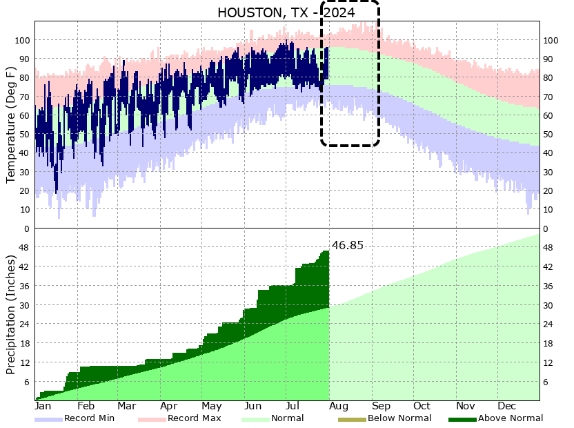
In brief: Houston will face some of its hottest weather today and Saturday before a weak front makes its last gasp over the area. We cannot rule out a few thunderstorms on Saturday evening, and then some showers on Sunday, but for the most part our weather this weekend and next week is going to be hot and sunny.
Friday
High pressure will be dominant today and for much of Saturday, leading to some of our hottest conditions so far this summer. Friday, therefore, will likely a little bit warmer than we’ve experienced that last couple of days even. Most of the Houston region, away from the coast, is likely to see highs pushing into the upper-90s. Winds will be light, from the south at only 5 mph. With dewpoints in the mid- to upper-70s, the air will feel sticky. Low temperatures tonight will only fall to around 80 degrees for much of the city. So yeah, this will be full-on summer in Houston.
Saturday
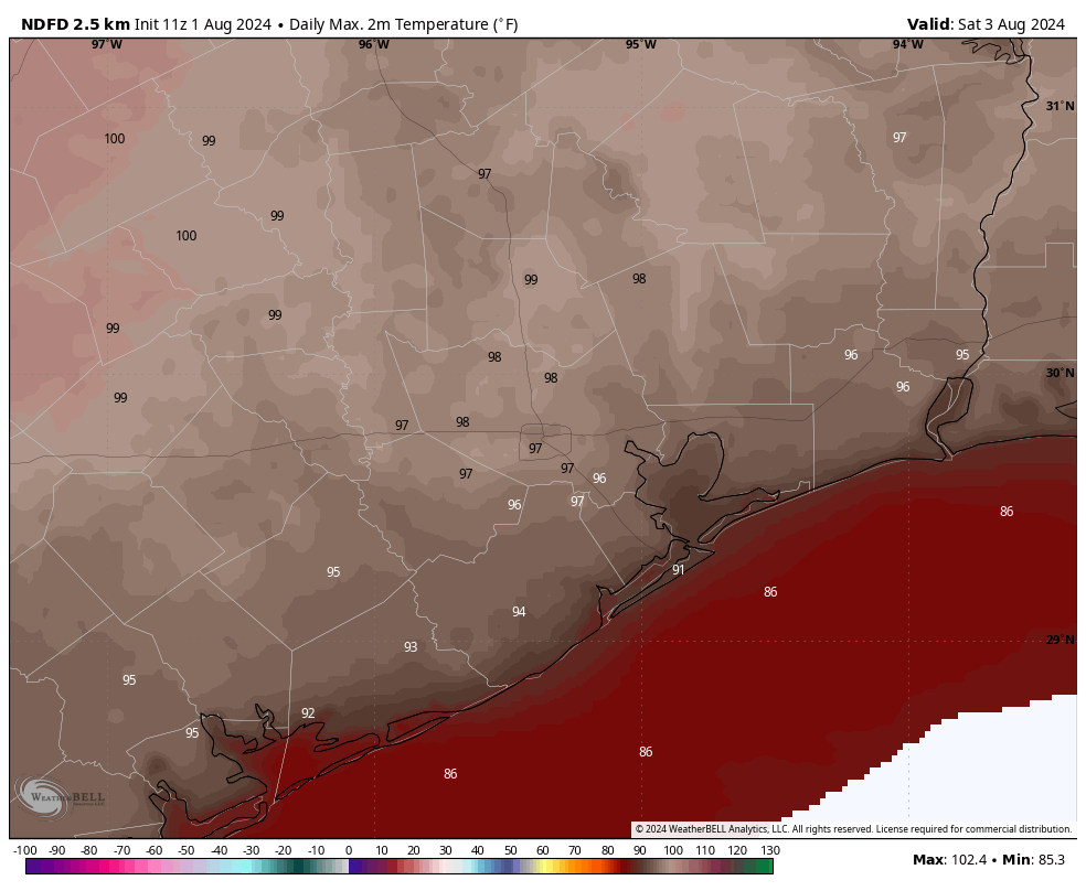
The first half of the weekend is likely to be even a touch warmer than Friday. This will be due, in part, to the advancement of a weak front that will eventually fizzle out over the Houston area. What happens as a front advances is that, typically, it compresses the air ahead of it downstream. The front is fairly weak, but this compressional heating could be enough to add a couple of degrees on Saturday. Therefore I expect most of the region to reach the upper 90s, with a few locations possibly hitting 100 degrees. Skies will be sunny during the daytime. I do think it’s possible that we see some isolated or scattered showers on Saturday evening, with the possibility of thunderstorms. So while these aren’t probable, they are possible.
Sunday
The front should bring a few degrees off the top end of our temperatures, so highs on Sunday will likely drop back into the mid- to upper-90s. There is also a decent chance of showers on Sunday and Sunday evening. By decent I mean maybe 30 percent for areas along and south of Interstate 10, and 20 percent further inland. Mostly, however, our skies will be sunny and the air plenty humid still—sorry, it’s a very weak front that will fall apart as it pushes into the region. Lows on Sunday night will drop into the upper 70s.
Next week
Most of next week looks sunny and hot, with high temperatures in the mid- to upper-90s. There will be a smattering of rain chances, but they’re low overall, perhaps 10 to 20 percent daily. Mostly, it’s just going to feel like Houston in August. For most of us, that’s pretty miserable. But aside from the heat we should have no worries about storms or the like, which is nice after what Houston has experienced so far this spring and summer.
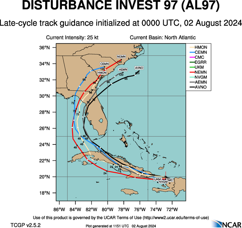
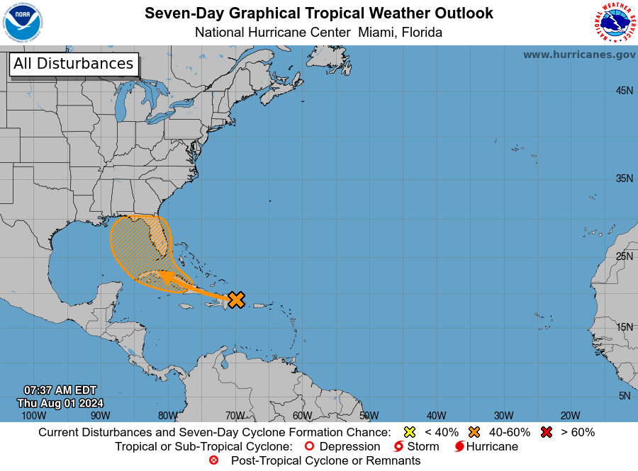
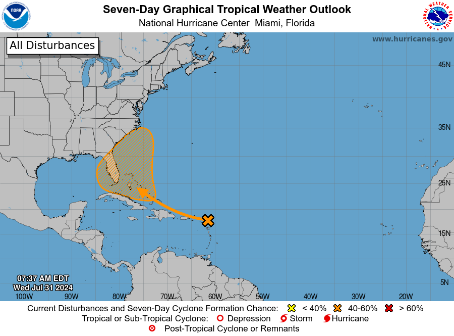
Tropics
The forecast for the tropical disturbance AL97 is coming into better focus, and it looks to be a rainmaker for Florida and potentially the US East Coast this weekend and into early next week. As we’ve been saying for a few days, there is zero threat to Texas from this system. We’ll continue to track the storm in depth today, and this weekend, on The Eyewall.