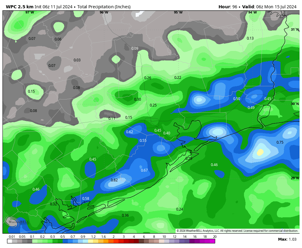
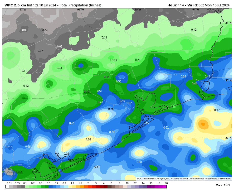
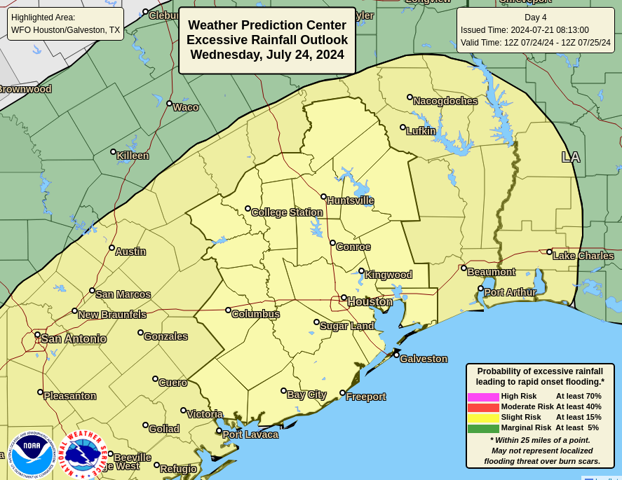
In brief: We are issuing a Stage 1 flood alert for the entire Houston metro area, through Thursday, to account for the potential of street flooding. Much of the Houston area should pick up 2 to 6 inches of rainfall through Thursday, with a few areas seeing higher bullseyes. This post describes what to expect, when to expect it, and explains why this is happening.
A setup for rainfall, some of it heavy
In the big picture for the coming week, the upper Texas coast will lie between two high pressure systems. As anyone who has lived in Houston for any time knows, high pressure during the height of summer means sunshine and hot temperatures. And it also means sinking air, which precludes the development of showers and thunderstorms.
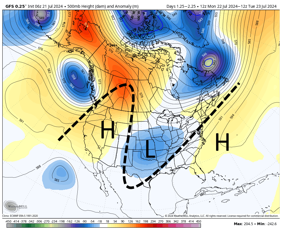
Conversely, when Houston lies beneath a trough of lower pressure—as we will this week—the opposite occurs. This environment promotes rising air, and thus all of the moisture at the surface can ascend into the atmosphere, cool and condense into clouds, and lead to showers and thunderstorms. Thus we will see a wet pattern this week, beginning on Monday. Showers and thunderstorms are likely on the daily, with heavy rain definitely possible as we are open to moisture streaming in from the Gulf of Mexico. We cannot rule out severe weather, but it seems unlikely with the heavy rains.
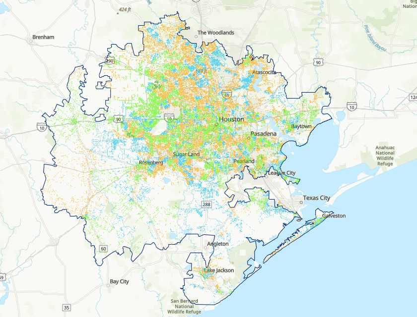
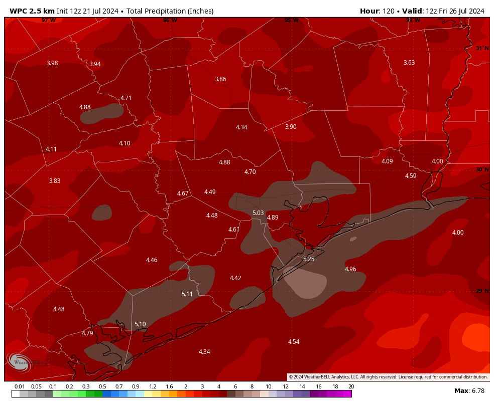
To account for this rainfall, we are issuing a Stage 1 flood alert on our scale (read more about our flood scale here). Generally, this means you can expect the potential for nuisance street flooding during the heaviest rains, the kind you typically see on some frontage roads or the like. However, we do not expect this to be a widely disruptive event. Overall, I expect much of the Houston area to pick up 2 to 6 inches of rainfall through Thursday, with a few areas seeing higher bullseyes.
As a bonus, beginning Monday, we are likely to see cooler daytime temperatures, with clouds and rain-cooled air limiting highs in the 80s. That’s a rare treat in July, and definitely a silver lining amongst the cloudy skies for the coming week. As for the humidity, well, bless your heart for expecting anything but the usual Houston steaminess in July.
What follows is not so much a daily forecast, but a guide to which days are likely to see the heaviest rains.
Sunday
Showers will be of a more scattered nature today, although areas near the coast are probably more likely to see rainfall than not. Overall conditions should not be particularly disruptive so go about your plans as usual. Have an umbrella handy this afternoon, however.
Monday and Tuesday
Both of these days will see widespread showers and thunderstorms. These should be nuisance showers for the most part, although a few storms should bring heavy rainfall. I do not recommend any outdoor plans, but in terms of traveling around Houston I don’t anticipate any major impacts.
Wednesday and Thursday
The potential for heavy rainfall looks to be highest on Wednesday through at least Thursday morning. For these days there could be some delays in getting to work, and traveling around the city. Again, we don’t anticipate major, sustained flooding. But you know how Houston thunderstorms can be. They can drop a deluge of rain in a short time, so some areas will see some fairly gnarly conditions over shorter periods of time. Basically, you’ll need to be weather aware these days.
Friday, Saturday, and Sunday
Rain chances lessen by Thursday night or so, which is why we’re presently planning to end our Stage 1 flood alert on Thursday night. But the possibility of rain is definitely not going away this weekend. Expect the rainy pattern to continue, albeit with less intensity and perhaps better odds to see some sunshine. Next week, however, does look hotter and sunnier.
A note of thanks
I want to thank Matt for covering the site all last week while I attended a family reunion in Michigan. I don’t want to brag too much, but it felt amazing to go running with temperatures of 60 degrees and low humidity. It offered a reminder that, in just a couple of months, we can look forward to some of the same here. Speaking of which, when we stepped off the plane at Hobby Airport and felt that first flush of Houston air, my family immediately knew we were home. We should come up with a word for what it’s like to experience that first taste of Houston humidity when landing here. Suggestions?